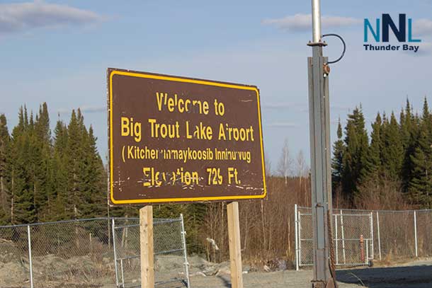
A three-day forecast for Northern Ontario Indigenous fly-in communities, including Sandy Lake, Pikangikum, Pickle Lake, Webequie, Fort Hope and remote northern communities
NORTHERN ONTARIO – Monday, October 5, 2026 – Residents of Northern Ontario fly-in communities can expect a cool start today, a wetter and windier Tuesday, and unsettled conditions continuing into Wednesday.
The greatest travel concerns are strong winds, rain, possible thunderstorms and reduced visibility. These conditions may affect scheduled flights, float-plane operations, boat travel and local airstrip access. Check directly with your airline, charter operator or community airport before travelling.
Environment and Climate Change Canada had no weather alert displayed for the communities reviewed at the time of this report. Local conditions can still become hazardous quickly, especially during thunderstorms and periods of strong wind.
Monday, October 5: Cool with a few showers
| Community or area | Forecast | Travel concerns |
|---|---|---|
| Sandy Lake, Weagamow Lake and Deer Lake | Mix of sun and cloud with a 40 per cent chance of showers early. High near 7 C. | Cool conditions and wet surfaces may affect morning air travel. |
| Pikangikum, Poplar Hill and MacDowell | Mainly sunny. Southeast winds near 20 km/h late. High near 10 C. | Wind may affect light aircraft, boats and exposed equipment. |
| Pickle Lake and Cat Lake | Mix of sun and cloud with a 30 per cent chance of flurries or rain showers. High near 9 C. | Watch for wet or locally slippery surfaces during morning showers. |
| Summer Beaver, Wunnumin Lake and Kingfisher Lake | Cool with a mix of cloud and sun. A few showers are possible. Highs near 9 to 11 C. | Small aircraft operators should monitor wind and visibility reports. |
| Big Trout Lake and Kasabonika | Cloud increasing, with rain or showers possible later. High near 9 to 10 C. | Rain may reduce visibility near airstrips and shorelines. |
| Sachigo Lake and Bearskin Lake | Cloudy periods with showers possible. High near 9 to 10 C. | Wet conditions may slow outdoor work and boat loading. |
| Fort Hope, Lansdowne House and Ogoki | Cloud increasing, with showers developing later. High near 10 C. | Plan for changing conditions on air and water routes. |
| Webequie, Fort Severn and Peawanuck | Cloudy periods with showers possible. Highs generally 6 to 9 C. | Cool temperatures and rain may create difficult conditions for outdoor travel. |
The current Far Northern Ontario bulletin identifies cool temperatures, showers and changing winds across the region.
Tuesday, October 6: Rain, strong winds and thunderstorm risk
Tuesday is the most unsettled day in this forecast period. Rain and showers will spread across many communities. Several areas may also see strong southwest or west winds, with gusts reaching 50 or 60 km/h.
- Sandy Lake, Weagamow Lake and Deer Lake: Cloudy with a 60 per cent chance of afternoon showers and a risk of a thunderstorm. South winds near 30 km/h will become west 30 km/h, gusting to 50. High near 14 C.
- Pikangikum, Poplar Hill and MacDowell: Increasing cloud, with a 40 per cent chance of showers late in the afternoon. West winds may gust to 50 km/h. High near 15 C.
- Pickle Lake and Cat Lake: Cloudy with a 60 per cent chance of showers and a risk of a thunderstorm. Winds will become west 30 km/h, gusting to 50. High near 16 C.
- Summer Beaver, Wunnumin Lake and Kingfisher Lake: A 60 per cent chance of showers and a risk of a thunderstorm. Southwest winds near 30 km/h, gusting to 50. High near 12 C.
- Big Trout Lake and Kasabonika: Periods of rain, with southeast winds becoming northwest 30 km/h, gusting to 50. High near 10 C.
- Sachigo Lake and Bearskin Lake: Periods of rain, with northwest winds near 30 km/h, gusting to 50. High near 10 to 11 C.
- Fort Hope, Lansdowne House and Ogoki: Showers ending near noon, followed by a 60 per cent chance of showers and a risk of a thunderstorm. Southwest winds may reach 40 km/h, gusting to 60. High near 10 C.
- Webequie: Periods of rain and a risk of a thunderstorm in the afternoon. Southwest winds may reach 40 km/h, gusting to 60. High near 8 C.
- Fort Severn and Peawanuck: Rain or afternoon showers, with southeast winds near 30 km/h and gusts up to 50. Highs near 6 C.
Strong gusts can affect small aircraft, float planes, boats, fuel transfers, construction materials and temporary structures. A thunderstorm may also bring a sudden wind shift and poor visibility.
Wednesday, October 7: Showers remain possible
Wednesday should be milder than Monday but still unsettled. Many western and central areas are expected to see a mix of sun and cloud with a 30 to 40 per cent chance of showers. Highs will generally be between 12 and 16 C.
Communities around Pikangikum, Pickle Lake, Cat Lake, Sandy Lake and the northwest coast should be prepared for forecast changes. The far-northern bulletin may be revised as Tuesday’s storm system develops and moves through the region.
Rainfall may be uneven. Some communities may receive only brief showers, while others could experience heavier rain or a thunderstorm.
Air travel and local transportation
Weather does not automatically mean a flight cancellation. Airlines and local operators make decisions based on wind, visibility, runway or airstrip conditions, aircraft type and operational safety.
- Confirm flights directly with the carrier before leaving home.
- Allow extra time for weather-related loading or unloading delays.
- Keep essential medication, identification and emergency supplies in carry-on baggage.
- Do not assume a scheduled flight will operate during thunderstorms or strong crosswinds.
- Residents travelling by boat should check wind conditions on the entire route, not only at the dock.
Advice for families and outdoor workers
- Dress in layers. Monday morning will feel cold, especially in exposed areas.
- Secure tents, signs, fuel containers, tools and other loose materials before Tuesday’s stronger winds.
- Postpone non-essential boat travel during thunderstorms or when winds gust above 50 km/h.
- Keep children away from shorelines during lightning, heavy rain and sudden wind shifts.
- Outdoor workers should plan for wet conditions, cold exposure and reduced visibility.
- Carry a charged phone, satellite communicator or other reliable emergency communication device when travelling outside the community.
Editor warnings – remove before publication
- Refresh all ECCC forecasts and alerts immediately before publication.
- Confirm flight, charter and airstrip information directly with the local operator.
- Thunderstorm timing and wind gusts may change quickly, especially Tuesday.
- Point forecasts can differ between nearby communities. Do not apply one community’s forecast to another without checking.
- No active ECCC alert was displayed for the communities reviewed during this check. Localized lightning, heavy rain, strong wind and poor visibility remain possible.