
Weather Update Shows Tracking of Storm
THUNDER BAY – WEATHER – Environment Canada is continuing to monitor a weather system that is tracking toward Thunder Bay and Northern Ontario.
The weather service reports, “There is potential for a significant freezing rain event across areas North and West of Lake Superior, including the Lakehead area at Thunder Bay early next week.
“A large low from Texas is expected to track northeast towards Lake Superior later this weekend into early next week.
“Latest indications suggest that the Thunder Bay to Marathon and Geraldton regions will remain in the cold air, to the north of the track of this low.”
The image from Weather Underground shows the low over Texas, which as formed into a long ridge of low pressure. The low pressure system has flood warnings in effect for Dallas Texas.
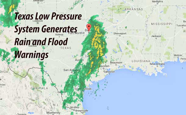
The Flood Warning continues for
  the Trinity River at Dallas.
* At 0100 PM Saturday the stage was 32.23 feet.
* Flood stage is  30 feet.
* Minor flooding is occurring and minor flooding is forecast.
* Forecast... the river will continue to fall to a stage near 32 feet
  by Sunday morning.
* At 32 feet, minor flooding of agricultural lands used for cattle
  grazing will occur. Low water crossings near the river will begin
  to flood.
The system however could well track east of Thunder Bay. This means that it is possible that the freezing rain that was forecast earlier for the region is likely to turn to snow. Environment Canada reports, “As a result, after several centimetres of snow falls Sunday into Sunday night, freezing rain may move in from the south as the low gets closer. Freezing rain may last for quite a few hours into Monday before either ending or turning back to snow in the wake of the low.”
There is still uncertainty as to the exact track of the low, which would affect how much snow or freezing rain would fall at a particular locale.


