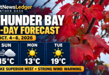
NetNewsLedger Weather Desk | October 7–9, 2026
THUNDER BAY — Gusty winds and possible afternoon thunderstorms lead the three-day outlook. Western Lake Superior’s latest retrieved marine bulletin carries a strong-wind warning.
At 5 a.m. Wednesday, Thunder Bay Airport reported clear skies and 7.5°C, with west-southwest winds at 9 km/h.
| Day | Thunder Bay forecast | High | Overnight low |
|---|---|---|---|
| Wednesday, October 7 | Clouds increasing; 40% chance of afternoon showers and a thunderstorm risk. Winds becoming northwest 40 km/h, gusting to 60 near noon. | 17°C | 8°C |
| Thursday, October 8 | Sunshine and clouds, with a 30% chance of showers. | 14°C | 2°C |
| Friday, October 9 | Sunshine and clouds, with a 30% chance of showers. | 15°C | 7°C |
Wednesday evening brings a 30% shower chance, with winds easing. Thursday and Friday nights also carry a 30% chance of showers.
Surrounding communities
For Fort William First Nation, Oliver Paipoonge, Kakabeka Falls, Neebing and Shuniah, the Thunder Bay outlook provides a nearby planning guide: prepare for a windy Wednesday, intermittent shower chances and cooler nights.
This is a regional interpretation of the Thunder Bay forecast, not separately verified forecasts for each community. Exact temperatures and wind exposure can differ between inland locations and the Lake Superior shoreline.
A wind-resistant jacket and waterproof outer layer are practical choices. Secure lightweight outdoor items before Wednesday’s stronger winds arrive, and leave extra time if showers affect visibility.
Lake Superior West marine outlook
The October 6 evening bulletin lists a strong-wind warning for Western Lake Superior, with scattered showers and possible thunderstorms Wednesday afternoon and evening.
| Day | Offshore wind forecast | Waves and weather |
|---|---|---|
| Wednesday, October 7 | Northwest around 15 knots early, becoming west 20 knots in the afternoon and northwest 20 knots in the evening. | Waves building to 1–1.5 metres early Wednesday. Scattered afternoon and evening showers; thunderstorm risk. |
| Thursday, October 8 | Northwest 20 knots. | Extended outlook does not provide a wave-height forecast. |
| Friday, October 9 | Northwest 15 knots, becoming southeast 15 knotslate in the day. | Extended outlook does not provide a wave-height forecast. |
Twenty knots is approximately 37 km/h. The forecast’s wave heights apply to the marine area; conditions inside sheltered bays can differ.
Marine winds describe offshore conditions. Shoreline effects can produce substantially different winds near land. Check the updated Western Lake Superior marine forecast and Canadian Coast Guard weather broadcasts before departure, particularly given the warning and thunderstorm risk.