
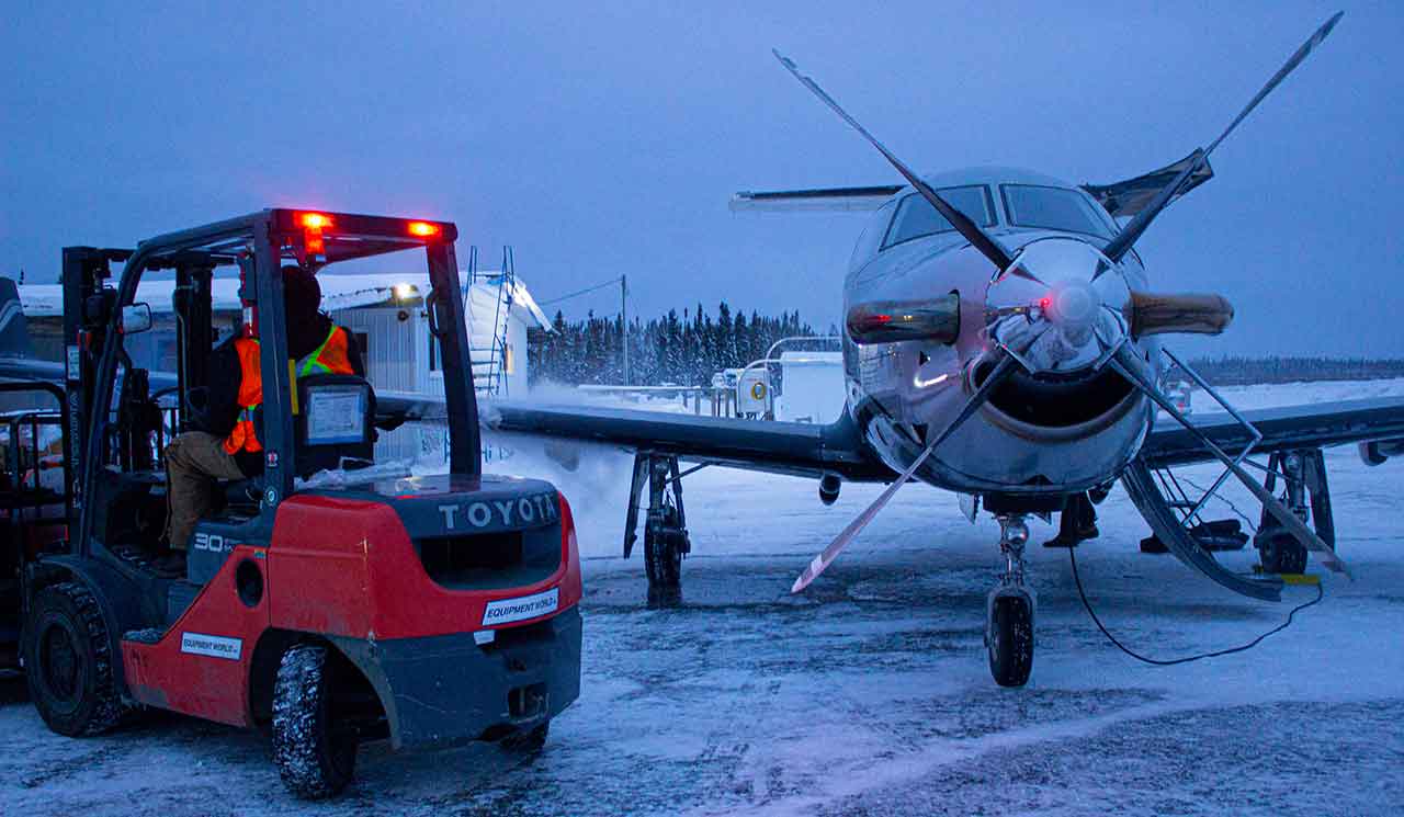
Three-day forecast for November 21–23, 2026, covering remote First Nations, fly-in communities and the James Bay and Hudson Bay coasts
NetNewsLedger Weather Desk | Saturday, November 21, 2026 | Morning Edition
THUNDER BAY, ON — Winter is making its presence felt across Northern Ontario’s remote First Nations this weekend, with snowfall, freezing precipitation, gusty winds and a sharp drop in temperatures expected from Sandy Lake to the Hudson Bay coast.
Saturday will bring snow to several communities north of Sioux Lookout, including Sandy Lake, Sachigo Lake, Kasabonika Lake and Webequie. Farther east, rain and mixed precipitation will affect communities along the James Bay coast.
The biggest change will come Saturday night and Sunday, when colder Arctic air moves across the region. Overnight temperatures could fall to -18°C in parts of the Far North, with wind chill values approaching -25.
For residents who depend on air transportation for medical appointments, groceries, mail, freight and family travel, Saturday’s combination of snow, freezing precipitation and changing visibility deserves particular attention.
Three-Day Far North Weather Overview
Sat, Nov. 21
Snow and mixed precipitation
Wind and icing risk
Sun, Nov. 22
Much colder
Flurries and sunny breaks
Mon, Nov. 23
Cold continues
Clouds and some sunshine
Regional Temperature Outlook
| Forecast region or community | Saturday | Sunday | Monday |
|---|---|---|---|
| Sandy Lake – Pikangikum | Falling to -6°C* | -13°C | -13°C |
| Pickle Lake – Wunnummin Lake | Falling below 0°C | -9°C | -12°C |
| Big Trout Lake – Sachigo Lake | -3°C | -14°C | -13°C |
| Fort Hope – Webequie | Up to 6°C regionally | -6°C | -10°C |
| Fort Albany | 11°C | 0°C | -7°C |
| Attawapiskat | Around 4°C | -3°C | -5°C |
| Fort Severn | -3°C | -10°C | -11°C |
| Peawanuck | 0°C | -10°C | -10°C |
Temperatures are in Celsius. Saturday values reflect the latest retrieved November 20 Environment Canada forecast bulletins; Sunday and Monday figures come from the regional extended forecasts. *Sandy Lake’s Saturday temperature is forecast to fall during the day. Fort Hope and Webequie have differing Saturday conditions within their shared extended forecast region.
Sandy Lake, Deer Lake and North Caribou Lake (Weagamow)
Saturday — Snow Ending Around Noon
Saturday will begin with snow across the Sandy Lake–Weagamow Lake–Deer Lake forecast region.
Environment Canada expects approximately 2 centimetres of additional snow before precipitation ends around noon.
Cloudy skies will follow, with a 40 per cent chance of flurries.
North winds near 20 km/h, gusting to 40 km/h, will make conditions feel colder.
Temperatures are forecast to fall to -6°C during the afternoon, with wind chill values approaching -13.
Saturday night will be particularly cold, with temperatures falling to -14°C and wind chill values near -21.
Sunday — Winter Settles In
Sunday will bring a mixture of sun and cloud, with a 40 per cent chance of flurries.
The regional forecast high is -13°C.
Sunday night will be colder still, dropping to approximately -19°C.
Monday — Cold but Some Sunshine
Monday will bring a mixture of sun and cloud, with another high near -13°C.
For residents travelling between buildings or working outdoors, insulated clothing will be essential.
Pikangikum, Poplar Hill and North Spirit Lake Area
Saturday will bring periods of snow ending around noon, followed by cloudy skies and a 60 per cent chance of flurries.
There is also a risk of freezing drizzle during the afternoon.
Approximately 2 centimetres of snow could accumulate locally.
Temperatures will fall toward -4°C, with a wind chill near -7.
Saturday night will be cloudy with flurries possible and a low of -9°C. Wind chill values could approach -15.
Sunday and Monday will be considerably colder, with highs near -13°C.
North Spirit Lake lies farther north and may experience somewhat different local conditions. Residents should check their community-specific forecast before travelling.
Sachigo Lake and Bearskin Lake First Nations
Saturday will bring periods of snow ending near noon, followed by cloudy skies and a 40 per cent chance of flurries.
Environment Canada forecasts approximately 2 centimetres of additional snow.
North winds will reach 20 km/h, gusting to 40 km/h.
The high will be -3°C, with a wind chill near -13.
Saturday night will become very cold, with a low of -18°C and wind chill values approaching -25.
Sunday will remain cloudy with a 30 per cent chance of flurries. The regional high will be near -14°C.
Monday should bring a mixture of sun and cloud, with a 30 per cent chance of flurries and a high near -13°C.
Residents should be prepared for significant wind chill, particularly during early morning and overnight activities.
Kitchenuhmaykoosib Inninuwug (Big Trout Lake) and Kasabonika Lake
Saturday’s weather will bring a combination of snow, wind and falling temperatures.
Environment Canada forecasts snow ending around noon, with approximately 5 centimetres possible during the day.
Cloudy skies will follow, with a 40 per cent chance of flurries.
North winds will reach 30 km/h, gusting to 50 km/h.
The daytime high will be -3°C, but wind chill values will be closer to -13.
Saturday night is expected to be particularly cold, with temperatures falling to -18°C and wind chills near -25.
Sunday will remain cold and cloudy, with a 30 per cent chance of flurries and a high near -14°C.
Monday will bring a mixture of sun and cloud with a 30 per cent chance of flurries. The high will be -13°C.
Summer Beaver, Wunnummin Lake and Kingfisher Lake
Saturday will bring snow ending near noon, followed by cloudy skies and a 60 per cent chance of light snow.
Environment Canada forecasts local snowfall amounts of approximately 5 centimetres during the day.
North winds will reach 30 km/h, with temperatures falling to -3°C during the afternoon.
Wind chill values will approach -9.
Saturday night will remain cloudy, with a 40 per cent chance of flurries. The overnight low will reach -10°C, with wind chill values near -16.
Sunday will be cloudy with a 30 per cent chance of flurries and a regional high near -9°C.
Monday will bring some sunny breaks, with temperatures around -12°C.
Cat Lake and Pickle Lake
Saturday will begin with rain or snow ending near noon.
Cloudy skies will follow, with a 40 per cent chance of flurries.
There is also a risk of freezing drizzle during the afternoon.
Temperatures are expected to fall to -1°C.
Saturday night will be cloudy with a 30 per cent chance of flurries and a low of -7°C. Wind chill values may approach -13.
Sunday will remain cloudy with occasional flurries possible and temperatures around -9°C.
Monday will bring a mixture of sun and cloud, with temperatures reaching approximately -12°C.
Webequie First Nation
Saturday — Snow, Rain and Freezing Rain Risk
Webequie faces one of the more complicated weather patterns Saturday.
Environment Canada’s Friday evening forecast calls for snow continuing through much of the day, mixed with rain during the morning.
There is a risk of freezing rain during the morning.
Additional snowfall of 2 to 4 centimetres is expected.
North winds will increase to 30 km/h, with temperatures falling to -2°C during the afternoon.
Wind chill values will approach -8.
Sunday — Sharp Temperature Drop
Saturday night will bring colder weather, with temperatures falling to -11°C and wind chills near -18.
Sunday will be cloudy with a 60 per cent chance of flurries.
The broader Fort Hope–Webequie forecast calls for a high near -6°C, although earlier Webequie-specific guidance suggested it could be colder.
Monday — Cold Continues
Monday will remain cold, with the regional outlook calling for cloudy skies and a high near -10°C.
Weather note: Freezing precipitation is a particular concern because it can affect aircraft operations and create slippery surfaces.
Eabametoong (Fort Hope), Neskantaga and Marten Falls
The Fort Hope–Lansdowne House–Ogoki forecast region will remain considerably milder than communities farther north during Saturday.
Environment Canada calls for periods of rain ending late in the afternoon.
Approximately 5 millimetres of additional rainfall is expected.
North winds will increase to 30 km/h.
The high will reach 6°C.
There is a risk of freezing drizzle late Saturday afternoon, making the transition toward colder weather important.
Saturday night will become cloudy with a 40 per cent chance of flurries and a continued freezing drizzle risk during the evening.
Temperatures will fall to -8°C, with wind chills near -16.
Sunday will bring cloudy skies and a 60 per cent chance of flurries, with a regional high near -6°C.
Monday will remain cloudy and colder, with temperatures around -10°C.
Neskantaga and Marten Falls residents should monitor their local forecasts, as precipitation timing and temperatures can differ from Fort Hope.
Attawapiskat First Nation
Saturday will begin relatively mild compared with communities farther west.
Environment Canada’s updated forecast calls for rain ending during the afternoon, followed by cloudy skies and a 40 per cent chance of flurries.
Temperatures will fall toward 1°C during the afternoon.
Northwest winds near 20 km/h will develop.
Saturday night will bring a low of -6°C, with wind chill values near -11.
Sunday will be cloudy with a 40 per cent chance of flurries and a high of -3°C.
Sunday night will fall to -7°C.
Monday should bring a mixture of sun and cloud, with a 30 per cent chance of flurries and a high near -5°C.
Residents should expect a transition from Saturday’s rain to more typical winter conditions Sunday and Monday.
Fort Albany, Kashechewan and Moosonee — James Bay Coast
The southern James Bay coast will experience one of the sharpest changes in weather over the weekend.
Saturday — Mild and Rainy
Fort Albany will receive periods of rain, with approximately 10 millimetres expected during the day.
Southwest winds will reach 30 km/h, gusting to 50 km/h, before shifting toward the northwest.
The high will reach 11°C.
Moosonee will be even warmer, with a high near 14°C and periods of rain.
Sunday — Rain Gives Way to Snow
Saturday night will bring falling temperatures.
Fort Albany will drop to -2°C, with rain ending and flurries possible.
Sunday will bring snow, with a high near 0°C.
Sunday night will remain snowy, with temperatures falling to -6°C.
Monday — Much Colder
Monday will be cloudy with a 60 per cent chance of flurries and a high near -7°C.
Kashechewan residents should use the nearby Fort Albany forecast for regional guidance while monitoring community-specific conditions.
The transition from Saturday’s mild, rainy weather to below-freezing temperatures could create slippery conditions around community roads and airport facilities.
Fort Severn — Wasaho Cree Nation
Fort Severn will remain cold throughout the three-day period.
Saturday will be cloudy with a 40 per cent chance of flurries and a risk of freezing drizzle during the afternoon.
North winds will reach 30 km/h, gusting to 50 km/h.
The daytime high will be -3°C, with wind chill values around -12.
Saturday night will become colder, with temperatures dropping to -14°C. Wind chill values could reach -22.
Sunday will bring a mixture of sun and cloud, with a 30 per cent chance of flurries and a high near -10°C.
Monday will remain cold, with another mixture of sun and cloud and a high near -11°C.
This is weather that demands proper winter clothing, particularly for residents working outdoors or travelling to the airport.
Peawanuck — Weenusk First Nation
Saturday will bring periods of snow ending near noon, followed by cloudy skies and a 40 per cent chance of flurries.
An additional 2 to 4 centimetres of snow is possible.
North winds will reach 20 km/h, gusting to 40 km/h.
The daytime high will be around 0°C, with morning wind chill values near -8.
Saturday night will turn colder, with a low of -12°C.
Sunday will be cloudy with a 40 per cent chance of flurries and a high near -10°C.
Monday will remain cloudy and cold, with another 40 per cent chance of flurries and a high near -10°C.
Northern Aviation Outlook: Saturday’s Weather Requires Attention
For Northern Ontario’s remote First Nations, aviation is an essential transportation service.
Passenger flights, freight aircraft and medical transportation depend on safe operating conditions at community airports.
Saturday — Highest concern for mixed precipitation
Snow, freezing rain, freezing drizzle, gusty winds and reduced visibility may affect flight operations. Conditions around Webequie, Kasabonika Lake, Sandy Lake and Fort Severn deserve close monitoring.
Sunday — Improving skies but colder weather
Snow will ease across parts of the western Far North, but the James Bay coast may continue receiving snow. Very cold temperatures will affect ground handling and outdoor activities.
Monday — Cold conditions continue
Some communities will experience clearer skies, while others remain cloudy with occasional flurries. Airlines will assess conditions at each airport individually.
There are no independently verified airline cancellations or airport closures included in this report.
Travellers should check directly with their airline, including North Star Air and Wasaya Airways, for updated flight information.
Winter Road and Ice Safety
As temperatures fall, residents may begin seeing more ice formation on lakes and rivers.
However, the recent warm weather and mixed precipitation mean ice conditions may remain unreliable.
Residents should not assume that lakes, rivers or winter-road routes are safe because the temperature has fallen below freezing.
Community leadership and official winter-road operators should be consulted before travelling on seasonal routes.
What to Wear: Get the Winter Gear Ready
Saturday’s mixed precipitation calls for waterproof and insulated clothing.
By Sunday, colder temperatures will make proper winter jackets, gloves, hats and insulated boots essential across much of the Far North.
For residents in Sandy Lake, Sachigo Lake and Kasabonika Lake, overnight temperatures near -18°C to -19°C will make exposed skin vulnerable to cold injury, particularly when wind is present.
Parents should ensure children are dressed for both snowfall and colder outdoor conditions.
Weather Trivia: Why Does Wind Chill Matter?
A temperature of -15°C can feel much colder when the wind is blowing.
Wind removes the thin layer of warm air that normally surrounds exposed skin, causing the body to lose heat more quickly.
That is why Environment Canada issues wind chill values alongside winter temperature forecasts.
Wind chill does not mean the air itself has become colder. It describes how quickly exposed skin loses heat under those conditions.
Looking Ahead: A Gradual Improvement by Midweek
The first half of next week will remain cold across much of Northern Ontario.
By Tuesday and Wednesday, Environment Canada’s extended forecast suggests temperatures may begin moderating slightly in some western and central communities.
Sandy Lake could rise from -13°C Monday to around -7°C Tuesday and -4°C Wednesday.
The Big Trout Lake–Sachigo Lake region may experience a similar gradual improvement.
For now, the main message is clear: Saturday brings the most widespread snow and freezing precipitation concerns, while Sunday and Monday bring much colder temperatures across Northern Ontario’s remote communities.
#NorthernOntario #FarNorthWeather #FirstNations #SandyLake #Webequie #SachigoLake #Attawapiskat #FortSevern #Peawanuck #WinterWeather #NetNewsLedger