Northwest Ontario Wildfire Update: 109 Active Fires as Rinker Lake Complex Remains Out of Control
THUNDER BAY — No new wildland fires were confirmed in Northwestern Ontario on Saturday, Aug. 8, but the region continues to face a significant wildfire workload, with 109 active fires burning across the Northwest Region.
According to Aviation, Forest Fire and Emergency Services, 13 fires were listed as not under control as of 6 p.m. CDT. Six were being held, six were under control and 84 were being observed.
The largest operational focus remains the Rinker Lake Complex, which includes Thunder Bay 36 and two major Dryden-area fires. Evacuation orders and alerts also remain connected to several fires across the region.
Rinker Lake Complex remains major focus for fire crews
The Rinker Lake Complex includes Thunder Bay 36 (THU036), Dryden 34 (DRY034) and Dryden 35 (DRY035).
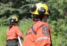
Twenty-five wildland firefighting crews from Ontario, Alberta and Nova Scotia are assigned to the complex, along with two 20-person crews from Mexico.
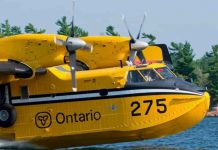
The response also includes heavy equipment operators, pilots, overhead personnel from Ontario and Quebec, an incident management team and 17 helicopters.
Crews are patrolling fire lines and extinguishing hot spots while consolidating hose lines, installing and maintaining values-protection equipment and constructing helipads to improve access to fire areas.
Heavy equipment continues to build fireguards along portions of the THU036 and DRY035 perimeters. Helicopters are conducting bucketing operations where needed.
A portion of THU036 was scanned using infrared technology early Saturday morning, allowing crews to identify additional hot spots for suppression.
Values-protection systems are also being monitored and maintained.
The three fires remain not under control:
- THU036 is estimated at 301,240 hectares.
- DRY034 is estimated at 45,800 hectares.
- DRY035 is estimated at 31,510 hectares.
The scale of THU036 in particular makes it a major concern for communities, transportation routes, aviation and resource activity across the Thunder Bay and surrounding Northwestern Ontario area.
Atikokan-area fires showing low fire behaviour
Fire crews are also continuing suppression work on the Atikokan Cluster, consisting of Fort Frances 13 (FOR013), Fort Frances 14 (FOR014) and Fort Frances 15 (FOR015).
Eight helicopters are assigned to the cluster.
Officials reported low fire behaviour on all three fires Saturday.
On the north side of FOR014, where water sources are limited, FireRanger crews are patrolling the perimeter and using helicopter buckets to extinguish hot spots, working approximately 100 feet inward from the fire’s edge.
Crews are also searching for and extinguishing hot spots along the north and northeast sides of FOR015, supported by helicopters in what officials describe as challenging terrain.
A wildland firefighting engine with a 4,000-litre water tank is now operating in the Cushing Lake area.
The three fires remain not under control:
- FOR013 is estimated at 25,279 hectares.
- FOR014 is estimated at 51,768 hectares.
- FOR015 is estimated at 42,273 hectares.
Evacuation orders and alerts remain in effect
Several evacuation orders and alerts remain associated with fires in the Northwest Region.
Ontario lists evacuation measures connected with Dryden 36; Thunder Bay 36, 54 and 56; Dryden 34 and 35; and Fort Frances 14.
An expanded evacuation alert is also associated with Fort Frances 14, while evacuation alerts remain connected to Fort Frances 15 and 38.
Residents in affected areas should continue following instructions from their First Nation, municipality, emergency management officials or other local authorities.
Conditions and evacuation requirements can change quickly depending on fire behaviour, wind, smoke and access conditions.
Airspace restrictions in place around major fires
A Notice to Airmen, or NOTAM, remains in effect around Thunder Bay 36.
A separate NOTAM is also in place around Fort Frances 14, northeast of Byers Lake.
These restrictions are in addition to the standard limits established under Section 601.15 of the Canadian Aviation Regulations.
Under those rules, airspace around an active forest fire is restricted to firefighting aircraft within five nautical miles of the fire and up to 3,000 feet above ground level.
The restrictions are intended to protect firefighting aircraft and crews operating in areas where helicopters and other suppression aircraft may be flying at low altitude.
Pilots should consult NAV CANADA flight-planning information for current NOTAMs before operating near wildfire areas.
Restricted Fire Zone remains in effect
A Restricted Fire Zone remains in place across the Northwest Region and a small portion of the Northeast Region.
The Ministry of Natural Resources implemented the restriction July 15 because of high to extreme fire hazard, increased wildfire activity and the overall number of fires already demanding suppression resources.
The measure is also intended to reduce the risk of additional human-caused fires while firefighting resources are heavily committed.
For Northwestern Ontario residents, campers, anglers, hunters, forestry workers and backcountry travellers, the restriction means fire-prevention measures remain especially important.
Why the wildfire situation matters across Northwestern Ontario
The continued presence of more than 100 active fires has implications well beyond individual fire boundaries.
Large fires can affect highway and forest-road access, remote aviation, forestry operations, mining exploration, tourism and supply routes serving First Nations and other isolated communities.
Smoke can also travel hundreds of kilometres from active fires, meaning communities far from the flames may still experience changing air quality.
The deployment of crews from several provinces and Mexico also illustrates the scale of the current fire response. Mutual-aid agreements and international firefighting support have become increasingly important during severe Canadian wildfire seasons when multiple jurisdictions face heavy fire activity at the same time.
For Thunder Bay, the continued growth and suppression effort around THU036 is particularly significant because the fire remains the largest of the fires highlighted in Saturday’s provincial update.
Fire danger can change through the day
Ontario’s fire danger rating is calculated using information from more than 130 weather stations across the province’s fire regions.
The rating can change during the day as temperature, humidity, wind and other weather conditions evolve.
Residents and travellers should check Ontario’s interactive fire map and local emergency information before travelling into remote or fire-affected areas.
Anyone who sees a wildland fire north of the French and Mattawa rivers should call 310-FIRE (3473). Fires south of the French or Mattawa rivers should be reported to 911.
The provincial wildfire situation remains fluid, and fire sizes, control status, evacuation measures and access restrictions may change as conditions develop.