TORNADO WATCH: Dryden and Vermilion Bay Face Risk of Severe Storms
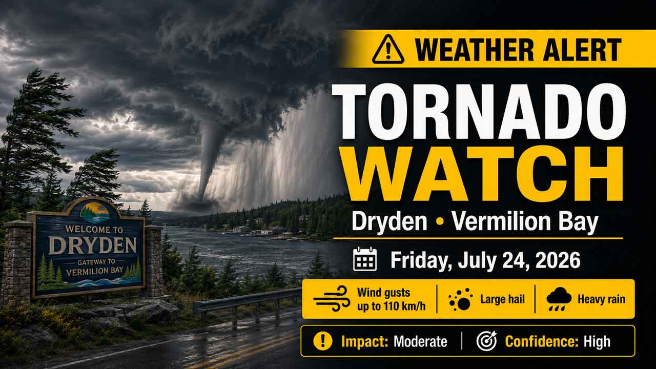
DRYDEN – WEATHER ALERT – A Yellow Tornado Watch is in effect for Dryden and Vermilion Bay as conditions become favourable for severe thunderstorms capable of producing tornadoes.
The watch was issued at 1:42 p.m. EDT on Friday, July 24, 2026, with a moderate impact level and high forecast confidence.
Severe thunderstorms may develop Friday afternoon and continue into late evening. In addition to tornadoes, the strongest storms could bring destructive winds, large hail and torrential rainfall.
Main Severe-Weather Threats
Potential hazards include:
- Tornadoes
- Wind gusts reaching 110 km/h
- Hail ranging from toonie size to golf-ball size
- Heavy rainfall, with localized amounts of up to 50 millimetres
Storms of this intensity could cause significant damage or destruction to homes, infrastructure, trees and the natural environment.
Timing of the Tornado Risk
The severe-weather threat is expected to begin Friday afternoon and continue until late Friday evening.
Residents, travellers, campers and people working outdoors should remain weather-aware and be prepared to seek shelter immediately.
What to Do if a Tornado Approaches
Move indoors immediately if a tornado warning is issued or threatening weather approaches.
Go to a room on the lowest floor, away from windows and outside walls. A basement, bathroom, stairwell or interior closet can provide better protection.
Leave mobile homes, vehicles, tents, trailers and other temporary or free-standing shelters. Move to a strong, permanent building whenever possible.
As a last resort, lie in a low-lying area and protect your head from flying debris.
Possible warning signs of a tornado include:
- A loud roaring sound
- A visible funnel cloud
- Swirling debris near the ground
- Flying debris
- Rapidly approaching threatening weather
Take shelter immediately when these signs are present. Do not wait for an official warning if a tornado appears imminent.
Boating and Outdoor Safety
People on lakes and waterways near Dryden and Vermilion Bay should be prepared to leave the water quickly.
Make for shore and seek shelter as soon as threatening weather approaches. Small boats and other watercraft are especially vulnerable to strong winds, hail and lightning on open water.
Campers should secure loose equipment and identify the nearest sturdy shelter before thunderstorms arrive.
Continue Monitoring Weather Alerts
Emergency Management Ontario recommends taking cover immediately when threatening weather approaches.
A tornado watch means conditions are favourable for severe thunderstorms capable of producing tornadoes. It does not mean a tornado has been confirmed.
Continue monitoring Environment Canada alerts, forecasts and radar throughout the afternoon and evening.
Severe-weather reports may be sent to ONstorm@ec.gc.ca or shared on social media using #ONStorm.
Emergency preparedness information is available through the Ontario government’s emergency readiness resources.
Overview
Tornado watch issued for Dryden and Vermilion Bay, with tornadoes, 110 km/h winds, large hail and up to 50 mm of rain possible Friday.