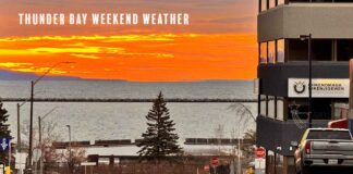
Thunder Bay’s September 27-29 forecast brings morning fog, possible Sunday showers, a sunny Monday and rain Tuesday. Lake Superior winds remain modest
THUNDER BAY – WEATHER DESK – Sunday, September 27, 2026 – Patchy fog may slow the morning drive in Thunder Bay before visibility improves. The city then faces a cloudy Sunday with a few possible showers, followed by a brighter and mild Monday. A more organized period of rain is expected Tuesday.
Conditions on Western Lake Superior remain relatively modest through Monday. No marine warning is in effect, offshore winds are forecast at 10 knots or less before becoming light Monday morning, and waves are expected to remain at 0.5 metres or less.
Current Conditions and Alerts
At 3:00 a.m. EDT, Thunder Bay Airport reported a temperature of 9.6 C, humidity of 100 per cent and a light northeast wind at 4 km/h. Fog patches were expected during the morning.
Sunday, September 27: Fog, Cloud and a Chance of Showers
Fog patches will dissipate this morning. Skies will remain cloudy, with a 30 per cent chance of showers late this morning and during the afternoon. The high will reach 19 C. The UV index will be 3, or moderate.
Skies will clear late this evening. The overnight low will fall to 7 C.
Monday, September 28: Mainly Sunny and Mild
Monday will be mainly sunny after any early fog dissipates. The high will reach about 20 C, several degrees above the late-September normal high of 15 C.
Cloud will increase Monday night, with a 30 per cent chance of showers. The low will be near 9 C.
Tuesday, September 29: Rain Returns
Showers are forecast Tuesday, with a high near 18 C. Periods of rain are expected to continue Tuesday night, when the temperature will fall to about 10 C.
Tuesday is the wettest day of the three-day outlook. The forecast does not indicate snow, freezing rain or a flash-freeze risk.
Three-Day Thunder Bay Forecast at a Glance
| Day | Forecast | High | Night |
|---|---|---|---|
| Sunday, Sept. 27 | Morning fog dissipating; cloudy with a 30% chance of showers | 19 C | Clearing late; low 7 C |
| Monday, Sept. 28 | Mainly sunny after any early fog | 20 C | Cloudy with a 30% chance of showers; low 9 C |
| Tuesday, Sept. 29 | Showers | 18 C | Showers; low 10 C |
Air Quality: Low Risk Indicated
The latest ECCC AQHI forecast available during preparation called for a maximum of 2, or low risk, for Sunday. At this level, the general population can continue normal outdoor activities. People with heart or breathing conditions should still follow their usual medical advice and pay attention to symptoms.
The accessible AQHI bulletin was issued Friday evening and should be refreshed before publication. Smoke conditions can also change quickly if wildfire smoke moves into the region.
Travel Conditions: Watch for Fog and Wet Roads
Morning fog could reduce visibility on Highway 11-17, Highway 61, Highway 102 and rural roads north and west of the city. Drivers should use low-beam headlights, leave extra space and avoid sudden braking where visibility drops.
Brief showers Sunday may leave isolated wet stretches. Travel conditions should improve Monday, but rain Tuesday may produce longer periods of wet pavement and reduced visibility. There is no snow or freezing-rain threat in the three-day city forecast.
Western Lake Superior Marine Forecast
Marine warnings: No watches or warnings were in effect for Western Lake Superior in the latest ECCC bulletin.
Sunday winds: Southeast wind at 10 knots will turn south at 10 knots early this morning, then southwest at 10 knots this afternoon.
Sunday night and Monday: Wind will turn northwest at 10 knots near midnight, then become light Monday morning.
Waves: Offshore waves are forecast at 0.5 metres or less through Sunday. The wave forecast applies to open water; nearshore conditions can vary because of shoreline and harbour effects.
Weather and visibility: The marine bulletin does not call for fog, thunderstorms or another specific visibility restriction on Western Lake Superior. However, patchy fog is forecast over Thunder Bay early Sunday, so boaters should be prepared for locally reduced visibility near shore and in the harbour.
Extended wind outlook: Light winds are forecast Monday. On Tuesday, light winds will become south at 15 knots. Southwest winds at 15 knots are expected Wednesday. The broader Lake Superior outlook calls for northwest winds increasing to 20 knots Thursday.
Thunder Bay Harbour and the Open Lake Are Different
Thunder Bay Harbour and protected bays can be calmer than open Western Lake Superior because the breakwall, islands and shoreline provide shelter. That does not mean every part of the harbour will be smooth. Harbour entrances, channels and exposed shorelines can become choppy when wind direction changes.
Open-lake waves of 0.5 metres or less are modest by Lake Superior standards, but cold water, fog and sudden local changes still matter to people in canoes, kayaks, paddleboards and small fishing boats. Conditions seen from a sheltered marina are not a reliable guide to conditions beyond the harbour.
Safety Guidance for Boaters
- Wear an approved personal flotation device.
- Check the newest marine forecast and local observations immediately before departure.
- Carry reliable communications and tell someone your route and return time.
- Use navigation lights and reduce speed if fog limits visibility.
- Small-craft operators planning a Tuesday trip should watch for the forecast increase to south winds at 15 knots.
Sources Checked
- Environment and Climate Change Canada – Thunder Bay forecast and airport observations
- Environment and Climate Change Canada – Northern Ontario public forecast bulletin
- Environment and Climate Change Canada – public weather alerts
- Environment and Climate Change Canada – Thunder Bay AQHI
- Environment and Climate Change Canada – Western Lake Superior marine forecast
- Environment and Climate Change Canada – Great Lakes marine bulletin
- Environment and Climate Change Canada – extended Great Lakes marine outlook