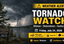
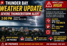
ATIKOKAN – WEATHER ALERT – Environment Canada issued a yellow tornado watch at 1:42 p.m. EDT Friday for Atikokan, Shebandowan and Quetico Park.
The alert carries a moderate impact level and high forecast confidence. Conditions are favourable for severe thunderstorms capable of producing tornadoes, destructive winds, large hail and torrential rainfall from Friday afternoon through late evening.
A tornado watch does not mean a tornado has been observed. It means the atmosphere is capable of producing severe thunderstorms with tornadoes, and residents and visitors should be ready to seek shelter immediately.
Primary Severe-Weather Threats
Environment Canada says the strongest storms could produce:
- Tornadoes
- Wind gusts reaching 110 km/h
- Hail ranging from toonie size to golf-ball size
- Heavy rainfall, with local totals reaching 50 millimetres
Storms of this strength could cause significant damage or destruction to homes, infrastructure, trees and the natural environment.
Today’s Weather Overview
Current Conditions
At noon EST, the Atikokan weather station reported a temperature of 24.4°C, with a humidex of 30. Humidity was 63 per cent and the dew point stood at 16.9°C.
Southwest winds were blowing at 14 km/h, gusting to 36 km/h. Barometric pressure was 101.1 kPa and falling, indicating the approach of changing weather.
Clouds will continue increasing during the afternoon. The public forecast calls for a 40 per cent chance of showers late in the day, along with a risk of thunderstorms.
Southwest winds will strengthen to 30 km/h, gusting to 60 km/h outside of thunderstorms. Friday’s high will reach 28°C, with a humidex of 34. The UV index is 7, or high.
The tornado watch indicates that individual thunderstorms could produce winds considerably stronger than those in the regular forecast.
Tornado Safety
Take shelter immediately when threatening weather approaches or when a tornado warning is issued.
Inside a building: Move to the lowest floor and choose a small interior room away from windows and outside walls. A basement, bathroom, stairwell or interior closet offers better protection.
In a temporary shelter: Leave mobile homes, tents, trailers and other free-standing shelters. Move to a strong building before the storm arrives.
Inside a vehicle: Do not attempt to outrun a tornado. Seek shelter in a substantial building. As a last resort, lie in a low-lying area and protect your head from flying debris.
Watch for warning signs: A loud roaring sound, a funnel cloud, rotating debris near the ground or objects flying through the air can indicate an approaching tornado. Take cover immediately.
Special Warning for Campers and Boaters
People camping, canoeing or boating in Quetico Park should closely monitor the sky, radar and Environment Canada alerts.
Make for shore immediately when threatening weather approaches. Lightning is especially dangerous for people travelling in small watercraft on open lakes.
Do not wait for rain to begin before seeking shelter. Severe wind, hail and lightning may arrive before the heaviest precipitation.
Tonight’s Forecast
Storm Risk Continues Overnight
Skies will remain mainly cloudy tonight. There is a 40 per cent chance of showers during the evening, with more persistent showers beginning late in the evening.
Thunderstorms remain possible through the evening and overnight hours.
Southwest winds of 30 km/h, gusting to 50, will shift to the northwest at 40 km/h with gusts reaching 60 late in the evening. Winds will later become southwest at 20 km/h. The overnight low will be 17°C.
Saturday’s Forecast
Improving Conditions After Morning Showers
Saturday will bring a mixture of sunshine and cloud, with a 40 per cent chance of showers during the morning.
Northwest winds will increase to 20 km/h, gusting to 40. The temperature will reach 27°C, with a humidex of 32. The UV index will remain high at 7.
Saturday night will be partly cloudy with a 40 per cent chance of showers and a low of 14°C.
Extended Outlook
Sunday is expected to be hot, with a high of 31°C and a 30 per cent chance of showers. Sunday night will bring another 30 per cent chance of showers and a low of 16°C.
Monday will reach 29°C, with a 40 per cent chance of showers. Monday night will be cloudy with a low of 14°C.
Wardrobe Recommendations
Light and breathable clothing will be most comfortable because of the heat and humidity. Keep a rain jacket and sturdy, closed-toe footwear nearby.
An umbrella may be difficult to control in powerful winds. The priority should be having rapid access to a strong building rather than relying on outdoor rain protection.
Campers should secure loose equipment before storms arrive and keep footwear, flashlights and essential supplies ready in case they need to move quickly.
Weather Trivia
A tornado watch is issued when weather conditions are favourable for severe thunderstorms capable of producing tornadoes. It is an advance signal to prepare and remain alert—not confirmation that a tornado is already on the ground.
Continue monitoring Environment Canada forecasts, radar and alerts throughout the afternoon and evening. Severe-weather reports may be sent to ONstorm@ec.gc.ca or posted on social media using #ONStorm.