THUNDER BAY – WEATHER DESK – Monday, September 21, 2026 – Northwestern Ontario is starting the week with areas of fog, frost and near-freezing temperatures, but the broader three-day outlook is dry, sunny and gradually warmer.
Environment and Climate Change Canada has frost advisories in effect for several inland districts early Monday. Residents should protect sensitive plants, while drivers should be ready for changing visibility in fog and possible slippery spots where frost forms on exposed surfaces.
Daytime temperatures will generally reach 16°C to 18°C Monday and Tuesday, followed by highs near 19°C to 21°C Wednesday. No significant rain, snow or freezing rain is indicated through Wednesday.
Weather Alerts: Frost Advisories Remain in Effect
Environment and Climate Change Canada had yellow frost advisories in effect early Monday for:
- Red Lake and Woodland Caribou Provincial Park;
- Ear Falls, Perrault Falls and Western Lac Seul;
- Sioux Lookout and Eastern Lac Seul;
- Savant Lake and Sturgeon Lake; and
- Atikokan, Shebandowan and Quetico Park.
Patchy frost was expected early Monday as temperatures fell close to freezing. Frost may develop again late Monday night into Tuesday morning in some districts. ECCC warns that cold-sensitive plants, trees and crops could be damaged.
No weather alert was displayed for Kenora, Dryden, Fort Frances or Pickle Lake during the early-morning check. However, several of those local forecasts still include a risk of frost or temperatures near freezing Monday night. Check the ECCC weather-alert map for changes.
Three-Day Northwestern Ontario Forecast
| Community | Monday, Sept. 21 | Tuesday, Sept. 22 | Wednesday, Sept. 23 |
|---|---|---|---|
| Kenora and Lake of the Woods | Fog dissipating, then mainly sunny. High 17°C. Clear tonight with fog developing and a frost risk. Low 3°C. | Mainly sunny after morning fog clears. South wind becoming 20 km/h. High 18°C. Clear Tuesday night, low 7°C. | Sunny. High 19°C. A 30% chance of showers Wednesday night, low 10°C. |
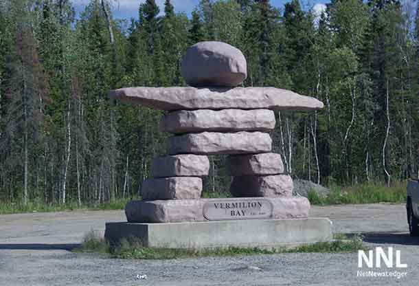
| Dryden and Vermilion Bay | Sunny after morning fog clears. High 16°C. Clear tonight with fog and a frost risk. Low 2°C. | Sunny after morning fog. South wind becoming 20 km/h late in the morning. High 17°C. Clear overnight, low 3°C. | Sunny and warmer. High 20°C. Clear Wednesday night, low 7°C. |
| Sioux Lookout and Eastern Lac Seul | Frost advisory early. Sunny after fog clears. High 17°C. Clear tonight with fog developing, low 3°C. | Sunny after morning fog clears. South wind becoming 20 km/h. High 18°C. Clear overnight, low 3°C. | Sunny and warmer. High 21°C. Clear Wednesday night, low 6°C. |
| Savant Lake and Sturgeon Lake | Frost advisory early. Sunny after fog clears. High 17°C. Clear tonight with fog developing, low 2°C. | Sunny after morning fog clears. South wind becoming 20 km/h. High 18°C. Clear overnight, low 3°C. | Sunny. High 21°C. Clear Wednesday night, low 6°C. |
| Red Lake and Woodland Caribou Park | Frost advisory early. Sunny after fog clears. High 17°C. Clear tonight with fog and another frost risk, low 3°C. | Sunny after morning fog. South wind 20 km/h, gusting to 40. High 18°C. Clear overnight, low 7°C. | Sunny. High 20°C. A 30% chance of showers Wednesday night, low 10°C. |
| Ear Falls, Perrault Falls and Western Lac Seul | Frost advisory early. Sunny after fog clears. High 17°C. Clear tonight with fog and a frost risk, low 3°C. | Sunny after morning fog. South wind 20 km/h, gusting to 40. High 18°C. Clear overnight, low 7°C. | Sunny. High 20°C. A 30% chance of showers Wednesday night, low 10°C. |
| Fort Frances, Emo and Rainy River | Fog clearing, then sunny. High 17°C. Clear tonight with fog and a frost risk, low 1°C. | Sunny after morning fog clears. Southeast wind becoming 20 km/h during the afternoon. High 17°C. Clear overnight, low 3°C. | Sunny and warmer. High 20°C. A 30% chance of showers Wednesday night, low 7°C. |
| Atikokan, Shebandowan and Quetico Park | Frost advisory early. Sunny after fog clears. High 17°C. Clear tonight with fog developing, low -1°C. | Sunny after morning fog. Southeast wind 20 km/h, gusting to 40. High 17°C. Clear overnight, low 1°C. | Sunny and warmer. High 20°C. Clear Wednesday night, low 5°C. |
| Pickle Lake and Cat Lake | Mainly sunny. Southwest wind becoming 20 km/h late in the morning. High 17°C. A few clouds tonight, low 3°C. | Mainly sunny. Southwest wind 20 km/h, gusting to 40. High 18°C. Clear overnight, low 7°C. | Sunny and warmer. High 20°C. Cloudy periods Wednesday night, low 11°C. |
Cold Night Ahead for Atikokan and Nearby Inland Areas
Atikokan, Shebandowan and Quetico Park are forecast to fall to -1°C Monday night. Upsala, Kakabeka Falls, Armstrong, Geraldton, Nakina and several other inland communities may also reach or fall below freezing.
Families should bring sensitive plants indoors or cover them before sunset. Outdoor water lines, pet water dishes and equipment containing liquids should also be checked. Frost can form on docks, wooden steps, vehicle roofs and exposed bridge surfaces even when nearby paved roads remain dry.
Travel Outlook: Watch for Fog and Local Frost
Fog patches may reduce visibility early Monday and again early Tuesday along parts of Highways 11, 17, 71, 105, 502 and 599, as well as secondary and access roads. Drivers should use low-beam headlights, reduce speed and leave more space between vehicles.
Because the forecast is dry, widespread road icing is not expected. However, isolated frost could make exposed bridges, wooden surfaces and shaded rural stretches locally slippery near sunrise.
Southerly winds increase Tuesday. Gusts may reach 40 km/h around Red Lake, Ear Falls, Ignace, Atikokan, Quetico and Pickle Lake. Drivers of transport trucks, campers and other high-profile vehicles should be ready for crosswinds on exposed sections of highway.
Boating and Outdoor Work
Monday offers generally quiet weather for work and recreation, although morning fog could hide shorelines, islands and other boats. Tuesday’s southerly or southwesterly winds may produce choppier water on Lake of the Woods, Lac Seul, Wabigoon Lake, Rainy Lake and other large inland lakes.
- Wear an approved personal flotation device; northern lakes are cold enough for immersion to become dangerous quickly.
- Do not judge open-water conditions only from a protected dock or bay.
- Carry working communications and tell someone your route and return time.
- Outdoor workers should secure lightweight materials before Tuesday’s gusts develop.
- Dress in layers for near-freezing morning conditions, even though afternoons will become mild.
This report uses public community forecasts, not specialized marine or aviation forecasts. Boaters and pilots should consult the appropriate official bulletin before departure.
School Buses: All Routes Displayed as On Time
The Northwestern Ontario Student Services Consortium displayed all buses as running on time in its early-morning update Monday. The consortium notes that only delays of 15 minutes or longer are posted.
No weather-related cancellation or delay was displayed. No driver-shortage or other operational cancellation was displayed during the check. Families should still review the consortium’s current bus-status page before leaving home because route conditions can change.