Far North Ontario weather for August 7-9, 2026, including Sandy Lake, KI/Big Trout Lake, Neskantaga, Marten Falls/Ogoki Post and Attawapiskat
FAR NORTH ONTARIO – WEATHER – An unsettled weather pattern will dominate much of Far North Ontario through the weekend, bringing showers, occasional thunderstorms and gusty west winds from Sandy Lake eastward through Kitchenuhmaykoosib Inninuwug, Neskantaga, Marten Falls/Ogoki Post and Attawapiskat.
Friday and Saturday carry the greatest thunderstorm risk. Temperatures will generally remain in the upper teens in Sandy Lake and KI, while communities farther east will reach the low to mid-20s before somewhat cooler air settles in Sunday.
Environment Canada forecasts also point to repeated shower chances through the weekend, making changing flying and boating conditions an important consideration.
Today’s Weather Overview
Sandy Lake
At 6:00 a.m. CDT, Sandy Lake Airport reported cloudy skies and a temperature of 12.6°C. Humidity was at 100 per cent, pressure was 100.7 kPa and west winds were blowing at 11 km/h.
Friday: Cloudy with a 60 per cent chance of showers and a risk of an afternoon thunderstorm. Northwest winds at 30 km/h become lighter during the afternoon before turning west at 20 km/h late in the day. The high will reach 19°C. Tonight remains mainly cloudy with a 60 per cent chance of showers and an evening thunderstorm risk. Low 11°C.
Saturday: Cloudy, with the chance of showers increasing to 70 per cent during the morning. A thunderstorm is possible from late morning through the afternoon. West winds develop at 20 km/h. High 19°C, with a nighttime low of 12°C.
Sunday: Cloudy with a 40 per cent chance of showers. High 19°C and low 12°C Sunday night.
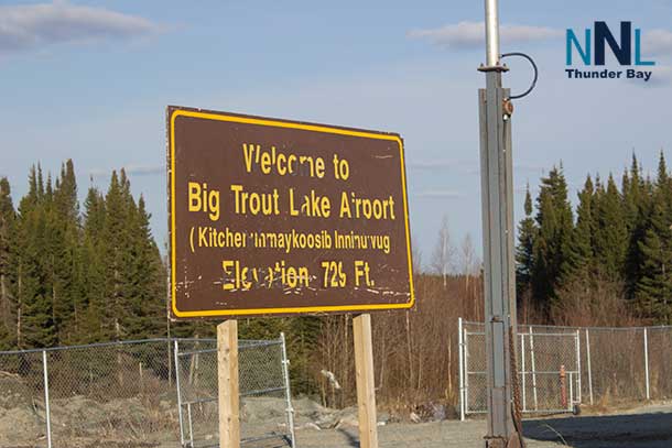
KI / Big Trout Lake
At Big Trout Lake Airport, Environment Canada reported light rain and 13.2°C at 6:14 a.m. CDT. Humidity was 97 per cent, pressure was 100.2 kPa and west-northwest winds were blowing at 15 km/h with gusts to 35 km/h.
Friday: Showers will end during the afternoon, followed by cloudy skies and a continuing 40 per cent chance of showers. There is a thunderstorm risk through early afternoon. West winds will reach 30 km/h with gusts to 50. High 19°C. Tonight will bring a 40 per cent chance of showers and a low of 10°C.
Saturday: Cloudy with a 70 per cent chance of showers and an afternoon thunderstorm risk. West winds of 30 km/h could gust to 50. High 18°C. Saturday night remains cloudy with a 60 per cent chance of showers and a low of 11°C.
Sunday: Cloudy with a 60 per cent chance of showers. High 18°C, with a low of 11°C Sunday night.
Neskantaga
Environment Canada’s Lansdowne House forecast and airport observation provide the closest official conditions for the Neskantaga area.
At 7:00 a.m. EDT, Lansdowne House Airport reported mainly sunny skies and 15.2°C. Humidity was 87 per cent and pressure stood at 100.5 kPa. West winds were already fairly strong at 26 km/h, gusting to 42 km/h.
Friday: Cloudy with a 60 per cent chance of showers and a risk of thunderstorms. West winds will reach 20 km/h with gusts to 40. The high will be 24°C, with a humidex near 26. Tonight brings a 40 per cent chance of showers early and a low of 12°C.
Saturday: Mainly cloudy. The chance of showers rises to 70 per cent during the afternoon, when thunderstorms are also possible. West winds will reach 20 km/h with gusts to 40. High 23°C, feeling closer to 27 with the humidex. Low 12°C Saturday night.
Sunday: A mix of sun and cloud with a 60 per cent chance of showers. High 21°C and low 12°C Sunday night.
Marten Falls / Ogoki Post
Ogoki Post Airport reported light rain and a temperature of 16.3°C at 7:17 a.m. EDT. Humidity was 93 per cent, pressure was 100.5 kPa and winds were light from the south at 8 km/h.
Friday: Cloudy with a 60 per cent chance of showers and a risk of a thunderstorm. West winds strengthen to 20 km/h with gusts to 40. High 24°C, with a humidex of 26. Tonight has a 40 per cent chance of showers and an evening thunderstorm risk, with a low of 12°C.
Saturday: Mainly cloudy, with the likelihood of showers increasing to 70 per cent in the afternoon. Thunderstorms are possible during the afternoon. West winds will reach 20 km/h and gust to 40. High 23°C, humidex 27. Low 12°C overnight.
Sunday: A mix of sun and cloud with a 60 per cent chance of showers. High 21°C. Sunday night remains unsettled with a 60 per cent chance of showers and a low of 12°C.
Attawapiskat
Attawapiskat Airport reported mostly cloudy skies and 17.8°C at 7:00 a.m. EDT. Humidity was 80 per cent, pressure was 100.5 kPa and south-southwest winds were blowing at 15 km/h with gusts to 28.
Friday: Mainly cloudy with a 60 per cent chance of showers and an afternoon thunderstorm risk. West winds will reach 20 km/h with gusts to 40. The high will be 23°C, although the humidex could make it feel closer to 28. Tonight has a 30 per cent chance of showers and a low of 12°C.
Saturday: Mainly cloudy. The chance of showers rises from 30 per cent around midday to 70 per cent during the afternoon, with thunderstorms possible. West winds develop at 20 km/h. High 21°C, humidex 26. Low 12°C overnight.
Sunday: A mix of sun and cloud with a 60 per cent chance of showers. Cooler conditions arrive with a high of 19°C. Sunday night remains cloudy with a 60 per cent chance of showers and a low of 12°C.
Far North Travel and Aviation Focus
Friday and Saturday will be the more challenging days for regional travel. Showers, thunderstorms and west winds gusting as high as 40 to 50 km/h could lead to rapidly changing conditions for aircraft operating into remote communities.
Low cloud and heavier showers can reduce visibility around airstrips, while thunderstorms can generate stronger localized wind gusts than the general forecast suggests.
Boaters should also monitor conditions carefully. Open lakes can become rough quickly when west winds strengthen. Anyone hearing thunder while on the water should seek safe shelter rather than waiting for rain to arrive.
Wardrobe Recommendations
A waterproof and wind-resistant jacket will be useful throughout the weekend. Temperatures around Sandy Lake and KI will stay relatively cool, with daytime readings near 18°C to 19°C, making sweaters or light fleece layers practical.
Neskantaga, Marten Falls and Attawapiskat will be warmer Friday and Saturday, so lighter clothing will work during the afternoon, but rain gear should remain close at hand. Waterproof footwear will also be valuable where repeated showers leave trails and community roads wet.
Weather Trivia
The weekend highlights just how much summer temperatures can vary across Ontario’s Far North. Environment Canada lists an early-August normal daytime high of about 23°C at Sandy Lake, compared with about 20°C at Attawapiskat. Friday reverses some of that usual west-to-east difference: Sandy Lake is forecast to reach only 19°C while Attawapiskat climbs to 23°C.
Summary: Far North Ontario weather for August 7-9, 2026, including Sandy Lake, KI/Big Trout Lake, Neskantaga, Marten Falls/Ogoki Post and Attawapiskat. Expect showers, gusty west winds and thunderstorm risks through the weekend.