Northwest Wildfire Update: 129 Active Fires, Evacuations and Highway Closures
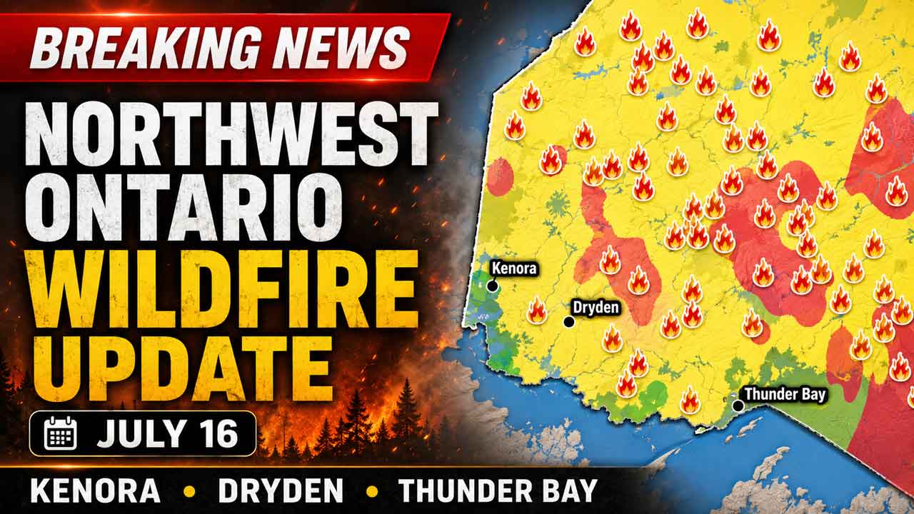
THUNDER BAY — Northwestern Ontario had 129 active wildland fires as of the latest provincial update, including 62 fires listed as not under control.
Five new fires were reported in the Northwest Fire Region, while major incidents near Wabakimi Provincial Park, Lac des Mille Lacs, Atikokan and several First Nations continued to threaten communities, transportation routes and critical infrastructure.
A Restricted Fire Zone remains in effect across the region, prohibiting campfires and other forms of open-air burning.
The Aviation, Forest Fire and Emergency Services bulletin is dated July 15 but includes operational information and fire danger conditions from the evening of July 16. NetNewsLedger is using the July 16 figures contained in the report while noting the discrepancy.
Five New Wildfires Confirmed in Northwest Region
Aviation, Forest Fire and Emergency Services reported five new fires by the evening of July 16:
Nipigon 63 is near the northwest end of Onaman Lake. The 0.1-hectare fire is not under control.
Nipigon 64 is about 7.3 kilometres northeast of Jobrin Lake. The four-hectare fire is not under control.
Nipigon 65 is about nine kilometres northeast of Kagianagami Lake. The four-hectare fire is not under control.
Nipigon 66 is about 9.3 kilometres south of Highway 11 and southeast of Gort Lake. The 0.1-hectare fire is not under control.
Kenora 18 is on an island at the north end of Lake of the Woods. The 0.1-hectare fire is not under control.
Of the region’s 129 active fires, 62 were not under control, five were being held, four were under control and 58 were being observed.
Thunder Bay 36 Now Includes Several Merged Fires
Dryden 13 and several fires carrying Thunder Bay designations have merged with Thunder Bay 36.
The combined fire in the Wabakimi area will now be identified as Thunder Bay 36.
The consolidation reflects the scale and complexity of the fire activity in and around Wabakimi Provincial Park. Large merged fires can create extended perimeters, complicate suppression planning and produce heavy smoke across a wide area.
The fire is also significant for remote communities, tourism operators, rail and aviation services, and Indigenous land users in the region.
Fort Frances 14 Remains Out of Control
Fort Frances 14 was estimated at 55,106 hectares and remained not under control.
The northern edge of the fire was estimated to be approximately five kilometres southwest of the Trans-Canada Highway at its closest point.
The southern perimeter extended to Fork Lake, about six kilometres north of Highway 11.
Fort Frances 14 and Fort Frances 15 showed significantly less growth overnight than during previous days. Provincial officials attributed the temporary reduction in fire behaviour to cloud cover, higher relative humidity and lower wind speeds.
However, the fire hazard remained high and conditions could deteriorate again with the return of hot, dry and windy weather.
Heavy smoke was also limiting visibility and restricting aircraft operations in the fire area.
Communities and Areas Affected by Fire Growth
Areas where fires showed significant growth on July 13 and 14 included:
Namaygoosisagagun First Nation, also known as Collins, Armstrong and Whitesand First Nation, affected by Dryden 13
McDowell First Nation, affected by Red Lake 23
Quetico Provincial Park and the Atikokan area, affected by Fort Frances 15 and Fort Frances 38
Gakijiwanong Anishinaabe Nation, affected by Fort Frances 37 and Minnesota’s Thumb Fire
Lac des Mille Lacs and the Upsala area, affected by Fort Frances 14
Mishkeegogamang First Nation, where multiple fires are burning
Wabakimi Provincial Park, where several fires have merged
Cat Lake, where multiple fires are burning
Fort Hope, affected by Nipigon 36 and Nipigon 58
The widespread nature of the fire activity means suppression resources must be divided across a large geographic area.
Provincial officials said priority is being given to operations where suppression is most likely to succeed, while protecting firefighters, residents, critical infrastructure and communities.
Crews are also working to contain new fires before they become larger incidents.
Mandatory Evacuation Orders Reported
The Ontario Provincial Police advised that mandatory evacuation orders were in effect for the following areas at the time of the bulletin:
Armstrong
Namaygoosisagagun First Nation
Cushing Lake
Lac des Mille Lacs First Nation and nearby communities
Whitesand First Nation
Cat Lake
Saugeen First Nation
McDowell Lake
Fort Hope
Mishkeegogamang First Nation
Residents should follow instructions from their First Nation leadership, municipality, emergency management officials and police.
Conditions can change quickly when fires are driven by wind, prolonged heat and dry forest fuels.
Ignace and Other Areas Told to Prepare
Residents in several areas were encouraged to prepare for a possible evacuation:
Ignace
Crystal Lake
The Highway 633 area
People in evacuation alert areas should be ready to leave on short notice.
Preparation should include gathering identification, medications, important documents, clothing, food and supplies for children and pets. Residents should also ensure their vehicles have fuel and that family members know how they will remain in contact if communications are disrupted.
Northwestern Ontario Highway Closures
The following highway closures were reported:
Highway 11 between Highway 633 and Highway 623
Highway 599 between Highway 516 and Mishkeegogamang First Nation
Highway 527 between Gull Bay First Nation and Armstrong
These closures affect important transportation corridors used by residents, emergency services, freight carriers and northern supply chains.
Motorists should not attempt to bypass barricades or use forest access roads as unofficial detours. Smoke, falling trees, emergency equipment and rapidly changing fire conditions can make those routes dangerous.
Travellers should confirm road conditions through official Ontario 511 information before leaving.
Evacuation Alerts Near Fort Frances and Atikokan
The Dryden, Fort Frances and Atikokan fire management district issued an evacuation alert because of Fort Frances 14, Fort Frances 15 and Fort Frances 38.
People living, working or travelling near the fires were strongly encouraged to prepare to evacuate on short notice.
A separate alert was issued for areas affected by Fort Frances 39 and Minnesota’s Thumb Fire. People in the Ontario portion of the affected area were also told to prepare for a possible evacuation.
The cross-border nature of the Thumb Fire demonstrates how fire and smoke conditions in Minnesota can directly affect Northwestern Ontario communities, air quality, aviation and emergency planning.
Hot, Dry and Windy Conditions Expected
The fire hazard was expected to remain high to extreme across Northwestern Ontario.
Hot, dry and windy conditions could increase fire intensity and cause existing fires to spread more rapidly.
Wind can push a fire’s leading edge toward roads, communities or infrastructure with little warning. It can also carry embers ahead of the main fire, creating new spot fires beyond established control lines.
Provincial officials said the size and location of the current fires require the full deployment of available resources.
Protection of life, property and infrastructure remains the focus of operations.
Restricted Fire Zone Prohibits Campfires
A Restricted Fire Zone took effect at 12:01 a.m. local time on July 15 across the Northwest Fire Region and a small part of the Northeast Fire Region.
The restriction was imposed because of the high-to-extreme fire hazard, the number of active fires and the need to prevent additional human-caused fires.
Open-air burning is prohibited inside the Restricted Fire Zone. That includes campfires.
All burning permits are suspended.
Portable gas or propane stoves may be used for cooking or warmth but must be handled with extreme caution.
The Restricted Fire Zone will remain in effect until further notice.
Preventing human-caused fires is particularly important while crews and aircraft are committed to protecting communities and fighting existing fires. Even a small new fire can require personnel, helicopters or waterbombers that are needed elsewhere.
Smoke Drifting Across the Region
Smoke from fires in Canada and the United States remained visible across parts of Northwestern Ontario.
Smoke conditions can change depending on wind direction, fire activity and atmospheric conditions. Communities far from an active fire may still experience poor air quality.
Wildfire smoke can be especially concerning for older adults, infants, pregnant people and people with heart or respiratory conditions.
Residents should monitor official air-quality information and local public-health guidance. Reducing strenuous outdoor activity, keeping windows closed when practical and using properly maintained indoor air filtration can help limit exposure during heavy smoke.
The movement of smoke across North America can be monitored through the FireSmoke Canada forecasting system.
Flight Restrictions Near Fort Frances 14
A Notice to Airmen, or NOTAM, was in effect near Fort Frances 14, northeast of Byers Lake.
The restriction is in addition to the standard Canadian Aviation Regulations governing airspace around active forest fires.
Under Section 601.15 of the regulations, aircraft that are not involved in fire suppression are generally prohibited from flying within five nautical miles of an active forest fire or below 3,000 feet above ground level.
Unauthorized aircraft, including drones, can force waterbombers and helicopters to leave the area, delaying suppression operations and placing flight crews at risk.
Pilots should review current wildfire NOTAMs through NAV Canada’s Collaborative Flight Planning Services before departure.
Why the Fire Situation Matters to Northwestern Ontario
The 2026 fire situation is affecting communities across a vast area, from Lake of the Woods and Quetico Provincial Park to Wabakimi, Cat Lake and Fort Hope.
For remote First Nations, an evacuation may require aircraft, buses and temporary accommodations hundreds of kilometres from home. Displacement can also interrupt health care, education, community services and access to traditional lands.
Highway closures may affect food, fuel and medical supply deliveries. They can also disrupt forestry, mining, construction and tourism operations during a critical period of the northern economy.
The fires near Highway 11, Highway 527, Highway 599 and the Trans-Canada Highway are particularly important because Northwestern Ontario has relatively few alternate transportation routes.
A closure on one major highway can create lengthy detours or temporarily isolate communities.
How to Report a Wildland Fire
To report a wildland fire north of the French and Mattawa rivers, call 310-FIRE, or 310-3473.
To report a wildland fire south of the French or Mattawa rivers, call 911.
Information about active fires, evacuation alerts, the Restricted Fire Zone and regional fire danger is available through Ontario’s official forest fire information service.
Residents should continue monitoring instructions from provincial authorities, police, municipalities and First Nation leadership as the situation evolves.