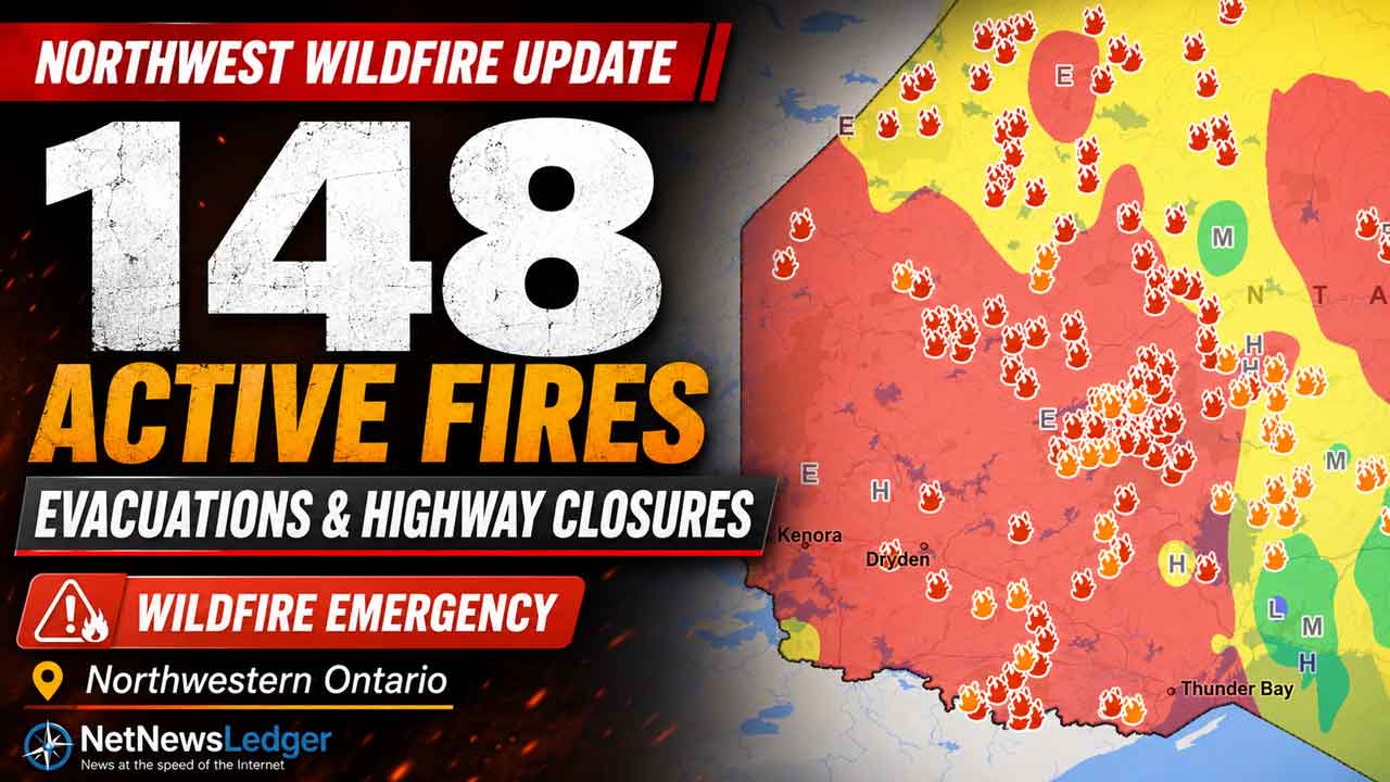
Evacuations, highway closures and 148 active fires intensify Northwestern Ontario’s wildfire emergency
THUNDER BAY – Northwestern Ontario recorded 26 new wildland fires by late Tuesday as emergency officials focused available resources on protecting communities, critical infrastructure and transportation routes.
As of 9:18 p.m. CDT on July 14, the Northwest Fire Region had 148 active fires. Sixty-nine were not under control, seven were being held, five were under control and 67 were being observed, according to Ontario’s Aviation, Forest Fire and Emergency Services.
Mandatory evacuation orders remained in place for several communities, while residents in Ignace, Crystal Lake and the Highway 633 area were being advised to prepare for a possible evacuation. Conditions remain fluid and official directions may change with little notice.
Evacuation Orders Remain in Effect
The Ontario Provincial Police reported mandatory evacuation orders for:
Armstrong
Namaygoosisagagun First Nation, also known as Collins First Nation
Cushing Lake
Lac des Mille Lacs First Nation and nearby communities
Whitesand First Nation
Residents in Ignace, Crystal Lake and the Highway 633 area were encouraged to prepare for a possible evacuation as wildfire conditions continued to evolve.
People requiring emergency assistance with an evacuation should call 9-1-1. Residents should follow instructions issued by their First Nation leadership, municipality, police or emergency-management officials.
Reports published Tuesday also listed Lac La Croix First Nation among communities affected by evacuation orders. Because evacuation information can change rapidly, residents should confirm their community’s current status through official channels.
Highway Closures Affect Regional Travel
Wildfire conditions resulted in closures on three important Northwestern Ontario transportation corridors:
Highway 11 between Highway 633 and Highway 623
Highway 599 between Highway 516 and Mishkeegogamang First Nation
Highway 527 between Gull Bay First Nation and Armstrong
The closures affect travel between communities and may complicate evacuations, emergency response, freight movement and the delivery of supplies.
Motorists should not attempt to drive through closed areas. Travellers should check current Ontario 511 information before leaving and be prepared to change or postpone their plans.
For Thunder Bay, the closures reinforce the city’s role as a regional reception, transportation and service centre for people displaced by northern emergencies.
Fires Threatening Communities and Infrastructure
Ontario fire officials identified several areas where fires experienced significant growth on July 13 and 14.
Priority areas included:
Namaygoosisagagun First Nation, Armstrong and Whitesand First Nation, affected by Dryden 13
MacDowell First Nation, affected by Red Lake 23
Quetico Provincial Park and the Atikokan area, affected by Fort Frances 15 and Fort Frances 38
Gakijiwanong Anishinaabe Nation, affected by Fort Frances 37 and Minnesota’s Thumb Fire
Lac des Mille Lacs First Nation and the Upsala area, affected by Fort Frances 14
Mishkeegogamang First Nation, where several fires were active
Wabakimi Provincial Park, where multiple fires had merged
Cat Lake, where several fires were burning
The ministry said the size of some fires and their proximity to communities, infrastructure and natural resources required the full deployment of available firefighting resources.
Fire operations were focused on protecting lives, property and infrastructure while attempting to contain new fires where suppression efforts were most likely to succeed.
Red Lake Fire Reaches More Than 3,000 Hectares
Red Lake 24 was located about nine kilometres west of MacDowell Lake.
The fire was estimated at 3,079 hectares and was not under control.
MacDowell First Nation and the surrounding area were among the locations identified by officials as priorities because of significant fire growth and potential risks to communities.
Large Fire Near Eabametoong First Nation
Nipigon 45 merged with Nipigon 46 to form an estimated 1,200-hectare fire.
The fire was located about 10 kilometres southeast of Eabametoong First Nation, also known as Fort Hope, between the Albany River and Eabamet Lake.
Nipigon 50, east of Miminiska Lake and north of Petawanga Lake, was estimated at 730 hectares and remained not under control.
Two additional fires north of Makokibatan Lake measured approximately 108 and 52 hectares. Both remained not under control.
New Fires in the Nipigon Sector
Several smaller fires were confirmed across the Nipigon sector:
Nipigon 41, about 5.5 kilometres north of Highway 11 near Windigokan Lake, was 0.1 hectares and not under control.
Nipigon 42, about 14.5 kilometres northwest of Onaman Lake, was 0.1 hectares and not under control.
Nipigon 43, east of South Ombabika Bay near Beaver Creek, was 0.7 hectares and not under control.
Nipigon 44 and Nipigon 49, west of Ogoki Lake near Mahamo Lake, measured 0.1 and one hectare.
Nipigon 51, 52 and 53, north of Wababimiga Lake, measured two, one and 0.5 hectares.
Nipigon 54, north of Chipman Lake and the Kenogami River, was three hectares.
Nipigon 55, between Atwood Lake and Guerin Lake, was one hectare.
Nipigon 56, on a small island near the southern side of Kagianagami Lake, was 0.3 hectares.
These fires were listed as not under control at the time of the update.
Fires in the Sioux Lookout Sector
Seven new fires were identified in the Sioux Lookout sector:
Sioux Lookout 90 was located on an island on the southeast side of Osnaburgh Lake. The 0.2-hectare fire was not under control.
Sioux Lookout 91 was about 18 kilometres northwest of Wabakimi Lake. The six-hectare fire was being observed.
Sioux Lookout 92 was located on Kagami Island in the Albany River. The 60-hectare fire was being observed.
Sioux Lookout 93 and 94 were between Windigo Lake and Pipestone River Provincial Park. They measured seven and 0.5 hectares and were not under control.
Sioux Lookout 95 was east of Highway 599, south of Jabez Lake. The four-hectare fire was not under control.
Sioux Lookout 96 was south of Rat Rapids between Highway 599 and the Albany River. The 0.2-hectare fire was not under control.
Multiple merged fires were also active in Wabakimi Provincial Park, adding pressure to an area used by residents, tourism operators and backcountry travellers.
Fire Near Ignace Being Held
Dryden 37 was located about 21 kilometres southeast of Ignace and north of Highway 17.
The fire was estimated at 1.5 hectares and was being held, meaning firefighters had achieved sufficient suppression to prevent further spread under expected conditions.
Residents in Ignace remained under instructions to prepare for a possible evacuation because of the broader regional fire situation.
Fort Frances and International Border Fires
Fort Frances 39 was burning across several small islands in Lac La Croix, south of Eastbend Island along the Canada-U.S. border.
The fire was estimated at 41.5 hectares and was being observed.
The location highlights the cross-border nature of the current wildfire emergency. Smoke, firefighting aircraft and fires near the international boundary may affect communities and transportation routes on both sides of the border.
Gakijiwanong Anishinaabe Nation was also being affected by Fort Frances 37 and Minnesota’s Thumb Fire.
Restricted Fire Zone Now in Effect
A Restricted Fire Zone came into effect at 12:01 a.m. local time on Wednesday, July 15, covering the Northwest Fire Region and a small portion of the Northeast Fire Region.
The restriction was imposed because of high to extreme fire danger, increased wildfire activity and the need to reduce human-caused fires.
Open-air burning, including campfires, is prohibited within the Restricted Fire Zone. Burning permits are suspended.
Portable gas or propane stoves may be used for cooking and warmth but must be operated with extreme caution.
Provincial rules prohibit open fires within a Restricted Fire Zone except under limited authorized conditions. The prohibition includes campfires and fires in outdoor grates, fireplaces and fire pits.
The Restricted Fire Zone will remain in effect until further notice.
Airspace Restrictions Near Active Fires
A Notice to Airmen was issued around Fort Frances 14, northeast of Byers Lake.
The restriction is in addition to standard Canadian Aviation Regulations prohibiting unauthorized aircraft from operating within five nautical miles of an active forest fire and below 3,000 feet above ground level.
Unauthorized aircraft, including drones, can force firefighting aircraft to leave an area and interrupt suppression operations.
Pilots should check current notices through NAV Canada before entering affected airspace.
Smoke Drifting Across Northwestern Ontario
Smoke from fires in Canada and the United States remained visible across portions of Northwestern Ontario.
Smoke conditions may change depending on wind direction, fire activity and atmospheric conditions. People with respiratory or cardiovascular conditions, older adults, children and people working outdoors may be more vulnerable to wildfire smoke.
Residents can monitor smoke movement through FireSmoke.ca and should follow health guidance when air quality deteriorates.
What the Fire Situation Means for the Region
The growing number of fires is placing pressure on firefighting crews, aircraft and emergency-management resources across a vast geographic area.
Highway closures can disrupt the movement of food, fuel, medical supplies and other essential goods to First Nations and northern municipalities. Tourism, forestry, mining, construction and transportation operations may also face delays or temporary shutdowns.
Thunder Bay is likely to remain an important destination for evacuees because of its airport, highway connections, accommodation capacity, health-care services and emergency-support infrastructure. There are reports that many hotels are already full.
The number, size and location of fires can change quickly. Residents should continue monitoring official updates rather than relying on older maps or social-media posts.
How to Report a Wildland Fire
To report a wildland fire north of the French and Mattawa rivers, call 310-FIRE — 310-3473.
Call 9-1-1 to report an immediate threat to life, a structure fire or an emergency requiring police, fire or ambulance services.
Information about current fires, restrictions and danger ratings is available through Ontario’s forest fire information service.