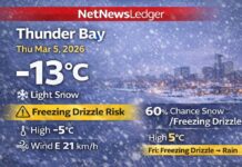
Morning snow tapers with a freezing-drizzle risk, then mainly cloudy and +2°C
Report has been updated… Freezing Rain Warning and Highway Closures in Effect
Observed (2:00 a.m. CST, Sat Nov 22, 2025 — Kenora Airport): It’s cloudy and –1.1°C (feels like –6). Pressure 101.0 kPa (falling), humidity 78%, wind SSE 16 km/h, and visibility 32 km.
Today — Periods of snow end, watch early glaze, afternoon turns milder
Kenora – WEATHER – Overnight periods of snow arrive with a risk of freezing drizzle before morning—that’s the thin, hard-to-see ice coating that makes steps and bridges treacherous.
Through the morning, the snow ends, leaving it mainly cloudy. Wind shifts to west 20 km/h early this afternoon. High +2°C. Plan for slick spots on untreated roads and sidewalks during the morning transition.
Tonight — Mostly cloudy, a touch breezy early, refreeze late
Mainly cloudy. Wind west 20 km/h becoming light late this evening. Low –2°C, with wind chill near –5 overnight. Any wet surfaces refreeze, so expect patchy black ice toward dawn.
Sunday — Brighter and a little warmer
A mix of sun and cloud, high +4°C.
Sunday night: Cloudy periods, low –1°C.
What to wear & travel tips
-
Layers: thermal top, warm mid-layer, wind-resistant jacket.
-
Waterproof, grippy footwear for early slick spots and evening refreeze.
-
Driving: slow down for freezing drizzle glaze, give extra space on bridges and overpasses, and keep low beams on in any patchy morning mist.
Current numbers at a glance
Wind: SSE 16 km/h (turning W 20 km/h this afternoon) • Pressure: 101.0 kPa (falling) • Humidity: 78% • Visibility: 32 km
Lake of the Woods weather trivia
Freezing drizzle forms when a shallow warm layer melts snow into drops that supercool in near-freezing air, then freeze on contact—why “wet” turns to “ice” fast.

