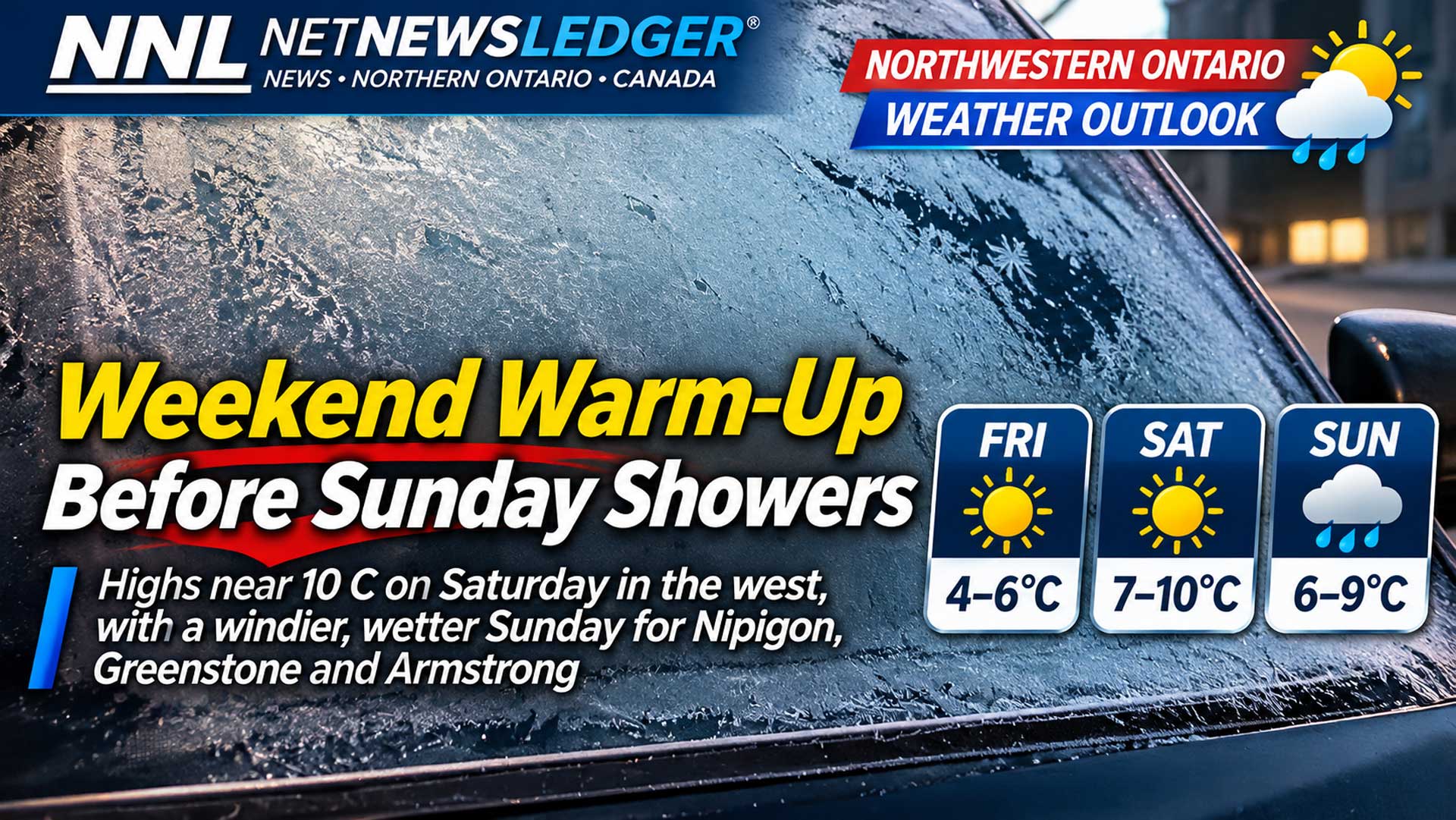
Highs near 10 C arrive Saturday in the west, while Nipigon, Greenstone and Armstrong face a windier, wetter Sunday
Sun first, showers later
THUNDER BAY, Ont. — Issued Friday, Nov. 6, 2026, at 6:11 a.m. EST – WEATHER –A ridge of high pressure will give Northwestern Ontario a dry, bright Friday and Saturday before cloud and scattered showers arrive in the eastern part of the region Sunday. Environment and Climate Change Canada issued the short-range and extended bulletins at 5:30 a.m. EST Friday.
Cold morning wind chills and the Sunday return of showers are the main practical concerns. It is a morning for walkers to grab a pair of gloves. Motorists heading out might be scrapping the first frost off the windshields.
Friday Mainly sunny across the region
Kenora will be mainly sunny with a south wind increasing to 20 km/h and gusting to 40 near noon. The high is 6 C after a morning wind chill near minus 6. Red Lake also reaches 6 C, with southwest winds of 20 km/h gusting to 40. Red Lake’s Friday-night low is 1 C, while Kenora stays near 2 C.
Dryden and Ignace share an official forecast: mainly sunny, a south wind increasing to 20 km/h near noon, a high of 5 C and a morning wind chill near minus 5. Friday night falls to minus 1. Fort Frances will be mainly sunny with a high of 5 C and a low of minus 1.
Sioux Lookout will be mainly sunny with a high of 4 C and a morning wind chill near minus 9; the night is partly cloudy with a low of 1 C.
Armstrong is represented by the official Lake Nipigon–Wabakimi forecast. Cloud will clear near noon, with a high of 3 C and a Friday-night low of minus 4. Greenstone is represented by Geraldton–Longlac–Caramat: clearing in the morning, a high of 3 C and a low of minus 6. Nipigon clears in the morning, reaches 3 C and falls to minus 3 overnight.
Saturday Western highs reach 10 C
Kenora, Dryden, Ignace and Fort Frances rise to 10 C under mainly sunny skies. Dryden and Ignace will see southwest winds of 30 km/h gusting to 50 in the morning. Red Lake and Sioux Lookout also reach 10 C with a mix of sun and cloud; Sioux Lookout clears near noon.
Farther east, Armstrong’s substitute region reaches 6 C with sun and cloud. Greenstone reaches 7 C under a mix of sun and cloud, and Nipigon becomes cloudy in the morning before reaching 6 C. Saturday night brings a 40 per cent shower chance to Armstrong, Greenstone and Nipigon, with lows from 1 C to 4 C. The west remains mainly dry.
Sunday Showers favour the east
Kenora and Dryden–Ignace will see sun and cloud with highs of 9 C and 8 C respectively. Fort Frances will be sunny with a high of 9 C. Red Lake and Sioux Lookout have a mix of sun and cloud and highs of 7 C.
The more consequential change is east of Sioux Lookout. Armstrong and Greenstone have a 60 per cent chance of showers, windy conditions and highs near 6 C. Nipigon also has a 60 per cent chance of showers, will be windy and reaches 7 C. Wet roads and gusts may make travel less comfortable along Highway 11 and Highway 17, though Environment Canada did not specify rainfall totals in the morning bulletin.
Wardrobe and travel
Use gloves and a warm layer for the sub-zero starts, then choose layers that can be removed as temperatures rise. Sunglasses will be useful Friday and Saturday. Travellers heading through Armstrong, Greenstone or Nipigon on Sunday should add waterproof footwear and a rain shell and allow for wet pavement.
Weather trivia
A ridge is an elongated area of relatively high atmospheric pressure. It often brings sinking air and fewer clouds, which fits the sunnier first half of this forecast before the next system approaches.