THUNDER BAY — WEATHER — Friday, Sept. 18, 2026 — Northern Ontario’s remote and fly-in communities are heading into a cool early-autumn weekend, with the chilliest conditions along Hudson Bay and James Bay and somewhat milder temperatures across inland communities.
Friday offers the best weather window for many inland locations, including Summer Beaver, Sachigo Lake and Kitchenuhmaykoosib Inninuwug. Conditions become more unsettled Saturday in several communities, while Sunday brings another push of cooler air toward Hudson and James Bays.
Travellers should be prepared for rapid changes in cloud, visibility and wind. Those flying should check directly with their airline or community airport before departure because general public forecasts do not replace aviation forecasts.
Three-Day Northern Ontario Weather Outlook
Wasaho Cree Nation — Fort Severn
Fort Severn starts Friday very cold for mid-September, with temperatures around or below freezing early in the morning before a significant daytime recovery.
Friday, Sept. 18: Some sunshine early followed by increasing cloud. An isolated afternoon shower is possible. High near 12 C, with an overnight low around 7 C.
Saturday, Sept. 19: Cloudy and windy with one or two brief showers possible. High near 10 C, falling to about 4 C overnight.
Sunday, Sept. 20: Breezy during the morning and generally cloudy. High near 11 C. Sunday night falls to approximately 4 C.
For people travelling on the land or water, warm and wind-resistant clothing will be important. Temperatures around Hudson Bay can feel considerably colder when exposed to wind.
Peawanuck — Weenusk First Nation
Cool Hudson Bay air remains firmly in control at Peawanuck through the weekend.
Friday: A mixture of cloud and sunshine. High near 12 C, with a low near 6 C tonight.
Saturday: Some sunshine initially before cloud increases. Periods of rain or drizzle may develop during the afternoon. High near 13 C, low around 4 C.
Sunday: Cloudy, with a spot shower possible and breezy conditions during the morning. High only 9 C. Temperatures could fall to around 0 C Sunday night.
The Sunday night temperature is worth watching. People with outdoor water systems, equipment or sensitive plants should prepare for the possibility of frost or freezing temperatures.
Attawapiskat First Nation
James Bay will continue to keep Attawapiskat considerably cooler than communities farther inland.
Friday: Considerable cloudiness with a couple of showers possible. High near 11 C, falling to 4 C overnight.
Saturday: Cloud and sunny breaks with afternoon showers possible. High near 12 C, low near 5 C.
Sunday: Cloudy and cool with a high near 10 C. Sunday night could fall to approximately -1 C.
That near-freezing Sunday night forecast means frost is increasingly possible heading into Monday morning.
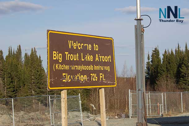
Kitchenuhmaykoosib Inninuwug — Big Trout Lake
KI should enjoy relatively comfortable Friday conditions before temperatures drop Saturday.
Friday: Partly sunny and pleasant with a high near 16 C. Overnight low around 9 C.
Saturday: A mixture of cloud and sunshine. Cooler, with a high near 13 C and overnight low around 3 C.
Sunday: Cloud increases through the day. High near 14 C, with a low around 5 C Sunday night.
The Saturday night temperature could produce localized frost in colder or sheltered areas.
Sachigo Lake First Nation
Sachigo Lake has one of the brighter Friday forecasts across the Far North.
Friday: Mostly sunny and pleasant. High near 17 C, low around 8 C.
Saturday: Partial sunshine with a cooler high near 12 C. Temperatures fall to approximately 2 C overnight.
Sunday: Mostly cloudy but somewhat milder, reaching about 15 C. Low near 6 C.
Saturday night will be cold enough for patchy frost to become a concern, especially away from the immediate lakeshore.
Sandy Lake First Nation
Sandy Lake should see fairly quiet weather for much of the weekend.
Friday: Sunshine mixed with some cloud, although a couple of afternoon showers are possible. High near 15 C, with a low near 7 C.
Saturday: Sunny to partly cloudy. High near 14 C, low around 4 C.
Sunday: Periods of cloud and sunshine with a high near 15 C. Overnight low around 4 C.
Overall, this is a relatively favourable weekend for local travel, although afternoon showers Friday could briefly lower visibility.
Nibinamik First Nation — Summer Beaver
Summer Beaver should have some of the warmest weather in this northern forecast area Friday and Saturday.
Friday: Plenty of sunshine and a high near 17 C. Overnight low around 8 C.
Saturday: Mainly sunny and again reaching about 17 C. The temperature falls sharply Saturday night to around 3 C.
Sunday: Mostly cloudy and cooler, with a high near 14 C and low around 4 C.
Saturday night’s temperature drop will make it feel much more like late September.
Other Remote Communities: Watch the Same Cooling Trend
Communities including Pikangikum, Deer Lake, North Spirit Lake, Bearskin Lake, Kasabonika Lake, Webequie, Neskantaga First Nation, Marten Falls and Cat Lake should generally expect the same broad weather pattern: relatively quiet or mild conditions Friday, cooler nights through the weekend and an increasing risk of temperatures approaching the freezing mark in some locations.
Conditions can vary substantially over relatively short distances in the Far North, particularly where lakes, muskeg and local wind direction influence temperature and fog.
Environment and Climate Change Canada already has frost advisories in effect Friday morning for several parts of Northwestern Ontario, including the Red Lake, Sioux Lookout and Thunder Bay forecast regions. The Sioux Lookout forecast called for temperatures near 1 C early Friday with patchy frost.
Flying and Travel Outlook
Friday provides the better overall travel window across many inland communities. Sunshine around Sachigo Lake, Big Trout Lake and Summer Beaver should help, although isolated showers remain possible elsewhere.
Saturday deserves closer attention near Hudson Bay and James Bay. Cloud, rain or drizzle and wind around Fort Severn, Peawanuck and Attawapiskat could result in periods of lower ceilings or reduced visibility.
Sunday becomes colder near the coast. Peawanuck drops to around 9 C and Attawapiskat to around 10 C, with near-freezing or sub-zero temperatures possible overnight.
Passengers should confirm flights directly with their carrier before heading to the airport. Pilots and operators should use current METARs, TAFs and aviation weather products rather than relying on a public weather forecast.
What to Wear This Weekend
Early autumn has arrived in the Far North. A sweater or fleece, wind-resistant outer layer and waterproof jacket should be part of the weekend wardrobe.
Anyone heading out hunting, fishing, travelling by boat or spending extended periods on the land should carry additional warm clothing. Daytime temperatures in the teens can become uncomfortable quickly once the sun sets, particularly with wind near Hudson and James bays.
Water temperatures are also increasingly cold. Anyone travelling by boat should wear an appropriate personal flotation device and prepare for conditions to change quickly.
Weekend Weather Bottom Line
The main weather story from Friday, Sept. 18 through Sunday, Sept. 20 is the growing difference between relatively mild inland communities and the much colder Hudson Bay and James Bay coast.
Summer Beaver and Sachigo Lake reach about 17 C Friday, while Fort Severn and Peawanuck remain near 12 C. By Sunday, coastal temperatures fall into the 9 C to 11 C range.
The second story is the overnight cold. Temperatures fall into the low single digits across many communities Saturday and Sunday nights, with Peawanuck approaching 0 C and Attawapiskat potentially dipping below freezing Sunday night.
Residents and travellers should check the latest Environment and Climate Change Canada alerts and local forecasts before travelling, as northern weather and aviation conditions can change quickly.
Summary: Northern Ontario remote communities face cool weather, showers and growing frost risk this weekend.