Thunder Bay – WEATHER DESK — SATURDAY, SEPTEMBER 12, 2026 — A cooler and unsettled weekend is unfolding across many remote northern communities, with scattered showers, gusty winds and periods of low cloud possible.
The roughest conditions are expected near Hudson Bay and James Bay, where wind and rain could affect local travel and aviation schedules. Western communities will remain cool through Sunday before another area of rain approaches Monday afternoon.
Temperatures should recover across much of the region on Monday, with daytime highs returning to the upper teens and, in a few communities, reaching 20°C.
Wasaho Cree Nation / Fort Severn
Saturday: Cloudy and becoming increasingly windy, with one or two brief showers. High near 10°C. Low near 5°C.
Sunday: Very windy, with occasional rain or drizzle during the morning. Cloudy conditions continue through the day. High near 11°C. Low near 6°C.
Monday: Breezy during the morning, then cloudy and considerably warmer. An isolated afternoon shower is possible. High near 18°C. Low near 6°C.
Travel outlook: Sunday presents the greatest risk of flight disruptions because of strong winds, low cloud and morning precipitation.
Peawanuck
Saturday: Mostly cloudy and cooler, with periods of showers. High near 18°C. Low near 6°C.
Sunday: Windy and sharply cooler. Morning rain and drizzle should become more scattered during the afternoon. High near 10°C. Low near 5°C.
Monday: Mostly cloudy and warmer, with a breeze during the morning. High near 19°C. Low near 8°C.
Travel outlook: Rain and wind could reduce visibility and produce difficult airport conditions on Sunday.
Attawapiskat and Kashechewan
Saturday: Attawapiskat can expect periods of rain, with a risk of a thunderstorm, followed by rain or drizzle. The high will be near 21°C. Kashechewan will be breezy with morning showers and a high near 19°C. Overnight lows will be close to 7°C.
Sunday: Much cooler and breezy. Attawapiskat will remain cloudy with an isolated shower and a high near 10°C. Kashechewan will be cloudy and windy with a high near 13°C. Overnight lows will range from 4°C to 5°C.
Monday: Improving conditions. Attawapiskat should become mostly sunny with a high near 18°C. Kashechewan will see a mix of sun and cloud and a high near 18°C. Monday-night temperatures should remain between 10°C and 11°C.
Travel outlook: Thunder, rain and lower visibility are the main concerns on Saturday. Wind becomes the greater concern on Sunday.
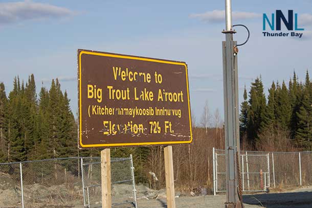
Kitchenuhmaykoosib Inninuwug
Saturday: Cloudy, breezy and cool, with passing showers. High near 11°C. Low near 6°C.
Sunday: Cloudy and breezy during the morning, followed by some afternoon sunny breaks. High near 13°C. Low near 6°C.
Monday: Increasing cloud and warmer temperatures. High near 18°C. Low near 9°C.
Sachigo Lake and Bearskin Lake
Saturday: A cold day for mid-September. Sachigo Lake will be cloudy with one or two morning showers and a high near 9°C. Bearskin Lake will also reach only about 9°C, with several showers possible. Lows near 5°C.
Sunday: Mainly cloudy. Sachigo Lake could see a few morning showers, while Bearskin Lake should remain mostly cloudy. Highs near 13°C and lows between 5°C and 6°C.
Monday: Warmer, with highs from 16°C to 18°C. Bearskin Lake could receive rain or drizzle during the afternoon. Overnight lows from 8°C to 9°C.
Sandy Lake, Deer Lake and North Spirit Lake
Saturday: Cloudy and cool, with scattered showers. Highs near 11°C and lows near 6°C.
Sunday: A mix of cloud and occasional sunny breaks, with an isolated shower possible. Highs between 15°C and 16°C. Overnight lows near 4°C to 5°C.
Monday: Cloud will increase, followed by periods of afternoon rain. Highs near 16°C to 17°C. Lows near 10°C.
Travel outlook: Monday afternoon could bring lowering cloud and visibility as rain spreads into the western communities.
Pikangikum
Saturday: Mostly cloudy and cooler, with morning rain or drizzle followed by an isolated afternoon shower. High near 11°C. Low near 6°C.
Sunday: Mostly cloudy with a chance of a shower. High near 14°C. Low near 4°C.
Monday: Cloudy, with periods of rain developing during the afternoon. High near 17°C. Low near 9°C.
Kasabonika Lake
Saturday: Turning cloudy and cooler, with one or two brief afternoon showers. High near 15°C. Low near 5°C.
Sunday: Mostly cloudy with a steady breeze. High near 13°C. Low near 4°C.
Monday: Warmer and increasingly cloudy. High near 20°C. Low near 9°C.
Webequie
Saturday: Cloudy and cooler, with light rain possible and breezy conditions developing during the afternoon. High near 17°C. Low near 5°C.
Sunday: A couple of morning showers, followed by mostly cloudy and breezy conditions. High near 13°C. Low near 5°C.
Monday: Turning cloudy and warmer. High near 18°C. Low near 9°C.
Neskantaga
Saturday: Cloudy and cooler, with one or two brief afternoon showers. High near 17°C. Low near 5°C.
Sunday: Remaining cloudy and cool. High near 12°C. Low near 4°C.
Monday: Some early sunshine followed by increasing cloud. High near 17°C. Low near 10°C.
Eabametoong and Marten Falls
Saturday: The Marten Falls and Ogoki Post area will be cloudy with showers and a high near 20°C. Similar unsettled conditions are possible across nearby Eabametoong, although residents should check the latest community-specific forecast. The overnight low near Marten Falls will be about 5°C.
Sunday: Cooler and breezy during the morning, with some sunshine and a chance of a shower. High near 13°C. The overnight low could fall to about 2°C, bringing near-frost temperatures in colder locations.
Monday: Increasing cloud and warmer. High near 19°C. Low near 10°C.
Regional Aviation and Travel Outlook
Passengers should expect the greatest potential for delays along the Hudson Bay and James Bay coast on Saturday and Sunday because of rain, wind and possible low ceilings.
Scattered showers may cause brief reductions in visibility across central and western communities through Sunday. Another area of rain is expected to move into parts of the western region Monday afternoon.
People travelling by small aircraft should confirm flight times directly with their airline. Pilots and operators must use current airport observations, forecasts and NOTAM information. This community forecast is not a substitute for an official aviation weather briefing.
What Residents Should Know
- Keep rain gear and a warmer jacket ready through Sunday.
- Secure loose outdoor items in coastal communities where stronger winds are expected.
- Watch for temperatures falling close to freezing around Marten Falls and other sheltered inland locations Sunday night.
- Check on Elders and anyone relying on wood heat as overnight temperatures fall.
- Check the latest Environment Canada forecasts and alerts before travelling on the land or water.
Weather information changes quickly across Northern Ontario. Always check the latest forecast, airport conditions and community advisories before departure.
Summary: A three-day weather forecast for Northern Ontario remote fly-in communities from September 12 to 14, 2026, including rain, wind, cooling temperatures and aviation concerns.