THUNDER BAY – WEATHER – Thunder Bay is beginning Tuesday under mostly cloudy skies, with gusty northwesterly winds and humid early-morning conditions. A few showers remain possible through early afternoon, while local smoke may continue to create hazy conditions. Skies should gradually clear tonight before warmer weather returns Wednesday.
Today’s Weather Overview
Current Conditions
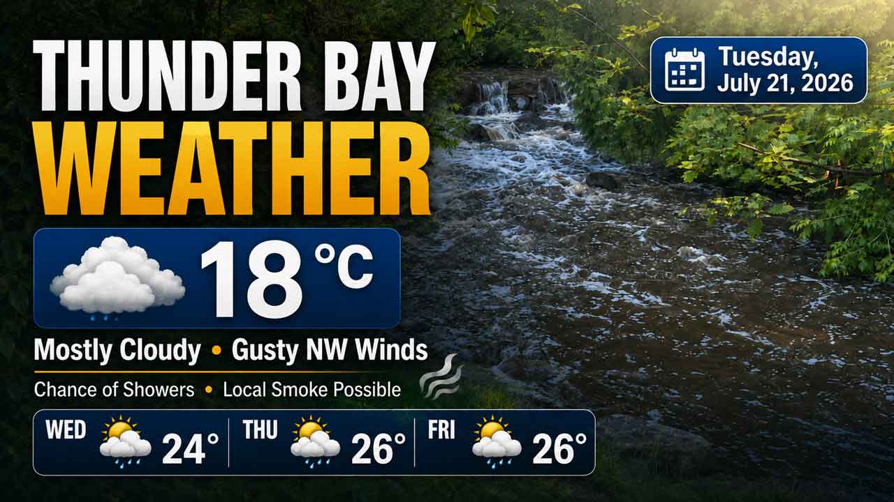
At 6:39 a.m. EDT, Thunder Bay Airport reported a temperature of 18°C under mostly cloudy skies. Humidity stood at 84 per cent, with a dew point of 15.3°C, giving the morning a somewhat damp feel.
The barometric pressure was 100.1 kPa and rising. Winds were coming from the north-northwest at 12 km/h, with gusts reaching 38 km/h. Visibility remained good at 32 kilometres. Environment Canada reported no weather alerts for Thunder Bay at the time of observation.
Cloudy skies will continue today, with a 40 per cent chance of showers this morning and early this afternoon. Local smoke is also expected. Northerly winds will strengthen to 30 km/h, with gusts potentially reaching 60 km/h during the morning.
The temperature will remain nearly steady at 20°C. The UV index is forecast to reach 5, or moderate, meaning sun protection is still recommended even with substantial cloud cover.
Tonight, the clouds should begin clearing late in the evening. Local smoke will remain possible. Northwest winds of 30 km/h, gusting to 50, will become light during the evening. The overnight low will fall to a cool 10°C.
Extended Weather Forecast
Expected Conditions
Wednesday, July 22
Wednesday will bring a more pleasant mixture of sunshine and cloud. Northwest winds will increase to 20 km/h, with gusts reaching 40 during the morning.
The afternoon high will reach 24°C, with a humidex of 25. The UV index will rise to 6, or high. Wednesday night will be clear, with a low of 12°C.
Thursday, July 23
Thursday will be warmer, with a mix of sun and cloud and a 30 per cent chance of showers. The daytime high will climb to 26°C.
Clouds will become more widespread Thursday night, accompanied by a continuing 30 per cent chance of showers. The overnight low will be 14°C.
Friday, July 24
Friday will remain warm and unsettled. A mixture of sunshine and cloud is forecast, along with a 30 per cent chance of showers and a high of 26°C.
Friday night will be cloudy with another 30 per cent chance of showers. Temperatures will remain relatively mild overnight, falling to 15°C.
Wardrobe Recommendations
A lightweight rain jacket or wind-resistant shell will be useful today. Strong wind gusts may make the temperature feel cooler, particularly near Lake Superior and in exposed areas. Secure loose hats and other outdoor items.
Long pants and closed footwear will provide comfort during the cooler evening, when temperatures begin dropping toward 10°C. Keep an umbrella nearby, although strong gusts may make a hooded rain jacket more practical.
Wednesday will be warm enough for lighter summer clothing during the afternoon, but a thin jacket may still be useful during the breezy morning. Sunglasses, sunscreen and a hat are recommended because the UV index will be high.
For Thursday and Friday, plan for warm-weather clothing while keeping a compact umbrella or rain jacket available for possible showers. Residents sensitive to smoke should also check the latest Air Quality Health Index before extended outdoor activity.
Weather Trivia
Thunder Bay’s normal temperature for this time of year is a daytime high of 25°C and an overnight low of 11°C. Tuesday’s forecast high of 20°C is therefore about five degrees below the seasonal daytime normal.
The sun rose at 6:18 a.m. and will set at 9:48 p.m., providing approximately 15 hours and 30 minutes of daylight.
Forecast source: Environment Canada, issued at 5:30 a.m. EDT on Tuesday, July 21, 2026.