August 10, 2026: Seasonal Temperatures and Scattered Showers Across Northwestern Ontario
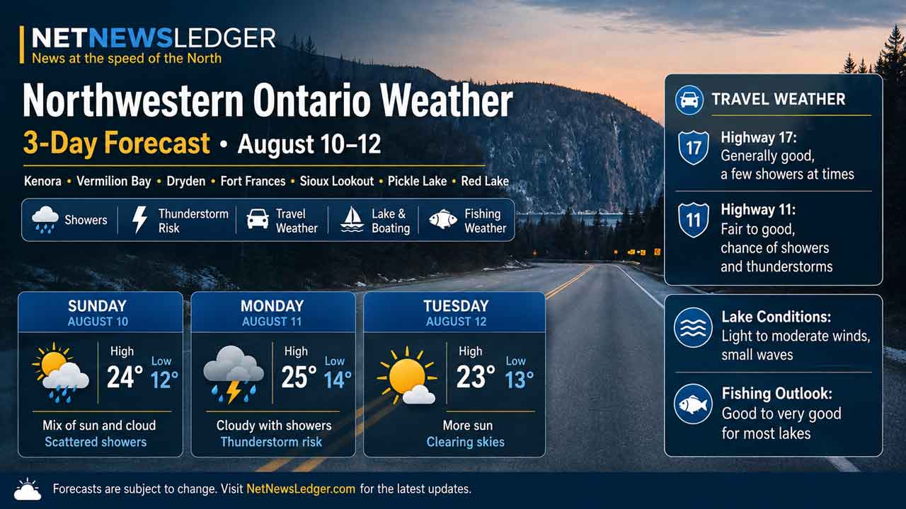
NORTHWESTERN ONTARIO – WEATHER – A fairly typical mid-August weather pattern is settling across Northwestern Ontario as the new week begins. Kenora, Vermilion Bay, Dryden, Fort Frances, Sioux Lookout, Pickle Lake and Red Lake can expect a mixture of sunshine and cloud through Wednesday, along with recurring chances for scattered showers.
Monday afternoon carries a 30 per cent shower risk across most of the region, increasing to 40 per cent around Pickle Lake, where Environment Canada also identifies a risk of thunderstorms. Temperatures warm Tuesday before easing slightly Wednesday.
Today’s Weather Overview
Current Conditions
Kenora: At 9:00 a.m. CDT, Kenora Airport was reporting partly cloudy skies and 18.0°C. Humidity was 73 per cent, pressure was rising at 101.5 kPa, and northwest winds were blowing at 10 km/h.
Dryden: Dryden Airport was sunny and 17.7°C at 9:00 a.m. Humidity stood at 73 per cent, pressure was 101.5 kPa and the west wind was 9 km/h.
Vermilion Bay: The Rawson Lake weather station recorded 18.7°C, humidity of 66 per cent and pressure of 101.5 kPa at 9:00 a.m. Winds were light from the west at 4 km/h. The station did not report a sky condition.
Fort Frances: The temperature was 18.9°C at 9:00 a.m., with humidity at 72 per cent and rising pressure of 101.5 kPa. North-northwest winds were blowing at 10 km/h.
Sioux Lookout: Sioux Lookout Airport reported partly cloudy skies and 18.3°C. Humidity was 68 per cent, pressure was rising at 101.4 kPa and northwest winds were light at 9 km/h.
Pickle Lake: At 9:00 a.m. EST, Pickle Lake Airport was partly cloudy and 15.4°C. Humidity was higher at 81 per cent, pressure was 101.2 kPa and west winds were blowing at 15 km/h.
Red Lake: Red Lake Airport was partly cloudy and 17.3°C at 9:00 a.m. Humidity was 79 per cent, pressure was rising at 101.4 kPa and winds were west-southwest at 9 km/h.
Three-Day Northwestern Ontario Forecast
Kenora
Monday, August 10: A mix of sun and cloud with a 30 per cent chance of afternoon showers. The high will reach 23°C, with a humidex of 25. Tonight has a 30 per cent chance of showers before skies clear later in the evening. Low 14°C.
Tuesday: Sunshine during the morning gives way to a mix of sun and cloud and a 40 per cent chance of afternoon showers. High 25°C, humidex 28. Tuesday night will be cloudy with a 30 per cent shower chance and a low of 15°C. Wednesday brings a mix of sun and cloud, a 30 per cent chance of showers and a high of 24°C before skies clear Wednesday night and temperatures fall to 12°C.
Dryden and Vermilion Bay
Dryden and Vermilion Bay share almost identical forecasts through the middle of the week.
Monday: A mix of sun and cloud with a 30 per cent chance of afternoon showers. West winds will increase to 20 km/h this afternoon. The high will be 22°C, with a low of 13°C tonight.
Tuesday: A mix of sun and cloud with a 40 per cent chance of afternoon showers. The high climbs to 24°C, feeling closer to 26 with the humidex. Tuesday night carries a 30 per cent shower chance with a low of 14°C. Wednesday remains partly unsettled with a 30 per cent chance of showers and a high of 23°C. Skies clear Wednesday night as the temperature falls to 11°C.
Fort Frances
Monday: A mix of sun and cloud with a 30 per cent chance of afternoon showers. The high will be 23°C, with a humidex of 26. Tonight will be mainly cloudy with a 30 per cent chance of showers and a low of 14°C.
Tuesday: Mainly cloudy with a 30 per cent chance of afternoon showers. Fort Frances will be among the warmest locations in the region at 25°C, with a humidex of 29. The overnight low will be 15°C. Wednesday brings a mix of sun and cloud with another 30 per cent shower chance and a high of 24°C, followed by clear skies and a low of 11°C.
Sioux Lookout
Monday: A mix of sun and cloud with a 30 per cent chance of afternoon showers. West winds will increase to 20 km/h this afternoon. The high will reach 21°C, followed by a low of 12°C tonight.
Tuesday: A warmer day with a mix of sun and cloud and a 40 per cent afternoon shower chance. High 24°C, with a humidex of 26. Tuesday night drops to 14°C with a 30 per cent chance of showers. Wednesday remains mixed with sun and cloud, a 30 per cent chance of showers and a high of 23°C. Clear skies are expected Wednesday night with a low of 11°C.
Pickle Lake
Monday: Pickle Lake has the most unsettled forecast of the communities covered today. A mix of sun and cloud comes with a 40 per cent chance of afternoon showers and a risk of a thunderstorm. West winds will increase to 20 km/h, with a high of 22°C. The thunderstorm risk continues early this evening before the temperature drops to 13°C.
Tuesday: Increasing cloud during the morning with a 30 per cent chance of late-afternoon showers. High 23°C, humidex 25, and an overnight low of 13°C. Wednesday turns cooler with a mix of sun and cloud and a 40 per cent chance of showers. The high will reach only 20°C, followed by a low of 11°C.
Red Lake
Monday: A mix of sun and cloud with a 30 per cent chance of afternoon showers. High 21°C. Tonight will be partly cloudy with a 30 per cent chance of an evening shower before skies clear toward morning. Low 12°C.
Tuesday: Sunny during the morning before clouds increase, bringing a 40 per cent chance of afternoon showers. High 22°C. Tuesday night has a 30 per cent shower chance and a low of 13°C. Wednesday features a mix of sun and cloud with a 30 per cent chance of showers and a high of 22°C, followed by clear skies and a low of 11°C.
Travel, Boating and Outdoor Focus
Overall, this is not a particularly stormy three-day period, but scattered showers mean conditions can vary considerably from one lake or highway corridor to another. West winds around 20 km/h develop in several areas Monday, including Dryden, Vermilion Bay, Sioux Lookout and Pickle Lake.
Pickle Lake deserves extra attention Monday afternoon because thunderstorms are possible. Boaters, anglers, paddlers and campers should monitor the sky and updated radar, particularly when travelling on larger exposed lakes.
Tuesday will likely be the warmest of the three days, with highs reaching 25°C in Kenora and Fort Frances and 24°C around Dryden, Vermilion Bay and Sioux Lookout.
Wardrobe Recommendations
Light summer clothing will work well during the afternoon, particularly Tuesday. A light waterproof jacket is still a good addition because shower chances run between 30 and 40 per cent across much of the region.
Morning and nighttime temperatures will generally fall into the 11°C to 15°C range, so campers, anglers and people spending evenings outdoors should bring a sweater or light fleece. Pickle Lake will feel coolest by Wednesday, when the daytime high is forecast at only 20°C.
Weather Trivia
The forecast is remarkably close to normal for mid-August. Environment Canada lists normal highs and lows of 24°C and 14°C for Kenora, 23°C and 12°C for Dryden and Vermilion Bay, 25°C and 12°C for Fort Frances, 23°C and 13°C for Sioux Lookout, and 22°C and 11°C for Pickle Lake.
Weather Overview: Northwestern Ontario weather for August 10-12, 2026, covering Kenora, Vermilion Bay, Dryden, Fort Frances, Sioux Lookout, Pickle Lake and Red Lake. Expect seasonal temperatures, scattered showers and a thunderstorm risk around Pickle Lake.