Northwest Ontario reports 137 active wildfires, eight new fires and expanded burning restrictions
THUNDER BAY — Weather conditions are likely to aid fire rangers. There are crews arriving in the region, and in Thunder Bay, some of them are being housed in residence at Lakehead University.
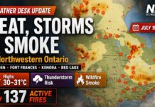
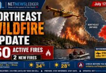
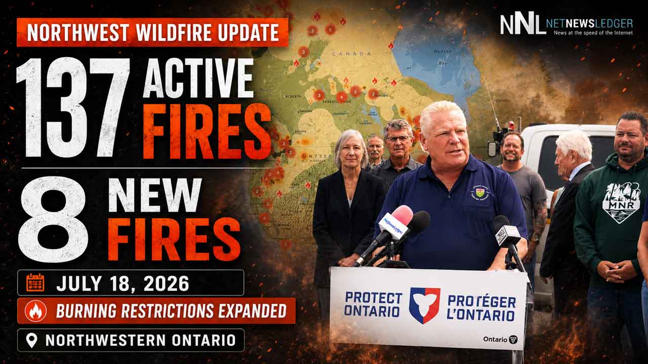
There were eight new wildland fires were confirmed across Northwestern Ontario by Saturday evening, bringing the regional total to 137 active fires.
It bears notice to readers that evacuation orders are in effect. There has been confusion from some over the evacuations. For the Wildfire Fort Frances 14 that is not impacting the Town of Fort Frances. Fires in the Thunder Bay region are not impacting the City of Thunder Bay in terms of evacuation. For example, the Wildfire Thunder Bay 36 is situated near Wabikimi Provincial Park, it is one of the larger fires. It is far from Thunder Bay.
Starting on Saturday, Neskantaga, or Fort Hope is in the process of being evacuated.
Wildfire Update
Ontario Premier Doug Ford was in Thunder Bay on Saturday.
Two of the newly identified fires were already larger than 1,000 hectares, including Nipigon 69 near Atwood Lake and Nipigon 70 in the northeastern section of Wabakimi Provincial Park.
Thunder Bay 36 remained the region’s largest fire at more than 318,000 hectares, while evacuation orders and alerts continued around Fort Frances 14, Fort Frances 15 and Fort Frances 38.
Eight New Wildfires Confirmed July 18
Aviation, Forest Fire and Emergency Services reported the following new fires:
Dryden 38 was located near Patricia Lake, west of Dryden 36. The 0.1-hectare fire has been declared out.
Nipigon 69 is approximately 12 kilometres northwest of Atwood Lake, near Vick Lake. The 2,142-hectare fire is not under control.
Nipigon 70 is in the northeastern section of Wabakimi Provincial Park, near Loune Lake. The 1,200-hectare fire is not under control.
Nipigon 71 is approximately 28 kilometres northeast of Machawaian Lake. The six-hectare fire is not under control.
Nipigon 72 is approximately five kilometres north of Rose Island on Attawapiskat Lake. The eight-hectare fire is not under control.
Nipigon 73 is approximately 16 kilometres northeast of Attawapiskat Lake, north of Aldred Lake. The two-hectare fire is not under control.
Nipigon 74 is approximately 17 kilometres west of the Attawapiskat River and northeast of Kitchie Lake. The 15-hectare fire is not under control.
Nipigon 75 is approximately 33 kilometres northwest of Marten Falls First Nation, east of Sebert Lake. The 40-hectare fire is not under control.
The size of Nipigon 69 and Nipigon 70 indicates that both fires were likely active before they were detected or formally confirmed.
Remote fires can grow quickly before aircraft are able to assess them, particularly when smoke and poor visibility limit surveillance.
Sixty-Seven Fires Remain Out of Control
There were 137 active wildland fires in the Northwest Fire Region as of the 8 p.m. update.
Of those fires:
67 were not under control
Seven were being held
Four were under control
59 were being observed
The number of fires listed as not under control continues to place heavy demands on firefighting crews, aircraft and emergency planners across the region.
Thunder Bay 36 Exceeds 318,000 Hectares
An Incident Management Team has assumed command of Thunder Bay 36.
The fire was estimated at 318,812.7 hectares and remained not under control.
Officials were unable to provide an updated perimeter or fire size because poor flying conditions had prevented aerial mapping during the previous several days.
Recent precipitation temporarily reduced fire activity, but the fire hazard remained high across the affected area.
Thunder Bay 36 includes several merged fires in and around Wabakimi Provincial Park. Its size and remote location create challenges for aircraft access, fire mapping and the movement of crews.
The fire may also affect First Nations, traditional land users, tourism operators, rail services and aviation routes across a wide section of Northwestern Ontario.
Fort Frances 14 Remapped at 51,806 Hectares
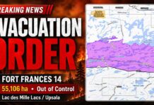
Fort Frances 14 was remapped to a more accurate size of 51,806 hectares. The fire remained not under control.
Its northern perimeter was approximately five kilometres southwest of the Trans-Canada Highway.
The southern perimeter was estimated at approximately nine kilometres north of Highway 11.
The fire remains a concern for the Lac des Mille Lacs and Upsala area because of its proximity to communities, transportation routes and infrastructure.
An evacuation order and an expanded evacuation alert remain associated with Fort Frances 14.
People inside an evacuation-order area must leave immediately and must not return unless authorized by the Ministry of Natural Resources.
Fort Frances 15 Remains Close to Highway 11
Fort Frances 15 was estimated at 48,261.4 hectares and was not under control.
The northern edge of the fire remained approximately 1.5 kilometres south of Highway 11.
The fire’s proximity to the highway is significant because Highway 11 is a major east-west transportation corridor for residents, emergency services, commercial trucking and northern supply chains.
Travellers should check Ontario 511 before entering the area and should not attempt to bypass road closures or emergency barricades.
Fort Frances 38 Being Held Near Crystal Lake
Fort Frances 38, north of Crystal Lake, was being held at 44.2 hectares.
A fire classified as being held is not expected to spread beyond its current boundaries under prevailing and forecast conditions if suppression efforts continue.
An evacuation alert remained in effect for areas associated with Fort Frances 15 and Fort Frances 38.
Residents in an evacuation-alert area should be prepared to leave on short notice if fire conditions worsen.
It is important to note that these evacuation orders are NOT for the Town of Fort Frances.
Rainfall Temporarily Reduces Fire Behaviour
Recent rainfall, lower wind speeds and higher relative humidity continued to reduce fire activity around the Fort Frances fires.
The improvement was considered temporary. It would take several days of precipitation to knock down these fires.
Fire behaviour can increase rapidly when temperatures rise, humidity drops or stronger winds return. Even after rainfall, dry forest fuels may remain capable of supporting active and intense fire.
Residents should continue following official evacuation instructions and should not interpret reduced fire behaviour as an indication that the danger has passed.
Restricted Fire Zone Expanded
The Restricted Fire Zone remains in effect across the Northwest Fire Region and has been expanded farther into Northeastern Ontario.
The original restriction took effect July 15 and was expanded at 12:01 a.m. on Saturday, July 18.
The restricted area now includes much of northern Ontario from the Manitoba boundary through portions of the Cochrane, Sudbury and Algoma districts.
No open-air burning, including campfires, is permitted within the Restricted Fire Zone.
All burning permits are suspended.
Portable gas or propane stoves may be used for cooking or warmth, but they must be operated with extreme caution.
The restrictions will remain in place until further notice.
The purpose of the order is to reduce the number of preventable human-caused fires while crews and aircraft are heavily committed to existing incidents.
Smoke Continues Across Ontario
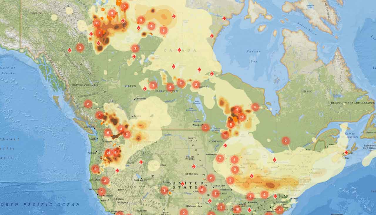
Smoke from fires in Canada and the United States continued to affect parts of Ontario.
Smoke conditions can change quickly depending on wind direction, fire activity and atmospheric conditions.
Heavy smoke can reduce highway visibility, disrupt aircraft operations and create health risks for people with heart or respiratory conditions.
Older adults, children, pregnant people and anyone with asthma or other lung conditions should monitor air-quality information and follow public-health guidance.
The movement of smoke across North America can be monitored using the FireSmoke Canada forecast.
Flight Restrictions Remain Near Fort Frances 14
A Notice to Airmen, or NOTAM, remained in effect near Fort Frances 14, northeast of Byers Lake.
The restriction is in addition to the automatic airspace rules that apply around every active forest fire.
Section 601.15 of the Canadian Aviation Regulations restricts unauthorized aircraft from flying within five nautical miles — approximately 9.3 kilometres — of an active forest fire and below 3,000 feet above ground level.
The restriction applies to drones as well as conventional aircraft.
Unauthorized aircraft can force waterbombers and helicopters to leave the area, delaying suppression operations and placing pilots and firefighters at risk.
Pilots must check current NOTAM information through NAV Canada’s Collaborative Flight Planning Services before departure.
Why the Fire Situation Matters Across Northwestern Ontario
The active fires stretch from the Fort Frances and Dryden districts to Wabakimi Provincial Park, Attawapiskat Lake and the Marten Falls area.
This broad geographic spread affects communities, First Nations, tourism, mining exploration, forestry, rail transportation and remote supply routes.
The new fire northwest of Marten Falls First Nation is especially important because remote communities may have limited evacuation routes and depend on aircraft for food, fuel, medical supplies and emergency transportation.
Fires near Highway 11 and the Trans-Canada Highway also pose risks to the movement of goods and residents across the region.
How to Report a Wildland Fire
To report a wildland fire north of the French and Mattawa rivers, call 310-FIRE, or 310-3473.
To report a wildland fire south of the French or Mattawa rivers, call 911.
Residents should continue monitoring information from the Ministry of Natural Resources, police, municipalities and First Nation leadership as fire conditions evolve.