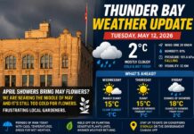
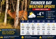
Thunder Bay Weather – Sunday, November 2 to Wednesday, November 5, 2025
THUNDER BAY – November eases in with a classic Lake Superior shuffle: a cold, mostly cloudy start, a quick swing to strong southwesterlies and showers today, brisk sunshine Monday, a gentler and milder Tuesday, and then a seasonable Wednesday. At 7:00 AM EST Sunday, Thunder Bay Airport reported mostly cloudy skies and –2.1°C, with a north-northeast breeze at 5 km/h putting the wind chill at –4. The barometric pressure is 101.5 kPa and falling, a tell that change is inbound, while humidity sits at 90% and visibility stretches 24 km.
Sunday, November 2 – Clouds, Showers, and a Windy Flip to Southwest
The morning holds onto mainly cloudy skies with a 30% chance of showers, but the headline is the wind shift. Expect southwest winds ramping up to 40 km/h with gusts to 60 this morning, pushing the high to 8°C after a biting morning wind chill near –7. The UV index is a tame 2, but the gusts will make it feel cooler than the thermometer suggests. Through the evening and after midnight it remains mainly cloudy with a 30% chance of showers, and those southwest winds ease slightly to 30 km/h gusting 50. Temperatures dip to +3°C before skies clear toward dawn.
Monday, November 3 – Brisk Sunshine and a Stiff Westerly
Monday starts brightening as a mix of sun and cloud gives way to clearing early in the afternoon. It’s a breezy one, with west winds near 40 km/h gusting to 60, enough to send leaves scurrying down Memorial Avenue. Despite the wind, the air moderates with a high of 9°C and a low UV index of 1. Monday night turns clear and cool, settling to +1°C under calm, starry skies.
Tuesday, November 4 – Pleasantly Mild Under Patchy Cloud
Tuesday offers one of the milder highs of the stretch with a mix of sun and cloud and temperatures reaching 10°C in the afternoon. Drier air and lighter winds make it feel friendlier than recent days. By night, skies remain clear, and the radiational cooling nips back, taking the low to –3°C with areas of frost by dawn.
Wednesday, November 5 – Seasonable, With Clouds Nudging Back
Mid-week looks seasonable and steady. Following the clear, frosty start, expect clouds to drift back in with afternoon temperatures in the mid-single digits to near 8°C and light to moderate breezes. With no organized system flagged in the provided guidance, any precipitation risk appears low, but the cooler evening may allow patchy frost again overnight.
Note on historical records: Precise record high/low for November 2 in Thunder Bay were not included in the provided data. Early-November history here typically ranges from the mid-teens warmth in a strong southwest flow to sharp early-season cold well below –15°C in arctic outbreaks. Climatic normals for early November generally hover around a few degrees above and below freezing.
What to Wear
Today demands strategy: start with a warm base layer and add a wind-resistant jacket to tame those 40–60 km/h gusts. Gloves and a toque make the morning wind chill of –7 far more pleasant. Monday’s sunshine is deceiving—keep the windproof layer handy. Tuesday is your “lighter jacket” day, but plan for a frosty return Tuesday night, so swap to insulated footwear if you’re out late.
H3: Thunder Bay Weather Trivia
Lake Superior is the stealthy stage manager of your forecast. In autumn, its relatively warm waters fuel clouds and wind shifts; then, under clear night skies, the same lake can set the table for sharp radiational cooling and crisp morning frosts—sometimes within 12 hours of gusty, mild air.
Welcome to shoulder season on the Big Lake!


