
New Fires Reported; Key Fires Near Kenora, Fort Frances, Sioux Lookout See Ongoing Suppression Efforts
THUNDER BAY, ON – Aviation, Forest Fire and Emergency Services (AFFES) is reporting 14 active wildland fires across the Northwest Region as of Thursday evening, May 15, with three new fires confirmed today and four others declared out.
Of the active fires:
-
3 are under control
-
3 are being held
-
1 is being observed
-
7 remain not under control
The wildfire hazard remains elevated to extreme across much of the region, particularly in the Fort Frances and Kenora fire management sectors, where forested areas are critically dry. Residents and visitors are urged to exercise extreme caution with any outdoor activities.
Newly Confirmed Fires:
-
KEN027: 0.3 hectares, near Joyce Lake, now being held.
-
KEN028: 1.0 hectare, northwest of Lennan Lake, not under control.
-
KEN029: 0.1 hectare, near Highway 17 and Highway 71 junction, not under control.
Full fire hazard details and interactive maps are available at Ontario Fire Map.
Fires of Note
Kenora 20 (KEN020) – Major Fire Near Wabaseemoong
-
Now measured at 27,647 hectares, remains not under control.
-
Fire perimeter remains approx. 2.5 km west of Wabaseemoong, but low fire behaviour due to cooler, wetter weather has stabilized the fire line.
-
Structural protection is 1/3 complete in Wabaseemoong; crews focusing on hoseline establishment.
-
Favourable weather expected to assist suppression efforts into the weekend.
-
80 additional firefighting personnel arriving in coming days.
Restrictions:
-
Emergency Area Order EAO 2025-03 remains in effect.
-
All travel, use of Crown land, and water bodies in the area is prohibited without travel permits.
Contact: Annie Langford at (807) 456-2370 | Annie.Langford@ontario.ca
Kenora 14 (KEN014) – Fire North of Wabaseemoong
-
Remapped to 1,617 hectares, remains not under control.
-
11 FireRanger crews continue structural protection and suppression efforts.
-
13 helicopters are assigned to Kenora 14 and 20 combined.
Restrictions:
-
Emergency Area Order EAO 2025-03 remains in effect for this fire.
-
All travel and water access in impacted areas, including Highway 525 and English River system, is restricted.
Contact: Annie Langford at (807) 456-2370 | Annie.Langford@ontario.ca
Fort Frances 4 (FOR004) – South of Atikokan Area
-
Expanded to approx. 3,593 hectares, remains not under control.
-
8 FireRanger crews and 2 fire engines on site; helicopters conducting bucketing.
-
Evacuation alert remains in place for surrounding areas; residents urged to be prepared to evacuate at short notice.
Restrictions:
-
Emergency Area Order EAO 2025-04 remains in effect.
-
Key access roads and waterways, including Crooked Pine Road and Atikokan River system, are closed without permits.
Contact: Laura Pfeifer at (807) 597-5001
Sioux Lookout 3 (SLK003) – Savant Lake Area
-
Fire now measured at 2,100 hectares, limited growth observed.
-
Heavy equipment and crews focusing on protection of values at risk.
Restrictions:
-
Emergency Area Order EAO 2025-05 remains in effect.
-
All travel, Crown land use, and water access in affected areas, including Highway 599, is prohibited without a travel permit.
Contact: Jacey Cole at (807) 738-5658
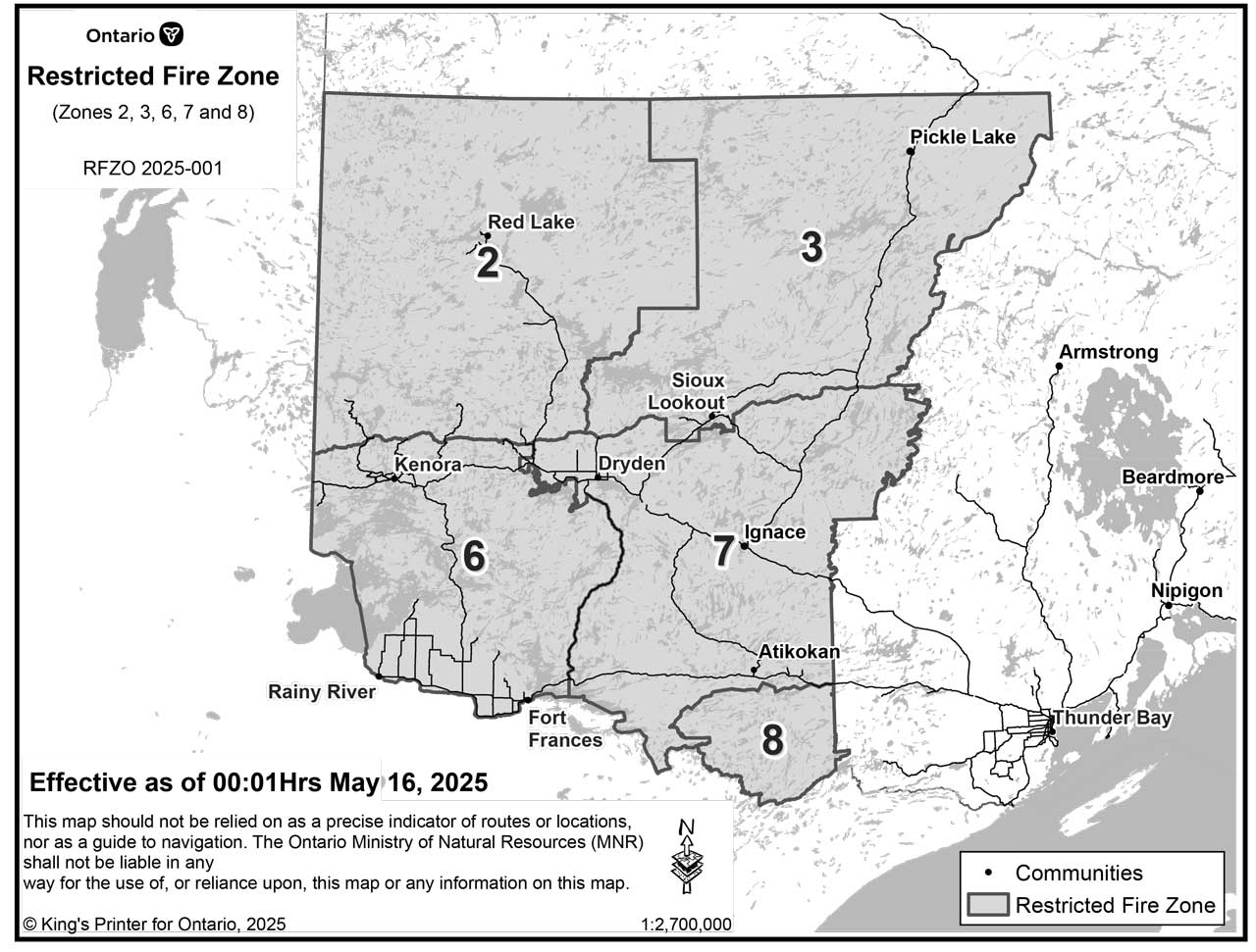
Restricted Fire Zone Declared for Parts of Northwest Region
Effective Friday, May 16 at 12:01 a.m., a Restricted Fire Zone (RFZ) will be in place for much of the Northwest Region, including areas along the Manitoba border, Wabakimi Provincial Park, and Quetico Provincial Park.
-
No open air burning or campfires permitted.
-
Portable gas/propane stoves allowed with extreme caution.
-
All burning permits suspended until further notice.
See map of RFZ here.
Learn what is permitted in an RFZ.
Public Safety Reminders:
-
Drones are strictly prohibited near forest fires. Flying drones puts firefighting crews and aircraft at risk. Report drone activity to authorities immediately.
-
Report a wildfire north of the French or Mattawa Rivers: Dial 310-FIRE (3473).
-
Report south of the French or Mattawa Rivers: Dial 9-1-1.
Stay informed at ontario.ca/fireupdates.


