THUNDER BAY – The Ministry of Natural Resources and Forestry (MNRF) – Thunder Bay District is advising area residents that a Watershed Conditions Statement – Flood Outlook is in effect in the District.
Residents in Thunder Bay district should keep a close watch on conditions, regularly check for updated messages . People are asked to stay away from fast moving rivers and streams.
MNRF is closely monitoring the weather and developing watershed conditions . Further updates will be issued as appropriate .
Description of Weather System
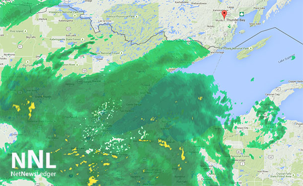
A significant low pressure system originating from the American southwest is moving into the Northwestern Region anywhere from Thunder Bay to Lake of the Woods beginning Tuesday evening. There will be significant rain in the amount of 30 to 50 mm for the Northwest Region cumulatively for the next two days from this system.
Areas to the north of a line from Thunder Bay to Lake of Woods as far north as Lansdowne House/Pickle Lake are under this risk of rain and thunderstorm due to this system. Severe Thunderstorms are also likely in isolated areas in the above region which could drive this number well above 70mm in the next two days. Rain should be severe Tuesday into Wednesday and continuing on Wednesday as the system progresses in a northeast direction before the system and the associated rainfall tapers and exits out of province by Thursday evening.
Description of Current Conditions
Stream flow conditions are low to moderate in the northwest due to cumulative rainfall events in the recent past. The streams are reactive to precipitation and any could reach flood like conditions due to any significant rain events with thunderstorms. Rainfall accompanied with thunderstorm due to the passage of this system has the potential to cause flooding in areas where streams are moderately high. A watch on local conditions is recommended, especially where rain is accompanied with thunderstorms where the risks are higher.
TERMINOLOGY: Notification Levels
WATERSHED CONDITIONS STATEMENT – FLOOD OUTLOOK : gives early notice of the potential for flooding based on weather forecasts calling for heavy rain, snow melt, high winds or other conditions
WATERSHED CONDITIONS STATEMENT – WATER SAFETY : indicates that high flows , melting ice or other factors could be dangerous for such users as boaters, anglers and swimmers but flooding is not expected.
FLOOD WATCH : potential for flooding exists within specific watercourses and municipalities
FLOOD WARNING


