
Weather Alerts in Effect for Dryden, Vermilion Bay…
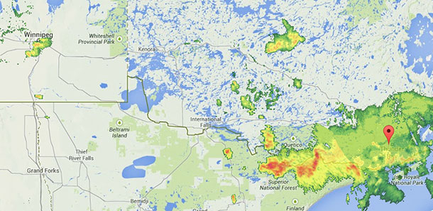
THUNDER BAY – There is a series of thunderstorm tracking across much of Northwestern Ontario this afternoon.
For Thunder Bay while there currently is not a stated alert or watch in effect there is steady rain accompanied by thunder.
Severe thunderstorm watch in effect for:
- Dryden – Vermilion Bay
- Ignace – English River
Severe thunderstorm conditions possible – late morning to late afternoon.
Conditions are favourable for the development of dangerous thunderstorms that may be capable of producing strong wind gusts, damaging hail and torential rain.
A very moist and unstable airmass will trigger thunderstorms over part of the regions this afternoon and evening. The main threats with these storms will be torrential rain, large hail, and localized damaging wind gusts.
Fast moving water across a road can sweep a vehicle away. Rapidly rising rivers and creeks can sweep away bridges, culverts, buildings, and people. Very large hail can damage property, break windows, dent vehicles and cause serious injury. Strong wind gusts can toss loose objects, damage weak buildings, break branches off trees and overturn large vehicles. Intense lightning is likely with any storm that develops. Remember, severe thunderstorms can produce tornadoes. Stay away from all windows, skylights and doors. In Canada, lightning kills up to 10 people every year. Remember, when thunder roars, go indoors.
Emergency Management Ontario recommends that you take cover immediately, if threatening weather approaches.
Environment Canada meteorologists will update alerts as required, so stay tuned to your local media or Weatheradio. Email reports of severe weather to storm.ontario@ec.gc.ca or tweet with the hashtag #ONStorm.
For Winnipeg, there is a tornado watch in effect.
Tornado warning in effect for:
- City of Winnipeg
Updated or ended by 3:20 p.m. CDT.
At 2:51 p.m. CDT, Environment Canada meteorologists are tracking a thunderstorm that is possibly producing a tornado.
An eyewitness reported a funnel cloud near Oak Bluff at 2:50pm. This cell will pass over the southernmost portion of the City of Winnipeg.
Take cover immediately, if threatening weather approaches. One or more weak tornadoes may be occurring in the area. They sometimes appear as funnel clouds with swirling debris near the ground.
Go indoors to a room on the lowest floor, away from outside walls and windows, such as a basement, bathroom, stairwell or interior closet. Leave mobile homes, vehicles, tents, trailers and other temporary or free-standing shelter, and move to a strong building if you can. As a last resort, lie in a low spot and protect your head from flying debris.
In Canada, lightning kills up to 10 people every year.
Remember, when thunder roars, go indoors.
Environment Canada meteorologists will update alerts as required. Please continue to monitor your local media or Weatheradio for further updates. If you would like to report severe weather, you can call 1-800-239-0484 or send an email to storm@ec.gc.ca or tweet reports to #MBStorm.


