Special Weather Statement for Northeastern Ontario

487
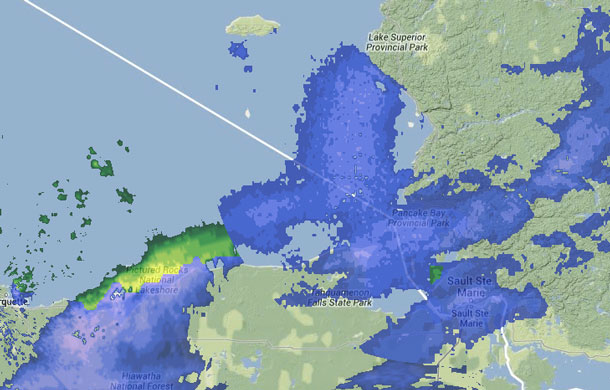
A sharp Arctic cold front will sweep through Northeastern Ontario through this morning. This front is capable of producing short bursts of heavy snow and blowing snow which could reduce visibilities to near zero. A couple of cm of snow may also quickly accumulate with bursts of heavy snow. Currently the front lies from near Timmins to Sault Ste Marie and it will pass through North Bay late this morning. Motorists planning to travel in these regions should be prepared for dangerous winter driving conditions.
Weather Statement issued for Northeastern Ontario for Monday November 11 2013

A sharp Arctic cold front will sweep through Northeastern Ontario  through this morning.  This front is capable of producing short  bursts of heavy snow and blowing snow which could reduce visibilities  to near zero.  A couple of cm of snow may also quickly accumulate  with bursts of heavy snow.  Currently the front lies from near Timmins to Sault Ste Marie and it  will pass through North Bay late this morning.  Motorists planning to travel in these regions should be prepared for  dangerous winter driving conditions.
Weather Statement issued for Northeastern Ontario for Monday November 11 2013ow 

Snow will impact road conditions in Northeastern Ontario

THUNDER BAY – Environment Canada has issued a Special Weather Statement for the Wawa, and Sault Set Marie areas of Northeastern Ontario.

A sharp Arctic cold front will sweep through Northeastern Ontario through this morning. This front is capable of producing short bursts of heavy snow and blowing snow which could reduce visibilities to near zero. A couple of cm of snow may also quickly accumulate with bursts of heavy snow.

Currently the front lies from near Timmins to Sault Ste Marie and it will pass through North Bay late this morning.

Motorists planning to travel in these regions should be prepared for dangerous winter driving conditions according to the weather service.

Enhanced by Zemanta