
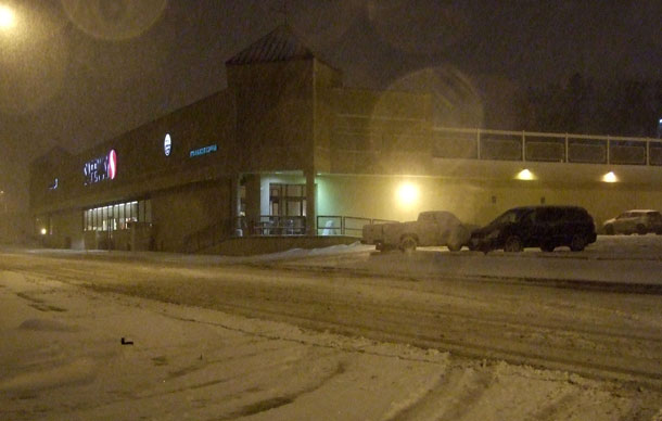
THUNDER BAY – Winter Storm warning in Thunder Bay. Environment Canada reports that heavy snow and blowing snow developing this evening.
Winter Storm for Thunder Bay
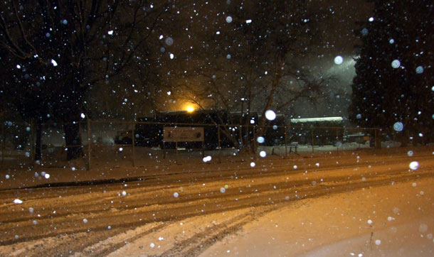
Significant snow will develop this evening and continue until midday Friday. 15 to 20 cm are expected with locally higher amounts possible along the north shore of Lake Superior and north through Geraldton. There will also be strong winds associated with the storm especially overnight tonight and through Friday. Northeast winds 30 to 50 km/h with higher gusts along Lake Superior shore will give reduced visibilities to less than 100 metres at times. Drifting snow may also cause difficulty for travel in exposed areas.
North Shore of Lake Superior
Significant freezing rain event tonight into Friday.
A large low pressure system originating from Texas will track towards the Central Great Lakes tonight. Freezing rain and ice pellets in Timmins will become heavier tonight and for the other regions. As temperatures fall later tonight, a prolonged period of freezing rain and ice pellets is expected to begin and persist until Friday morning.
Significant icing is possible across portions of the warned regions, particularly tonight, with up to 10 millimetres of freezing rain possible. As a result, there is a concern of power outages due to downed tree limbs and power lines. In addition, travelling conditions will deteriorate and become hazardous with icing on untreated surfaces.
For the Gogama region, temperatures across the southern portions of the region will remain above zero with only a risk of freezing rain. For this reason, a rainfall warning is also in effect for the southern sections.
The freezing rain is expected to change to snow then taper off later on Friday as the low pressure system pulls away into Quebec.


Storm Warnings across Region
Gull Bay – Black Sturgeon Lake
3:54 PM EDT Thursday 18 April 2013
Winter storm warning for
Gull Bay – Black Sturgeon Lake changed from Snowfall warning
Heavy snow and blowing snow developing this evening.
Significant snow will develop this evening and continue until midday Friday. 15 to 20 cm are expected with locally higher amounts possible along the north shore of Lake Superior and north through Geraldton. There will also be strong winds associated with the storm especially overnight tonight and through Friday. Northeast winds 30 to 50 km/h with higher gusts along Lake Superior shore will give reduced visibilities to less than 100 metres at times. Drifting snow may also cause difficulty for travel in exposed areas.
Beardmore – Jellicoe – Macdiarmid
3:54 PM EDT Thursday 18 April 2013
Winter storm warning for
Beardmore – Jellicoe – Macdiarmid changed from Snowfall warning
Heavy snow and blowing snow developing this evening.
Significant snow will develop this evening and continue until midday Friday. 15 to 20 cm are expected with locally higher amounts possible along the north shore of Lake Superior and north through Geraldton. There will also be strong winds associated with the storm especially overnight tonight and through Friday. Northeast winds 30 to 50 km/h with higher gusts along Lake Superior shore will give reduced visibilities to less than 100 metres at times. Drifting snow may also cause difficulty for travel in exposed areas.
Armstrong – Auden – Wabakimi Park
3:54 PM EDT Thursday 18 April 2013
Winter storm warning for
Armstrong – Auden – Wabakimi Park issued
Heavy snow and blowing snow developing this evening.
Significant snow will develop this evening and continue until midday Friday. 15 to 20 cm are expected with locally higher amounts possible along the north shore of Lake Superior and north through Geraldton. There will also be strong winds associated with the storm especially overnight tonight and through Friday. Northeast winds 30 to 50 km/h with higher gusts along Lake Superior shore will give reduced visibilities to less than 100 metres at times. Drifting snow may also cause difficulty for travel in exposed areas.


