
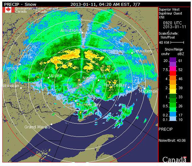
THUNDER BAY – Updated 8:40AM EDT – Environment Canada has issued a weather warning for Northwestern Ontario. Driving conditions Friday morning will be slippery in Thunder Bay and across much of Northwestern Ontario. Environment Canada reports, “A large area of precipitation will move into much of Northern Ontario overnight and into Friday morning. Rain has already reached the Fort Frances area and is expected to change to freezing rain for a couple of hours before changing back to rain overnight. Elsewhere precipitation is expected to begin as freezing rain or ice pellets before changing over to plain rain. At any given location, the freezing rain is not expected to last more than a few hours”.
The freezing rain warning for Thunder Bay has ended as of 6:59AM.
Wasaya Airways advises, For today, January 11th, please be advised of possible/probable flight delays, reroutes and/or cancellations today, due to the following forecasted and actual weather conditions:
*Freezing Rain
*Low ceilings
*Low visibility
*Ice Pellets
*Lack of Alternate Airports
These conditions are forecast to persist throughout the day.
However school buses are impacted by the weather.
Due to Weather Rural Transportation Cancelled for the Following Routes
- Routes that are cancelled in the morning are also cancelled in the afternoon
All Lakehead Public Schools Elemementary Schools are Closed. All Lakehead Public Schools High Schools are Open but Rural Transportation in the Areas Listed below is cancelled
- Crestview
- Five Mile
- Gorham Ware
- Kakabeka Falls
- McKenzie
- Nor’wester View
- Whitefish Valley
- Valley Central
- As well as the Lakeshore Area of Claude Garton and the Rosslyn Road area of Westmount
School buses in Dryden, Kenora, Vermillion Bay, Ignace, Sioux LookOut, Ear Falls, RedLake and Upsala are also cancelled for Friday January 11th.
For areas close to the Lake Superior shoreline, precipitation is more likely to be in the form of plain rain with only a risk of freezing rain.
Hazardous driving conditions are expected as untreated roads may quickly become icy and slippery.
A Colorado low is expected to move into Minnesota Friday then into Northwestern Ontario Saturday with a major winter storm expected in Northwestern Ontario as a result.
Elsewhere freezing rain is expected before changing over to rain as a mild air mass is pumped up from the Gulf of Mexico by southerly winds.
For traveler headed south to Minnesota, freezing rain and sleet is expected. The Weather Network shares the forecast for Northeastern Minnesota, “Rain and freezing rain, possibly mixed with sleet. Areas of fog. Low around 32. Southeast wind around 5 mph. Chance of precipitation is 80%. Total nighttime ice accumulation of 0.2 to 0.4 of an inch possible. Total nighttime sleet accumulation of less than a half inch possible”.


