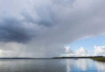

Wind chills near -16 C give way to above-freezing afternoons; Attawapiskat keeps an early flurry chance
Cold start is the main travel concern
THUNDER BAY, Ont. – Saturday, Nov. 14, 2026, 6:11 a.m. EST – Weather Desk – A ridge of high pressure is clearing skies across much of remote Northern Ontario, setting up cold mornings followed by an unusually mild rise through Monday. Environment and Climate Change Canada had no weather alerts in effect anywhere in Ontario at publication time.
The most immediate concern is the early cold. Morning wind chills range from about -10 C to -16 C in several communities. Clear skies and light winds will favour another quick temperature drop tonight, so travellers should still carry winter clothing even though afternoon highs climb above freezing.
Attawapiskat is the exception to the broadly dry start. The community has a 30-per-cent chance of flurries this morning, then cloud will linger before clearing late this evening. The remaining required communities move toward mainly sunny or clearing conditions today.
Saturday: clearing from west to east
Kitchenuhmaykoosib Inninuwug, also known as KI or Big Trout Lake, and Kasabonika Lake First Nation will see a mix of sun and cloud clear this afternoon. Highs reach about 2 C, after morning wind chills near -14. Tonight will be clear with lows near -5 C.
Sandy Lake and Pikangikum First Nation turn sunny, with highs near 1 C to 2 C. Bearskin Lake First Nation also clears, with a high near 2 C. Overnight lows in those western communities settle near -5 C to -7 C.
Neskantaga First Nation, Ogoki Post and Marten Falls First Nation will see a mix of sun and cloud clears near noon, with a high near 0 C and a morning wind chill as low as -16. Skies stay clear tonight and lows fall to about -8 C.
Attawapiskat reaches 3 C under cloud, with the early flurry chance and a northwest wind near 20 km/h. Clearing arrives late tonight as the temperature falls to about -8 C and the wind chill reaches -11.
Sunday: sunshine and a stronger rebound
Sandy Lake and Pikangikum are sunny near 4 C. KI, Kasabonika Lake and Bearskin Lake will have sun or a mix of sun and cloud with highs around 4 C. Ogoki Post, Marten Falls and Neskantaga rise to about 5 C to 6 C under sunshine.
Attawapiskat reaches about 4 C with a mix of sun and cloud. Overnight temperatures become less severe across the region, generally ranging from about -2 C to 1 C.
Monday: mild air settles in
Sandy Lake and Pikangikum are forecast to stay sunny near 6 C. Ogoki Post, Marten Falls and Neskantaga reach about 7 C, while KI, Kasabonika Lake and Bearskin Lake sit near 4 C to 5 C with a mix of sun and cloud.
Attawapiskat reaches about 5 C with sun and cloud. No precipitation is in the three-day forecast after the early Saturday flurry chance in Attawapiskat.
Wardrobe
Dress for two seasons in one day. Start with an insulated coat, toque, gloves and winter footwear for wind chills near -16 C. Use removable mid-layers for the milder afternoons. Remote travellers should keep dry spare socks, mitts and an emergency blanket in the vehicle or aircraft kit.
Weather trivia
Clear nights can be colder than cloudy ones because cloud acts like a partial blanket, absorbing and returning some outgoing infrared heat. With fewer clouds tonight, surface temperatures can fall quickly even as the broader air mass warms.