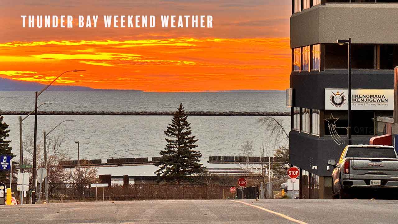
Thunder Bay Weather: Morning Fog, Mild Weekend and Calm Lake Superior Conditions
THUNDER BAY – WEATHER DESK – Saturday, September 26, 2026 – Thunder Bay begins the weekend with fog and cool temperatures, but the mist should lift through the morning. Mainly cloudy skies and a high of 18 C are expected Saturday.
Sunday brings a chance of showers, while Monday is forecast to turn sunny. Western Lake Superior remains under a quiet marine pattern, with no warning in effect, winds at 10 knots or less through Sunday and offshore waves of 0.5 metres or less.
Current Conditions and Weather Alerts
During the early-morning check, Environment and Climate Change Canada’s national conditions table listed Thunder Bay at 7 C with fog. Drivers should expect visibility to vary, especially near low-lying areas, waterways and the city’s outskirts.
No weather warning, watch or advisory was in effect for the City of Thunder Bay at 6:17 a.m. EDT Saturday. Conditions and alerts can change, so readers should check the official alert page before longer trips or outdoor events.
Saturday, September 26: Fog Lifts, Clouds Remain
Fog patches will dissipate this morning. The rest of Saturday will be mainly cloudy, with a high of 18 C. The UV index will be 4, or moderate.
Environment Canada has not identified a significant city wind in Saturday’s public forecast. Tonight will remain mainly cloudy. Fog patches are expected to develop again after midnight, with a low of 9 C.
Sunday, September 27: Chance of Showers
Sunday will be cloudy with a 40 per cent chance of showers. The high will be 17 C.
Cloudy conditions and a 40 per cent chance of showers will continue Sunday night. The low will fall to 8 C.
Monday, September 28: Sunshine Returns
Monday is expected to be sunny with a high of 18 C. Clouds will return Monday night, bringing a 30 per cent chance of showers and a low of 10 C.
Three-Day Thunder Bay Forecast at a Glance
| Day | Conditions | High | Night |
|---|---|---|---|
| Saturday, Sept. 26 | Mainly cloudy after morning fog dissipates | 18 C | Mainly cloudy; fog after midnight; low 9 C |
| Sunday, Sept. 27 | Cloudy with a 40% chance of showers | 17 C | Cloudy with a 40% chance of showers; low 8 C |
| Monday, Sept. 28 | Sunny | 18 C | Cloudy with a 30% chance of showers; low 10 C |
Air Quality: Low Risk
Thunder Bay’s Air Quality Health Index was 1, or low risk, in the 6:00 a.m. provincial summary. The forecast maximum is 2, also low risk, for Saturday, Saturday night, Sunday and Sunday night.
At these levels, most people can continue their usual outdoor activities. People with heart or breathing conditions should still follow their regular health plan and watch for symptoms.
Travel and Outdoor Conditions
Fog is the main early travel concern. Visibility can change quickly over short distances, even when nearby roads appear clear. Drivers should use low-beam headlights, slow down and leave more room between vehicles.
Fog could return late Saturday night and early Sunday. This may affect rural roads, Highway 11/17 approaches, bridges and areas near rivers and Lake Superior. No snow, freezing rain or major wind event is indicated in the three-day city forecast.
Sunday showers may leave roads and trails wet. Fallen leaves can become slippery on pavement, wooden stairs and walking paths. Outdoor workers should allow time for morning fog to clear before tasks that depend on good visibility.
Western Lake Superior Marine Forecast
Marine warnings: No marine watch or warning was in effect for Western Lake Superior in the forecast issued at 3:00 a.m. EDT Saturday.
Saturday: Light wind will become east at 10 knots this morning, then turn southeast at 10 knots this afternoon.
Saturday night and Sunday: The wind will turn south at 10 knots near midnight, then southwest at 10 knots Sunday evening.
Waves: Offshore waves are forecast to remain at 0.5 metres or less through Sunday.
Weather and visibility: The open-lake marine bulletin does not identify precipitation, thunderstorms, fog or another specific visibility restriction for the forecast period. However, fog in the Thunder Bay city forecast may affect the harbour, shoreline and some nearshore waters Saturday morning and again late Saturday night.
Extended wind outlook: Light winds are forecast Monday. On Tuesday, light winds will become southeast at 15 knots. South winds at 20 knots are forecast Wednesday before diminishing to light late in the day.
Thunder Bay Harbour and the Open Lake Are Different
The Western Lake Superior forecast describes a broad offshore area. Thunder Bay Harbour is partly protected by the breakwall, islands and shoreline, so it may be calmer than the open lake. Local wind direction, fog and traffic near harbour entrances can still create hazards.
Saturday and Sunday’s forecast is generally favourable for many powered recreational boats. Winds of 10 knots and waves no higher than 0.5 metres are below strong-wind-warning levels. That does not make every trip risk-free.
Small boats, canoes, kayaks and paddleboards remain more exposed to cold water, changing visibility and local chop. Conditions at a sheltered marina should not be used as the only guide for a trip beyond the harbour.
Boating Safety Guidance
- Wear an approved personal flotation device at all times.
- Check the latest marine forecast and local observations immediately before departure.
- Carry reliable communications and tell someone your route and expected return time.
- Use navigation lights and slow down if visibility becomes reduced by fog.
- Dress for the water temperature, not only the afternoon air temperature.
- Remember that Tuesday and Wednesday may become windier than the weekend.
Sources Checked
- Environment and Climate Change Canada – Thunder Bay forecast, forecast issued September 25, 2026 at 5:40 p.m. EDT;
- Environment and Climate Change Canada – City of Thunder Bay alerts, checked September 26, 2026 at 6:17 a.m. EDT;
- Environment and Climate Change Canada – Ontario AQHI summary, issued September 26, 2026 at 6:00 a.m. EDT;
- Environment and Climate Change Canada – Western Lake Superior marine forecast, issued September 26, 2026 at 3:00 a.m. EDT; and
- Environment and Climate Change Canada – Lake Superior marine warning map.