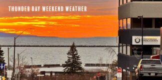
THUNDER BAY – WEATHER DESK – Saturday, September 26, 2026 – Northwestern Ontario begins Saturday with areas of fog, cloud and strengthening south winds. Rain will spread into western communities during the afternoon and evening, with the heaviest overnight totals expected around Dryden, Vermilion Bay and Ear Falls.
Conditions should improve from west to east Sunday, although showers or drizzle may linger through the morning. Monday will be cooler across the west, while Atikokan and communities closer to Thunder Bay should see more sunshine.
Weather Alerts: No ECCC Alerts for the Region
No Environment and Climate Change Canada weather or air-quality alert was listed for the covered Northwestern Ontario communities during the early-morning check.
The absence of an alert does not mean the weather will have no impact. South winds may gust to 50 km/h in several western districts, and some areas could receive 10 to 15 millimetres of rain overnight.
Saturday: Rain and Gusty Winds Build from the West
Kenora, Lake of the Woods, Grassy Narrows and Whitedog: Cloudy conditions will be followed by periods of rain this afternoon. Approximately 5 millimetres is expected during the day. South winds will reach 30 km/h with gusts to 50. The high will be 18 C. Rain will continue tonight before ending overnight, with another 5 to 10 millimetres possible. The low will be 13 C.
Dryden and Vermilion Bay: Morning fog patches will dissipate. Mainly cloudy skies and a 40 per cent chance of late-afternoon showers are expected. South winds will reach 20 km/h with gusts to 40. The high will be 19 C. Periods of rain tonight may produce 10 to 15 millimetres before ending Sunday morning. The low will be 12 C.
Sioux Lookout and Eastern Lac Seul: Morning fog will lift, followed by mainly cloudy skies. South winds will increase to 20 km/h with gusts to 40 near noon. The high will be 20 C. Rain will develop tonight, with a low of 12 C.
Savant Lake and Sturgeon Lake: Expect a mix of sun and cloud after morning fog dissipates. South winds will reach 20 km/h with gusts to 40 near noon. The high will be 20 C. Rain will begin late tonight, with a low of 12 C.
Red Lake and Woodland Caribou Park: Rain will begin this afternoon, with approximately 5 millimetres expected. South winds will reach 30 km/h with gusts to 50. The high will be 19 C. Another 5 to 10 millimetres may fall tonight before the steady rain ends overnight. The low will be 13 C.
Ear Falls, Perrault Falls and Western Lac Seul: Morning fog will dissipate. The afternoon brings a 40 per cent chance of showers and south winds of 20 km/h gusting to 40. The high will be 19 C. Rain tonight could produce 10 to 15 millimetres before ending Sunday morning. The low will be 13 C.
Fort Frances, Emo and Rainy River: Periods of rain will begin this afternoon, with 5 millimetres expected. South winds will reach 30 km/h with gusts to 50. The high will be 19 C. Rain will continue tonight, bringing another 5 to 10 millimetres before ending overnight. The low will be 12 C.
Atikokan, Shebandowan and Quetico Park: A mix of sun and cloud is expected after morning fog clears. South winds will reach 20 km/h with gusts to 40 near noon. The high will be 21 C. Rain mixed with drizzle will develop tonight. The low will be 11 C.
Pickle Lake: Cloud will clear near noon after morning fog dissipates. South winds will reach 20 km/h with gusts to 40. The high will be 21 C. Tonight will be cloudy with a 60 per cent chance of showers and a low of 13 C.
Sunday: Morning Showers, Then Gradual Improvement
Kenora, Lake of the Woods, Red Lake and Fort Frances should see early showers or drizzle followed by clearing. West winds near 20 km/h will develop in the Kenora, Red Lake and Rainy River districts. Highs will range from 20 C to 21 C.
Dryden, Ear Falls, Sioux Lookout and Savant Lake will have a 40 per cent chance of morning showers or drizzle before brighter conditions develop. Highs will be near 20 C.
Atikokan and Quetico will remain more unsettled. Rain and drizzle should end during the morning, followed by cloud and a 40 per cent chance of showers. The high will be 18 C.
Pickle Lake will be cloudy with a 40 per cent chance of showers and a high of 20 C. Temperatures will fall to approximately 5 C Sunday night.
Monday: Cooler in the West, Sunshine Farther East
Monday will be cooler around Kenora, Dryden, Red Lake and Sioux Lookout. Cloud and a 30 per cent chance of showers are expected, with highs from 15 C to 17 C.
Atikokan and Quetico are forecast to be sunny with a high of 18 C. Pickle Lake should see a mix of sun and cloud with a high of 17 C.
Another round of rain is possible Monday night across much of western Northwestern Ontario. Forecast confidence is lower for Monday than for the weekend, so travellers should check for revisions.
Three-Day Forecast at a Glance
| Community | Saturday, Sept. 26 | Sunday, Sept. 27 | Monday, Sept. 28 |
|---|---|---|---|
| Kenora and Lake of the Woods | Rain developing; south 30 km/h gusting to 50; 18 C / 13 C | Early showers or drizzle, then clearing; 21 C / 8 C | Cloudy; 30% chance of showers; 15 C / 10 C |
| Dryden and Vermilion Bay | 40% chance of late showers; gusts to 40; 19 C / 12 C | Morning showers or drizzle, then clearing; 20 C / 8 C | Cloudy; 30% chance of showers; 16 C / 10 C |
| Sioux Lookout | Mainly cloudy; gusts to 40; rain tonight; 20 C / 12 C | Morning showers or drizzle; 20 C / 7 C | Cloudy; 30% chance of showers; 17 C / 8 C |
| Savant Lake | Sun and cloud; gusts to 40; late rain; 20 C / 12 C | Morning showers or drizzle; 20 C / 7 C | Cloudy; 30% chance of showers; 17 C / 8 C |
| Red Lake and Ear Falls | Rain or showers; gusts from 40 to 50; 19 C / 13 C | Morning showers or drizzle, then clearing; about 20 C / 7 C | Cloudy; 30% chance of showers; 15 C / 8 C |
| Fort Frances, Emo and Rainy River | Rain developing; south 30 km/h gusting to 50; 19 C / 12 C | Early showers or drizzle, then clearing; 21 C / 9 C | Cloudy; 30% chance of showers; 16 C / 11 C |
| Atikokan and Quetico | Sun and cloud; gusts to 40; rain tonight; 21 C / 11 C | Rain or drizzle ending, then 40% chance of showers; 18 C / 8 C | Sunny; 18 C / 10 C |
| Pickle Lake | Clearing; south 20 km/h gusting to 40; 21 C / 13 C | Cloudy; 40% chance of showers; 20 C / 5 C | Sun and cloud; 17 C / 5 C |
Travel Outlook: Fog, Crosswinds and Wet Roads
Fog may reduce visibility early Saturday around several inland communities. Drivers should slow down, use low-beam headlights and allow more following distance until conditions improve.
South gusts of 40 to 50 km/h may create crosswinds on exposed sections of Highways 11, 17, 71, 105, 502 and 599. Transport trucks, campers and vehicles towing trailers may be more affected.
Rain will spread eastward during the afternoon and evening. Wet pavement, pooled water and slippery leaves are possible. The 10-to-15-millimetre totals forecast around Dryden and Ear Falls are not at warning level, but they may still produce poor visibility and slower travel overnight.
Boating and Outdoor Work
South winds gusting to 40 or 50 km/h can make large inland lakes rougher than conditions at a protected dock or launch. Lake of the Woods, Rainy Lake, Lac Seul and other exposed waters may become choppy.
- Wear an approved personal flotation device.
- Check a lake-specific marine forecast or local observation before departure.
- Allow additional time to return before the strongest gusts and rain arrive.
- Carry reliable communications and share a trip plan.
- Do not use sheltered shoreline conditions as the only guide for open water.
Outdoor workers should secure lightweight materials, signs and equipment. Rain may make ladders, roofs, wooden surfaces and unpaved work areas slippery. Forestry and construction crews should monitor changing wind and visibility through the day.
Sources Checked
- Environment and Climate Change Canada – Northern Ontario public forecast bulletin, issued September 26, 2026 at 5:30 a.m. EDT;
- Environment and Climate Change Canada – extended Northern Ontario forecast;
- Environment and Climate Change Canada – Pickle Lake forecast;
- Environment and Climate Change Canada – active weather and air-quality alerts, checked September 26, 2026; and
- Northwestern Ontario Student Services Consortium – current bus status, checked September 26, 2026 at 5:37 a.m. CST.