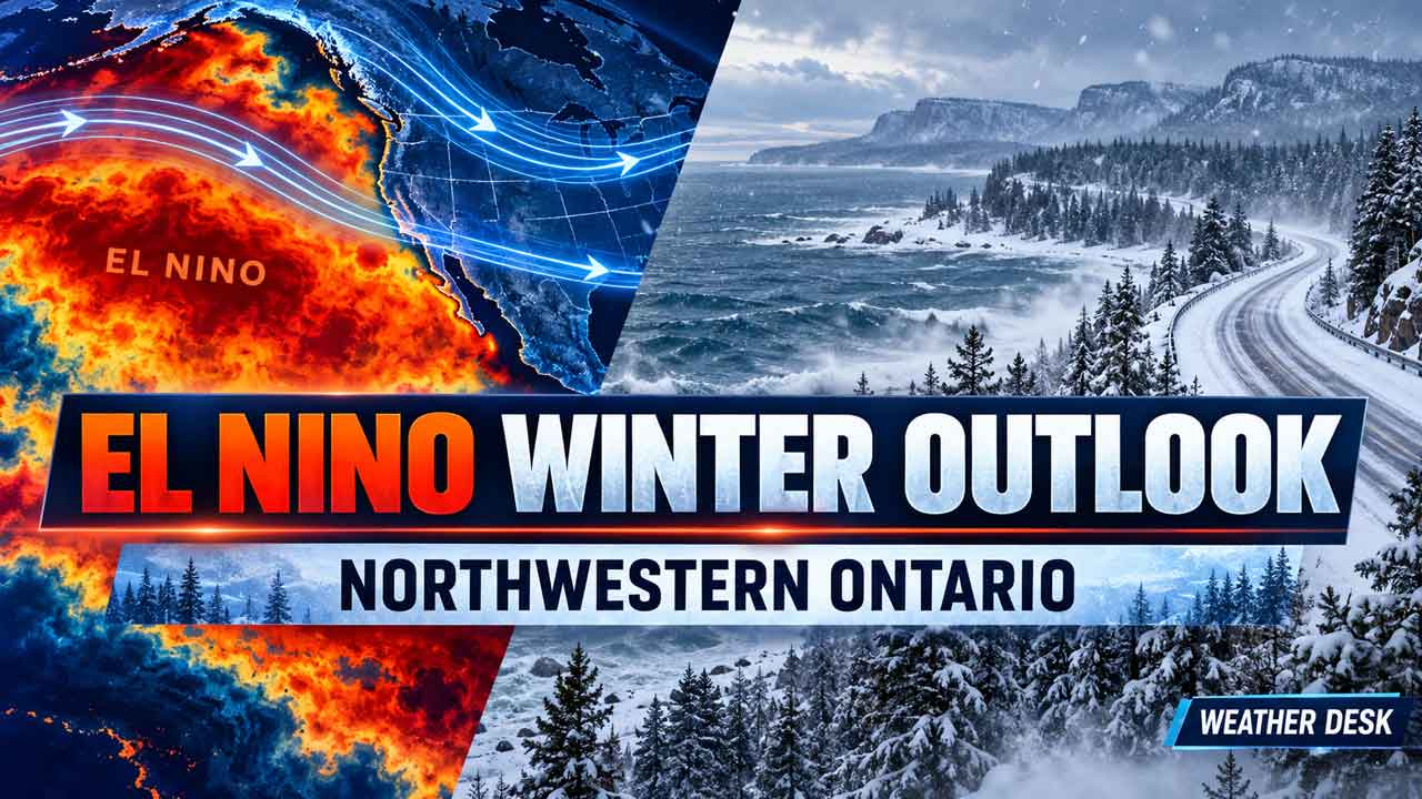
A strengthening, potentially historic El Niño could bring a milder, more changeable winter to Northwestern and Northern Ontario, with freeze-thaw cycles, unstable ice and lake-effect snow risks
THUNDER BAY — WEATHER DESK — A powerful El Niño is strengthening in the Pacific Ocean, and it could shape the winter weather pattern across Northwestern and Northern Ontario.
The most likely message for residents is not that winter will disappear. It is that the season may begin milder, bring more freeze-thaw swings and produce less dependable lake and road ice. At the same time, short but dangerous Arctic outbreaks, heavy snow squalls and major winter storms can still occur.
The outlook is based on a large-scale climate signal, not a day-by-day forecast. Local conditions will still depend on the jet stream, the North Atlantic Oscillation, storm tracks and temperatures over the Great Lakes.
A Very Strong El Niño Is Building
El Niño develops when unusually warm water spreads across the central and eastern equatorial Pacific. That extra heat changes tropical thunderstorms and shifts the jet streams that steer weather systems around the world.
In its September 10, 2026 diagnostic discussion, the U.S. National Oceanic and Atmospheric Administration said there was a greater than 90 per cent chance of a very strong El Niño during the Northern Hemisphere fall and winter of 2026–27. NOAA reported sea-surface temperature anomalies above 3°C in the eastern equatorial Pacific and gave the October-to-December period a 75 per cent chance of becoming a historic event compared with records dating back to 1950.
The World Meteorological Organization has also warned that the event could continue through February 2027 and become one of the strongest in the modern record. The term “super El Niño” is widely used in media coverage, but it is not a separate official category used by NOAA or the WMO.
Strong events increase the odds of typical El Niño effects. They do not guarantee one particular winter in every community.
What El Niño Usually Does to Ontario
Historical strong El Niño winters are generally milder across much of Canada, especially after the fall transition. The Weather Network’s review of strong events found that Ontario can have a cooler autumn, an earlier first snowfall in some areas and then a warmer start to winter. In Toronto, strong El Niño years have averaged a December that was 2.6°C warmer than normal.
Those southern Ontario numbers cannot simply be copied into Thunder Bay, Kenora, Red Lake or the Far North. Northern Ontario has a more continental climate, and its weather can be driven by Arctic air masses and storm tracks that overpower the Pacific signal for days or weeks at a time.
Likely Effects in Northwestern Ontario
A milder start to winter
Thunder Bay, Kenora, Dryden, Fort Frances and other communities may have a higher chance of above-normal temperatures during parts of December and early winter. The change may show up as more frequent thaws rather than a steady stretch of mild weather.
A milder average does not rule out temperatures of -20°C or colder. It means cold periods may be shorter or interrupted by warmer air.
More rain, wet snow and freezing rain during transitions
When temperatures hover near 0°C, storms that would normally produce snow can instead bring wet snow, rain or freezing rain. That creates difficult conditions for drivers and makes snow removal more complicated.
Communities should be prepared for rapid changes: a rainy afternoon, a flash freeze overnight and icy roads the next morning. The risk is especially important on Highways 11, 17, 527 and 61, as well as rural roads and airport access routes.
Less dependable ice on lakes and rivers
Warmer air and a later freeze-up would make early-season ice less reliable on Lake Superior, Lake of the Woods, Lac Seul, Rainy Lake and smaller lakes across the region. Ice roads and winter crossings in remote and fly-in communities could take longer to open or require more frequent inspections.
This is one of the most important practical concerns. A mild spell can weaken ice even when the shoreline still looks fully wintry. Snowmobile operators, anglers, trappers, winter-road crews and emergency responders should rely on local measurements, not the calendar.
Lake Superior may stay open longer, but snow will not disappear
A warmer winter could delay ice formation on Lake Superior. Open water can provide moisture for lake-effect snow when a cold wind crosses the lake. As a result, a generally mild season can still include intense snow squalls in Thunder Bay, Nipigon, Marathon, Terrace Bay, Sault Ste. Marie and areas downwind of the lake.
The amount and location of lake-effect snow will depend on wind direction, lake temperature, the depth of cold air and the position of snow bands. Less ice does not automatically mean less snow in every community.
Snow cover may be less persistent
For Northwestern Ontario, the strongest reasonable inference is a greater chance of interrupted snow cover and a lower chance of a continuously deep snowpack early in the season. That could affect snowmobile trails, winter tourism, forestry operations and municipal snow budgets.
However, a single storm can still deliver a major snowfall. Seasonal totals may end near normal even when the snow arrives in fewer, heavier events.
Regional Risk Snapshot
| Area | Possible winter signal | Practical concern |
|---|---|---|
| Thunder Bay and Lake Superior | Milder starts, more open water and rapid changes | Lake-effect snow squalls, freezing rain and unstable shoreline ice |
| Kenora, Dryden and Fort Frances | More thaw periods and less persistent snow cover | Variable road conditions, changing lake ice and repeated freeze-thaw damage |
| Red Lake, Sioux Lookout and Pickle Lake | A warmer average is possible, but cold outbreaks remain likely | Uncertain winter-road openings and fast changes in snowmobile conditions |
| Far North and James Bay communities | The El Niño signal is weaker and less certain farther north | Local Arctic patterns, wind and ice conditions may matter more than the Pacific signal |
Could This Affect Next Year’s Fire Season?
It is too early to predict the 2027 wildfire season from El Niño alone. A winter with less snow and an earlier melt could leave forest fuels drier sooner, but spring rainfall, soil moisture, wind and summer heat will be more important in determining fire danger.
Fire managers, municipalities and remote communities should watch snowpack and spring moisture rather than assume that a strong El Niño guarantees a severe fire season.
What Residents Should Do Now
- Do not delay winter-tire installation because a mild start is possible.
- Prepare for freezing rain, wet snow and flash-freeze conditions.
- Check ice thickness locally before travelling on any lake or river.
- Keep winter emergency supplies in vehicles, including warm clothing, food, water and a charged phone.
- Confirm winter-road and ferry information before travelling to remote communities.
- Follow Environment and Climate Change Canada warnings when individual storms develop.
The Bottom Line
A very strong El Niño raises the odds of a milder and more changeable winter across much of Northern Ontario. Northwestern Ontario could see delayed freeze-up, more rain-and-snow events, unstable early-season ice and less dependable snow cover.
But El Niño is not a guarantee of an easy winter. Arctic outbreaks and major snowstorms remain part of the pattern. The most realistic expectation is a season of contrasts: mild thaws followed by sharp cold, open water followed by sudden lake-effect snow, and a winter that may be harder to plan for than a consistently cold one.
This analysis describes seasonal probabilities, not a local daily forecast. Conditions will be updated as Environment and Climate Change Canada releases new seasonal guidance and as the winter pattern becomes clearer.
Sources Checked
- NOAA Climate Prediction Center, ENSO Diagnostic Discussion, September 10, 2026
- World Meteorological Organization climate updates, including the September 2026 El Niño outlook
- The Weather Network, “How a strong El Niño could shape Ontario’s fall weather,†August 20, 2026
- Environment and Climate Change Canada seasonal forecasts
- Reuters, NOAA very-strong El Niño report, September 10, 2026