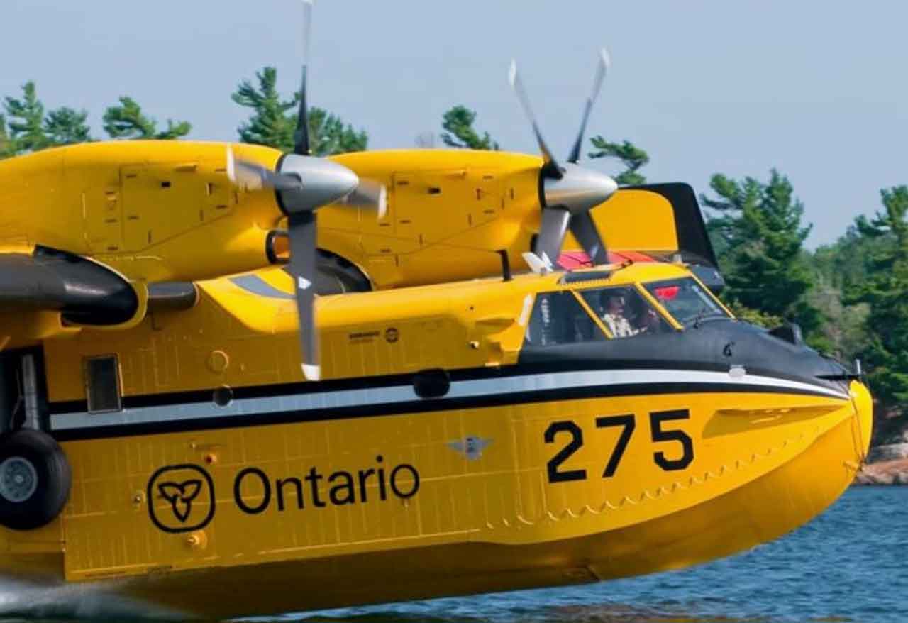
108 wildfires remain active across Northwestern Ontario as crews battle major Rinker Lake fires
THUNDER BAY – WILDFIRE UPDATE – Ontario’s Northwest Fire Region had 108 active wildland fires as of 6 p.m. CDT on Aug. 10, including 10 fires classified as not under control.
The massive Rinker Lake Complex remains the dominant wildfire emergency in Northwestern Ontario, with three major fires covering a combined 378,518 hectares. Farther west, the three fires making up the Atikokan Cluster cover another 119,320 hectares.
One new fire was confirmed since the previous provincial update.
Fort Frances 64 (FOR064), located near the Little Turtle River about four kilometres northeast of Riverview Lake, is 0.3 hectares and is under control.
Northwest Region Has 108 Active Wildfires
According to Ontario’s Aviation, Forest Fire and Emergency Services, the 108 active fires were classified as follows:
- 10 not under control
- Six being held
- Seven under control
- 85 being observed
Fire crews from several provinces and Mexico continue to support Ontario personnel as suppression operations focus on some of the largest fires in the region.
Rinker Lake Complex Remains Major Firefighting Operation
The Rinker Lake Complex consists of Thunder Bay 36 (THU036), Dryden 34 (DRY034) and Dryden 35 (DRY035).
A total of 29 wildland firefighting crews from Ontario, Alberta, Nova Scotia and Manitoba are assigned to the complex, along with two 20-person firefighting crews from Mexico.
Heavy equipment operators, pilots and overhead personnel from Ontario and Quebec are also involved, along with an incident management team.
There are currently 15 helicopters assigned to the complex.
Crews are patrolling fire areas and extinguishing hot spots while consolidating hose lines, maintaining equipment used to protect structures and other values, and constructing helipads to improve access to remote portions of the fires.
Heavy equipment crews continue building fireguards along sections of the THU036 and DRY035 perimeters.
Helicopter bucketing operations are being carried out where required.
The three fires remain not under control:
- Thunder Bay 36: 301,240 hectares
- Dryden 34: 45,800 hectares
- Dryden 35: 31,478 hectares following updated mapping
Together, the three fires cover approximately 378,518 hectares.
Atikokan Cluster Crews Target Hot Spots
Firefighters working on the Atikokan Cluster are using infrared scan information to locate and extinguish hot spots near fire perimeters and around areas containing structures.
The infrared data is collected during the early morning using sensor-equipped aircraft, including drones, helicopters and fixed-wing aircraft.
Three crews are also removing hose lines and recovering firefighting equipment from locations across the cluster.
Eight helicopters are assigned to the Atikokan fires.
Provincial officials report low fire behaviour on all three fires.
On the northern portion of Fort Frances 14, where surface water is limited, FireRanger crews are patrolling the perimeter and using helicopter buckets to extinguish hot spots up to approximately 30 metres inside the fire perimeter.
Crews are also patrolling the north and northeast sides of Fort Frances 15, using helicopter bucketing support while working in challenging terrain.
A wildland firefighting engine carrying approximately 4,000 litres of water is operating in the Cushing Lake area.
There are 103 firefighters assigned to operations across two divisions of Fort Frances 14.
The three fires remain not under control:
- Fort Frances 13: 25,279 hectares
- Fort Frances 14: 51,768 hectares
- Fort Frances 15: 42,273 hectares
The Atikokan Cluster covers approximately 119,320 hectares.
Evacuation Orders and Alerts Remain in Effect
A number of evacuation orders and alerts remain connected to fires in Northwestern Ontario.
Provincial officials list measures involving:
- Dryden 36
- Thunder Bay 36, 54 and 56
- Dryden 34 and 35
- Fort Frances 14
- Fort Frances 15 and 38
Residents in affected communities should continue following directions from their local municipalities, First Nations, emergency management officials and provincial authorities.
Conditions can change quickly as fire behaviour, weather, road accessibility and smoke conditions evolve.
Special Airspace Restrictions Near Major Fires
NOTAMs — notices to pilots advising of aviation hazards or restrictions — remain in place around Thunder Bay 36 and Fort Frances 14, northeast of Byers Lake.
These restrictions are in addition to the standard rules governing aircraft operating near wildland fires.
Under Section 601.15 of the Canadian Aviation Regulations, unauthorized aircraft are generally prohibited from flying within five nautical miles of a forest fire and below 3,000 feet above ground level.
Keeping private and recreational aircraft away from active fires is important because helicopters and fixed-wing aircraft may be operating at low altitudes while transporting personnel or dropping water.
Pilots should check current NOTAM information through NAV CANADA before flying in affected areas.
Restricted Fire Zone Continues Across Northwest
A Restricted Fire Zone remains in effect across the Northwest Region and a small portion of the Northeast Region.
The restriction took effect July 15 because of high to extreme fire hazard, elevated wildfire activity and the number of fires already demanding provincial firefighting resources.
Restricted Fire Zones are intended to reduce the risk of additional human-caused fires while firefighting resources are committed to existing incidents.
People travelling, camping or working in the region should confirm what activities are prohibited before starting any outdoor fire.
Why the Wildfire Situation Matters Across Northwestern Ontario
The size and geographic spread of this year’s fires continue to put pressure on firefighting crews, aircraft and emergency management systems across Northwestern Ontario.
The Rinker Lake and Atikokan fires alone account for almost 498,000 hectares of burned or burning forest.
Large wildfire complexes can also affect communities well beyond their immediate boundaries. Smoke can reduce air quality hundreds of kilometres away, while evacuation requirements can create significant transportation and accommodation demands in regional centres such as Thunder Bay, Dryden, Fort Frances and Kenora.
Wildfires can also affect forestry operations, mining exploration, remote tourism businesses, highway and air transportation, hydro infrastructure and access to remote First Nations.
For Indigenous communities, prolonged wildfire seasons can bring repeated evacuation pressures and disrupt access to traditional territories, hunting, fishing and other land-based activities.
The deployment of firefighters from across Canada and Mexico also illustrates the scale of resource-sharing increasingly required during severe Canadian wildfire seasons.
Fire Hazard Can Change Through the Day
Ontario calculates the regional forest fire danger rating using information collected by more than 130 weather stations across the province’s fire regions.
Because temperature, humidity, wind and precipitation influence fire behaviour, the hazard rating can change during the day.
Anyone travelling through Northwestern Ontario should check Ontario’s interactive fire map and current emergency information before heading into remote or forested areas.
How to Report a Wildland Fire
To report a wildland fire north of the French and Mattawa rivers, call:
310-FIRE (3473)
For fires south of the French or Mattawa rivers, call 911.
Current provincial fire information is available through Ontario’s Aviation, Forest Fire and Emergency Services and the Ontario forest fire information channels.
Source: Ontario Ministry of Natural Resources, Aviation, Forest Fire and Emergency Services, Northwest Fire Region update issued Aug. 10, 2026.