Far North Ontario forecast for Sandy Lake, KI, Neskantaga, Ogoki and Attawapiskat: gusty winds, thunderstorms, showers and a cooler Saturday
Thunder Bay – Weather Desk – A warm southwest flow is carrying unsettled weather across Far North Ontario today. Sandy Lake and Kitchenuhmaykoosib Inninuwug—also known as KI or Big Trout Lake—begin the day under thick cloud with showers nearby, while Neskantaga, Marten Falls and Attawapiskat will experience the warmest temperatures.
The main concerns through Saturday will be gusty winds, scattered thunderstorms, changing flying conditions and frequent showers. Temperatures will fall noticeably behind the system, especially around Sandy Lake and KI, where Saturday’s highs may struggle to reach 17°C.
Today’s Weather Overview
Current Conditions
Sandy Lake: At 5:11 a.m. CDT, Sandy Lake Airport reported cloudy skies and a temperature of 15.4°C. Humidity was high at 93 per cent, with a west-southwest wind at 11 km/h and pressure at 100.3 kPa. The damp air and low cloud cover are creating a grey, humid start to the morning.
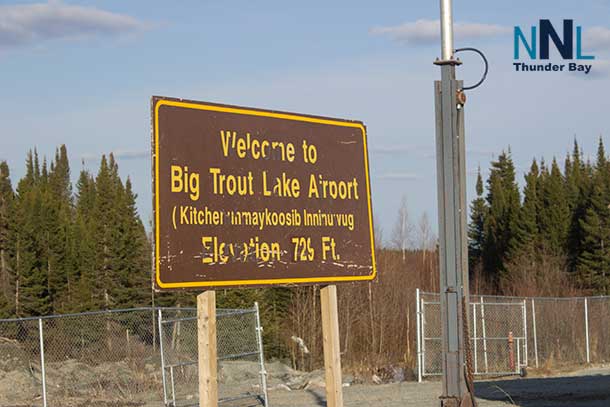
KI / Big Trout Lake: Big Trout Lake Airport reported cloudy conditions and 15.8°C at 5:05 a.m. CDT. Winds were from the south-southwest at 15 km/h, gusting to 28 km/h. Humidity stood at 89 per cent and pressure was 100.2 kPa.
Neskantaga / Lansdowne House: The Lansdowne House Airport observation at 6:00 a.m. EDT showed cloudy skies and 17.2°C. The south wind was blowing at 15 km/h with gusts to 28 km/h. Humidity was 62 per cent, while pressure was 100.7 kPa.
Marten Falls / Ogoki Post: Ogoki Post Airport began the morning under partly cloudy skies with a temperature of 13°C. Winds were southerly at 17 km/h, humidity was 78 per cent and pressure was 101.0 kPa at 6:00 a.m. EDT.
Attawapiskat: Attawapiskat had the brightest start, with sunny skies and a temperature of 12.3°C at 6:00 a.m. EDT. Winds were from the southwest at 9 km/h, humidity was 78 per cent and pressure was 101.1 kPa.
Tomorrow’s Forecast and Three-Day Outlook
Sandy Lake
Thursday: Cloudy with a 60 per cent chance of morning and early-afternoon showers. A thunderstorm is possible. Southwest winds will reach 30 km/h with gusts to 50. The high will be 23°C, with a humidex of 26. Showers and possible thunderstorms continue tonight, with a low of 14°C.
Friday: Cloudy with a 60 per cent chance of showers and a risk of an afternoon thunderstorm. The high will reach only 20°C, followed by a low of 13°C.
Saturday: Cloudy and considerably cooler, with a 60 per cent chance of showers. Expect a high of 17°C and an overnight low of 12°C.
KI / Big Trout Lake
Thursday: Periods of rain will end during the afternoon, followed by cloudy skies and a continuing 40 per cent chance of showers. Thunderstorms are possible through early afternoon. Southwest winds will reach 30 km/h with gusts to 50. The high will be 22°C, with a low of 14°C tonight.
Friday: Overnight showers will continue into the morning, with a thunderstorm possible before the rain ends near noon. Northwest winds will reach 30 km/h before becoming lighter during the afternoon. The high will be 20°C and the overnight low 12°C.
Saturday: Cloudy with a 60 per cent chance of showers. Cooler air settles over the community, producing a high of 17°C and a low of 11°C.
Neskantaga
The Neskantaga forecast is represented by Environment Canada’s Lansdowne House forecast and observations.
Thursday: Mainly cloudy, warm and windy. There is a 40 per cent chance of late-afternoon showers, along with a thunderstorm risk. Southwest winds will blow at 30 km/h with gusts to 50. The high will reach 27°C, feeling closer to 30. Tonight will remain mild at 17°C, with showers and thunderstorms possible.
Friday: Cloudy with a 60 per cent chance of showers and a risk of thunderstorms. Southwest winds will continue at 30 km/h with gusts to 50. The high will be 21°C, followed by a low of 13°C.
Saturday: Cloudy with a 60 per cent chance of showers. The high will be 21°C and the nighttime low 12°C.
Marten Falls / Ogoki Post
Thursday: Mainly cloudy with a 40 per cent chance of late-afternoon showers and a thunderstorm risk. Southwest winds will increase to 30 km/h with gusts to 50. Temperatures will climb quickly from the cool morning reading to a high of 27°C, with a humidex of 30. The overnight low will be 17°C.
Friday: Cloudy with a 60 per cent chance of showers and possible thunderstorms. Southwest winds will remain strong at 30 km/h with gusts to 50. The high will be 21°C and the low 13°C.
Saturday: Cloudy with a 60 per cent chance of showers. Expect a high of 21°C and a low of 12°C.
Attawapiskat
Thursday: Sunny, warm and increasingly windy. The south wind will rise to 20 km/h with gusts to 50 this morning, then increase to 40 km/h with gusts reaching 60 during the afternoon. The high will be 27°C, with a humidex of 29. Cloud will build tonight, bringing a 60 per cent chance of showers and a thunderstorm risk. The low will be 18°C.
Friday: Mainly cloudy with a 60 per cent chance of late-morning and afternoon showers. Thunderstorms are possible, and southwest winds will reach 30 km/h. The high will be 25°C and the low 14°C.
Saturday: A mix of sun and cloud with a 60 per cent chance of showers. Cooler conditions arrive, with a high of 21°C and a low of 12°C.
Regional Travel and Safety Focus
Strong winds could produce turbulence and rapidly changing conditions for flights, particularly around Sandy Lake, KI, Neskantaga, Ogoki Post and Attawapiskat. Thunderstorms may also bring brief heavy rain, sudden wind shifts and reduced visibility.
People travelling by boat should pay close attention to changing wind conditions. Attawapiskat faces the strongest forecast gusts today, reaching 60 km/h. Check updated forecasts before leaving the community and move off open water when thunder is heard.
Wardrobe Recommendations
Dress in light layers today, as cool mornings will give way to temperatures ranging from 22°C to 27°C in most communities. A waterproof jacket with a hood will be useful throughout the region.
Wind-resistant clothing is recommended in Attawapiskat, Neskantaga, Sandy Lake, KI and Ogoki Post. Waterproof footwear will help through Friday and Saturday, while a warmer sweater or fleece will be welcome during the cooler Saturday evening. Sunglasses and sunscreen remain useful in Attawapiskat before cloud and showers arrive.
Weather Trivia
Today’s forecast high of 27°C in Attawapiskat is approximately seven degrees above the community’s normal early-August maximum of 20°C. Neskantaga and Ogoki are also forecast to reach 27°C, compared with normal daytime highs near 22°C. Sandy Lake and KI will be much closer to their seasonal averages before cooler air arrives Friday and Saturday.