THUNDER BAY – Two new wildland fires were confirmed in Northwestern Ontario by the evening of Thursday, July 30, as firefighters continued suppression work on several large incidents affecting communities, transportation routes and remote areas across the region.
Aviation, Forest Fire and Emergency Services reported 115 active fires in the Northwest Fire Region as of 7:32 p.m. CDT. Twenty-two fires were not under control, six were being held, five were under control and 82 were being observed.
The continued fire activity has led to evacuation orders and alerts, aviation restrictions and an ongoing Restricted Fire Zone across the Northwest Region.
Two New Fires Confirmed in the Northwest
Red Lake 26, identified as RED026, is located southwest of Confusion Lake near Bond Road. The 0.2-hectare fire is being held.
Kenora 27, or KEN027, is located about three kilometres west of Highway 525 near Pig Lake. The two-hectare fire is not under control.
A fire classified as being held is not expected to spread beyond existing or planned control boundaries under current and forecast conditions, provided the committed firefighting resources remain in place.
Thunder Bay 36 and the Brightsand Cluster
An incoming Incident Management Team assumed command of the Thunder Bay 36 fire on July 30. The team is also scheduled to assume command of Dryden 34, Dryden 35 and Thunder Bay 54 on Friday, July 31.
Thunder Bay 36, or THU036, is estimated at 313,930 hectares and remains not under control.
Firefighters are using pumps and hose to extinguish hot spots, supported by helicopter water-bucketing operations. The work is focused on securing the fire perimeter and reducing the risk of further spread.
Heavy equipment operators are constructing fire guards to create breaks in forest fuels and support containment operations.
An Alberta wildland-urban interface team is developing plans to protect buildings, infrastructure and other values that could be threatened by the fire.
Dryden 34 is estimated at 44,954 hectares and remains not under control.
Dryden 35 is estimated at 22,461 hectares and remains not under control.
Thunder Bay 54 is estimated at 7,389 hectares and remains not under control.
Ontario and Alberta crews are reporting progress under favourable weather conditions. Heavy equipment and helicopter bucketing operations continue to support firefighters on the ground.
The size and location of these fires remain important for communities, resource operations and transportation corridors throughout the Brightsand and northern Thunder Bay District areas.
Atikokan Fire Cluster
The Atikokan cluster includes Fort Frances 14, Fort Frances 15 and Fort Frances 38.
Fort Frances 14 has been remapped to a slightly smaller estimated size of 51,768 hectares.
Fire behaviour increased in the northern interior of the fire on Wednesday as forest fuels dried. Rainfall on Thursday reduced fire activity.
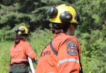
Firefighters are working from several locations along the perimeter using pumps and hose. Crews are advancing toward one another to connect and strengthen suppression lines.
Helicopters continue to drop water on hot spots and transport crews and equipment.
Fort Frances 15 is estimated at 42,273 hectares and remains not under control.
Crews are concentrating on the north side of the fire, where fire behaviour has been more active during hot and dry conditions. Helicopter bucketing has helped crews make progress in that area.
FireRanger crews on the west side are continuing to establish and reinforce hose lines. They are also patrolling completed lines and working approximately 30 metres inward from the fire perimeter.
Fort Frances 38, north of Crystal Lake, remains under control at 44.2 hectares.
One crew is extinguishing remaining hot spots identified through low-level infrared scanning.
Dryden 36 Near Upper and Lower Moosehide Lakes
Dryden 36 is now being held at 1,710 hectares.
The change in status means sufficient suppression work has been completed and, with the currently assigned resources, the fire is not expected to spread beyond existing or planned control boundaries under prevailing and forecast conditions.
Ontario FireRangers and Type 2 crews are working with helicopter bucketing support and heavy equipment operators.
Low fire behaviour has been observed in recent days under favourable weather conditions.
An evacuation order associated with Dryden 36 remains among the emergency measures listed by provincial officials.
Sioux Lookout 72 Near Cat Lake First Nation
Sioux Lookout 72 is estimated at 23,597 hectares and remains not under control.
FireRanger crews are reporting progress, supported by helicopters targeting hot spots with water drops.
Ground-based and aerial infrared scanning are being used to locate remaining sources of heat.
Minimal fire behaviour was observed Thursday.
The fire remains a significant concern because of its proximity to Cat Lake First Nation and the logistical challenges involved in protecting and supplying remote northern communities.
Highway 599 Fire Cluster
The Highway 599 cluster includes Sioux Lookout 84, Sioux Lookout 86 and Sioux Lookout 89.
No recent growth has been observed on the three fires.
There are 120 personnel assigned to the incident, supported by five helicopters.
Firefighters are using hand tools, pumps and hose to extinguish remaining sources of heat across all three fires.
Operations were delayed Thursday morning after a cold front brought rain and poor visibility. Helicopter water-bucketing operations were not required because of the rainfall.
Sioux Lookout 84 is estimated at 4,796.6 hectares and remains not under control.
Sioux Lookout 86 is estimated at 5,644 hectares and remains not under control.
Sioux Lookout 89 is estimated at 7,190.1 hectares and remains not under control.
The fires are being closely monitored because Highway 599 is a critical transportation and supply corridor serving Pickle Lake and several remote First Nations.
Evacuation Orders and Alerts
Provincial officials continue to list evacuation orders and alerts associated with several major fires.
These include an evacuation order for Dryden 36; an evacuation order connected to Thunder Bay 36, Thunder Bay 54, Thunder Bay 56, Dryden 34 and Dryden 35; and an evacuation order for Fort Frances 14.
An expanded evacuation alert remains associated with Fort Frances 14, while an evacuation alert remains in place for Fort Frances 15 and Fort Frances 38.
Residents and travellers in affected areas should follow instructions from their First Nation, municipality, emergency management officials or other local authorities. Conditions and evacuation measures may change with limited notice.
Aviation Restrictions Near Thunder Bay 36
A Notice to Air Missions, commonly known as a NOTAM, remains in effect in the area of the Thunder Bay 36 fire.
The NOTAM is in addition to the standard restrictions imposed under Section 601.15 of the Canadian Aviation Regulations.
The regulation restricts airspace around active forest fires to authorized fire-suppression aircraft. The restricted area generally extends five nautical miles around a fire and up to 3,000 feet above ground level.
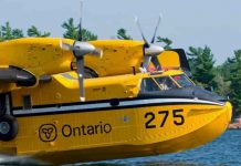
Unauthorized aircraft, including drones, can force water bombers and helicopters to leave the area, delaying suppression operations and creating a serious risk for pilots and firefighters.
Pilots should check NAV Canada’s Collaborative Flight Planning Services for current forest fire NOTAM information before flying.
Aviation Restrictions Near Fort Frances 14
A separate NOTAM is in effect around the Fort Frances 14 fire northeast of Byers Lake.
The restriction is also in addition to the standard five-nautical-mile and 3,000-foot airspace restrictions established under the Canadian Aviation Regulations.
Only aircraft involved in authorized fire-suppression operations should enter the restricted area.
Restricted Fire Zone Remains in Effect
A Restricted Fire Zone remains in effect across the Northwest Fire Region and a small portion of the Northeast Fire Region.
The restriction took effect July 15 at 12:01 a.m. local time because of high to extreme fire hazards, the number of active fires and the need to reduce human-caused ignitions.
During a Restricted Fire Zone, outdoor fires are prohibited unless specifically allowed under an exemption. The restrictions generally include campfires, charcoal fires and other open-air burning.
People travelling, camping or working in the region should confirm the current restrictions before conducting any activity involving fire or equipment that could produce sparks.
Regional Fire Hazard
Fire danger levels vary across Northwestern Ontario and can change during the day as temperatures, humidity, wind and precipitation conditions change.
Ontario’s interactive fire map calculates regional fire danger using information from more than 130 weather stations across the province’s fire regions.
Rain can temporarily reduce visible fire activity, but large fires may continue to hold heat beneath the surface. Drying conditions and stronger winds can cause fire behaviour to increase again.
How to Report a Wildland Fire
To report a wildland fire north of the French and Mattawa rivers, call 310-FIRE, or 310-3473.
To report a wildland fire south of the French or Mattawa rivers, call 911.