Thunder Bay – Weather Desk – Northern Ontario’s remote First Nation communities are beginning Thursday under warm, humid air, with thunderstorms moving through parts of the region before cooler and more stable conditions arrive Friday and Saturday.
The most urgent concern is in Sachigo Lake, where Environment Canada issued a yellow severe thunderstorm warning early this morning. Sandy Lake remains under a yellow heat warning. Residents should continue checking official alerts because thunderstorm warnings can be issued, updated or ended quickly.
Today’s Weather Overview
Current Conditions
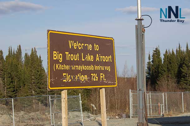
Sachigo Lake: Environment Canada’s listed observing station for the Sachigo Lake forecast is Big Trout Lake Airport. At 4:00 a.m. CDT, it reported mostly cloudy skies and a temperature of 21.5°C. Humidity was 80 per cent, the pressure was 100.4 kPa, and the south wind was blowing at 11 km/h. The humidex was 27. Conditions in Sachigo Lake itself may vary from this regional observation.
Sandy Lake: At 4:00 a.m. CDT, Sandy Lake Airport reported mostly cloudy skies and a warm temperature of 24.6°C. The humidex was already 30. Humidity stood at 62 per cent, pressure was 100.5 kPa, and the wind was west-southwest at 8 km/h.
Neskantaga: The Lansdowne House Airport observation at 5:00 a.m. EDT showed mainly clear skies and a temperature of 20.4°C. Humidity was 74 per cent, pressure was 100.9 kPa, and a south wind was blowing at 15 km/h. The humidex was 25.
Marten Falls/Ogoki Post: Ogoki Post Airport reported clear skies and 17.3°C at 5:00 a.m. EDT. Humidity was 82 per cent, pressure was 101.1 kPa, and the south-southeast wind was 11 km/h.
Kitchenuhmaykoosib Inninuwug—Big Trout Lake: At 4:00 a.m. CDT, Big Trout Lake Airport reported mostly cloudy skies and 21.5°C. Humidity was 80 per cent, pressure was 100.4 kPa, and the south wind was 11 km/h. The humidex was 27.
Weather Alerts and Safety
At 4:55 a.m. EDT, a yellow severe thunderstorm warning was in effect for the Sachigo Lake–Bearskin Lake area. Environment Canada said the storm could produce wind gusts reaching 90 km/h, hail as large as 2.5 centimetres and rainfall amounts of 15 to 50 millimetres. Heavy rain could sharply reduce visibility and cause localized flash flooding. Residents should move indoors and stay away from windows when threatening weather approaches.
A yellow heat warning remains in effect for Sandy Lake, Weagamow Lake and Deer Lake. The broader heat event has been producing daytime temperatures of 29°C to 31°C, humidex readings of 33 to 38 and overnight lows of 16°C to 20°C. The warning may continue into Friday in some areas. Check on Elders, people living alone and anyone with health conditions that increase their risk from heat.
Tomorrow’s Forecast and Three-Day Outlook
Expected Conditions
Sachigo Lake
Thursday: Mainly cloudy with a 70 per cent chance of early-morning showers and a thunderstorm risk. Skies should clear during the afternoon. West winds will increase to 30 km/h, gusting to 50. The high will reach 28°C, with a humidex of 33. Tonight will become cloudy again, with a low of 15°C.
Friday: Cloudy with a 30 per cent chance of morning showers, followed by clearing late in the afternoon. North winds will reach 20 km/h with gusts to 40. High 22°C and low 12°C.
Saturday: Sunny and more comfortable, with a high of 25°C and a clear-night low of 14°C.
Sandy Lake
Thursday: Mainly cloudy with a 60 per cent chance of early showers and a risk of thunderstorms. Clearing is expected during the afternoon. West winds will strengthen to 20 km/h, gusting to 40. High 28°C, humidex 33 and an overnight low of 17°C.
Friday: Cloudy early, then clearing during the afternoon. A north wind near 20 km/h will bring less humid air into the community. High 24°C and low 14°C.
Saturday: Sunny, with a high of 26°C and a clear-night low of 16°C.
Neskantaga
Thursday: A mix of sun and cloud, with the chance of showers increasing to 70 per cent near noon. Thunderstorms are possible during the afternoon. Southwest winds will increase to 20 km/h, gusting to 40. The high will reach 30°C, with a humidex of 37. Showers and a thunderstorm risk continue this evening before skies clear overnight. Low 19°C.
Friday: Clouds will increase early. Northwest winds will reach 20 km/h, gusting to 40. High 26°C, humidex 31 and low 13°C.
Saturday: Sunny and cooler, with a high of 24°C and low of 12°C.
Marten Falls/Ogoki Post
Thursday: Sun and cloud will give way to a 70 per cent chance of showers near noon. Thunderstorms are possible during the afternoon. Southwest winds will reach 20 km/h, gusting to 40. The afternoon high will be 30°C, with a humidex of 37. Showers and possible thunderstorms continue into the evening. Low 19°C.
Friday: Increasing cloudiness with northwest winds at 20 km/h, gusting to 40. High 26°C, humidex 31 and low 13°C.
Saturday: Sunny and noticeably more comfortable, with a high of 24°C and low of 12°C.
Kitchenuhmaykoosib Inninuwug—Big Trout Lake
Thursday: Mainly cloudy with a 70 per cent chance of morning showers and a risk of thunderstorms. Clearing is expected during the afternoon. West winds will increase to 30 km/h, gusting to 50. High 28°C, humidex 33 and low 16°C.
Friday: A 30 per cent chance of morning showers, followed by a mix of sun and cloud. North winds will reach 20 km/h with gusts to 40. High 22°C and low 12°C.
Saturday: Sunny, with a high of 25°C and a clear-night low of 14°C.
Wardrobe Recommendations
Wear lightweight, loose-fitting and light-coloured clothing today, especially in Sandy Lake, Neskantaga and Ogoki, where heat and humidity will be most noticeable. A wide-brimmed hat, sunglasses, sunscreen and a refillable water bottle are strongly recommended.
Keep a waterproof shell nearby because thunderstorms may develop quickly. Secure hats and loose outdoor items before the stronger wind gusts arrive. Friday and Saturday mornings will be much cooler, so travellers, boaters and people spending time on the land should pack a light jacket or warm sweater for temperatures between 12°C and 16°C.
Weather Trivia
Today’s warmth is well above the seasonal average in several communities. The normal late-July maximum at Big Trout Lake is about 22°C, while today’s forecast high is 28°C. At Lansdowne House and Ogoki, the normal maximum is also near 22°C, but temperatures are forecast to reach 30°C—approximately eight degrees above normal.