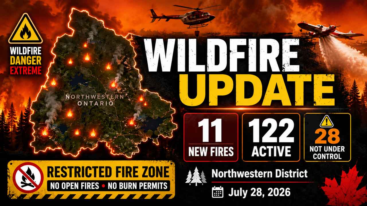
Eleven new fires were confirmed in Northwestern Ontario on July 28, bringing the regional total to 122 active wildland fires, including 28 not under control
THUNDER BAY – WILDFIRE UPDATE – Eleven new wildland fires were confirmed in Ontario’s Northwest Fire Region by the evening of Tuesday, July 28, 2026.
With heat warnings and alerts in effect for much of the Northwest, it is going to assist ramping up the wildland fires. Winds will likely be a factor.
As of 6:21 p.m. CDT, Aviation, Forest Fire and Emergency Services reported 122 active fires across Northwestern Ontario:
- 28 fires were not under control
- Five fires were being held
- Six fires were under control
- 83 fires were being observed
A Restricted Fire Zone remains in effect across the Northwest Region and a small portion of the Northeast Region because of the high to extreme fire hazard, heavy fire load and risk of additional human-caused fires.
Eleven New Wildland Fires Confirmed
Fort Frances District
Fort Frances 52 – FOR052 is located approximately half a kilometre east of Premier Lake Road, south of Durie Lake. The 0.1-hectare fire is under control.
Fort Frances 53 – FOR053 is located in Quetico Provincial Park between Draper Lake and Walter Lake. The 0.1-hectare fire is being held.
Fort Frances 54 – FOR054 was located approximately eight kilometres east of Highway 502, between Little Sawbill Lake and Big Sawbill Lake. The fire was called out at 0.1 hectares.
Thunder Bay District
Thunder Bay 65 – THU065 was located north of Highway 811 between Dog River Road and Rondeau Road. The fire was called out at 0.1 hectares.
Thunder Bay 66 – THU066 is located approximately two kilometres west of Highway 527, southwest of Swarbrick Lake. The 0.5-hectare fire is not under control.
Thunder Bay 67 – THU067 is located approximately 18.5 kilometres west of Highway 527, south of Pantagruel Creek Provincial Park. The 0.1-hectare fire is not under control.
Dryden District
Dryden 50 – DRY050 and Dryden 51 – DRY051 are located south of Savant Lake, between Highway 599 and Barnard Lake.
Dryden 50 is being held at 0.2 hectares. Dryden 51 was called out at 0.1 hectares.
Dryden 52 – DRY052 is located east of Sunday Lake, approximately 1.3 kilometres southeast of Richan. The 0.3-hectare fire is not under control.
Dryden 53 – DRY053 is located approximately 13 kilometres east of Dinorwic, north of Melgund Lake Road. The 0.1-hectare fire is not under control.
Nipigon District
Nipigon 86 – NIP086 is located approximately 13 kilometres west of Highway 585, near the west side of Frazer Lake. The 0.1-hectare fire is not under control.
Fires of Note
Thunder Bay 36
Thunder Bay 36 is currently listed at 313,930 hectares and remains not under control.
Ontario and Alberta crews are focused on extinguishing hot spots while maintaining and improving values-protection measures.
Helicopter bucketing operations are delivering water to priority areas to cool hot spots and reduce the possibility of renewed fire activity.
Heavy equipment operators continue constructing fire guards to create breaks in forest fuels and support containment work.
Values-protection operations remain underway.
Atikokan Fire Cluster
The Atikokan cluster includes Fort Frances 14, Fort Frances 15 and Fort Frances 38.
High humidity, cool overnight temperatures and calm or nearly calm winds have allowed crews to make progress along the fire perimeters.
Fort Frances 14
Fort Frances 14 is approximately 51,806 hectares and remains not under control.
FireRanger crews are establishing and strengthening hose lines along the perimeter. Heavy equipment and helicopter water drops are supporting operations in some areas.
Where hose lines have been established, crews are patrolling and working approximately 30 metres into the burned area to locate and extinguish hot spots.
Fort Frances 15
Fort Frances 15 is approximately 42,279 hectares and remains not under control.
FireRanger crews continue building and consolidating hose lines along the northern and northwestern portions of the fire.
Crews are also working inward from the perimeter to extinguish remaining heat. Helicopters are being used strategically to cool areas with increased fire activity and improve access for ground crews.
Fort Frances 38
Fort Frances 38, north of Crystal Lake, is under control at 44.2 hectares.
One firefighting crew is addressing hot spots detected by infrared scanning and assisting with demobilization work.
Sioux Lookout 72 – Cat Lake First Nation
Sioux Lookout 72 is approximately 23,597 hectares and remains not under control.
FireRanger crews are making progress on suppression work with support from helicopters targeting hot spots.
Hydro One has replaced poles damaged along the Cat Lake power line, and electricity has been restored.
Brightsand Fire Cluster
The Brightsand cluster includes Dryden 34, Dryden 35, Thunder Bay 54 and Thunder Bay 56.
Ontario and Alberta crews remain focused on suppression and values protection.
Dryden 34 – DRY034 is approximately 44,954 hectares and remains not under control.
Dryden 35 – DRY035 is approximately 22,461 hectares and remains not under control.
Crews are establishing hose lines while heavy equipment operators build fire guards along sections of Dryden 35.
Thunder Bay 54 – THU054 is approximately 7,389 hectares and remains not under control.
Thunder Bay 56 – THU056 is approximately 7,947 hectares and remains not under control.
Firefighters and bucketing helicopters are targeting hot spots on Thunder Bay 56 while heavy equipment operators construct fire guards.
Dryden 36 – Upper and Lower Moosehide Lakes
Dryden 36 has been more accurately mapped at 1,707 hectares and remains not under control.
Ontario FireRangers are working with Type 2 crews, Alberta personnel, helicopters and heavy equipment operators.
Low fire behaviour has been observed during recent days of favourable weather.
Highway 599 Fire Cluster
The Highway 599 cluster includes Sioux Lookout 84, Sioux Lookout 86 and Sioux Lookout 89.
Sioux Lookout 84 – SLK084 is approximately 4,796.6 hectares and remains not under control.
Sioux Lookout 86 – SLK086 is approximately 5,644 hectares and remains not under control.
Sioux Lookout 89 – SLK089 is approximately 7,190.1 hectares and remains not under control.
No recent growth has been observed within the cluster, and fire behaviour remains minimal.
Ontario and Alberta crews continue checking for hot spots and using hand tools, pumps and hose lines to extinguish remaining heat.
Evacuation Orders and Alerts
The following evacuation orders and alerts remain associated with wildland fires in the Northwest Region:
- Evacuation Order – Dryden 36
- Evacuation Order – Thunder Bay 36, Thunder Bay 54, Thunder Bay 56, Dryden 34 and Dryden 35
- Evacuation Order – Fort Frances 14
- Expanded Evacuation Alert – Fort Frances 14
- Evacuation Alert – Fort Frances 15 and Fort Frances 38
People in affected areas should continue following instructions from First Nation leadership, municipal officials, emergency managers and provincial authorities.
Aviation Restrictions
Thunder Bay 36 NOTAM
A Notice to Airmen remains in effect around Thunder Bay 36.
This restriction is in addition to standard wildfire airspace restrictions under Section 601.15 of the Canadian Aviation Regulations.
Airspace within five nautical miles of an active forest fire and up to 3,000 feet above ground level is restricted to authorized wildfire-suppression aircraft.
Fort Frances 14 NOTAM
A separate NOTAM remains in effect around Fort Frances 14, northeast of Byers Lake.
Pilots should check NAV CANADA’s Collaborative Flight Planning Services for current wildfire-related NOTAM information before flying.
Unauthorized aircraft can force waterbombers and helicopters to leave a fire area, delaying suppression work and placing crews at risk.
Restricted Fire Zone Remains in Effect
The Ministry of Natural Resources implemented a Restricted Fire Zone at 12:01 a.m. local time on July 15.
The restriction covers the Northwest Region and a small portion of the Northeast Region.
The measure was introduced because of the high to extreme fire hazard, increased wildfire activity and the need to prevent additional human-caused fires.
Open-air burning is prohibited within the restricted area unless specifically authorized.
Residents, campers, anglers and visitors should verify current restrictions before using any outdoor flame or heat source.
Regional Wildland Fire Hazard
Ontario’s interactive fire map calculates fire danger using information from more than 130 weather stations.
Fire danger ratings may change during the day as temperature, humidity, wind and rainfall conditions evolve.
The public should consult the provincial fire map for current fire locations, restrictions, danger ratings and status updates.
Reporting a Wildland Fire
To report a wildland fire north of the French and Mattawa rivers, call 310-FIRE — 310-3473.
To report a wildland fire south of the French or Mattawa rivers, call 911.
The public should remain clear of active fire areas and keep roads, waterways and airspace available for emergency personnel.