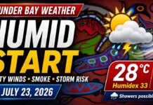
A heat warning is in effect for Kenora, Lake of the Woods, Grassy Narrows and Whitedog, with temperatures reaching 31°C and humidex values as high as 37
Thunder Bay – WEATHER DESK – A multi-day heat event will begin Tuesday across Kenora, Lake of the Woods, Grassy Narrows, Whitedog and surrounding communities.
Environment Canada has issued a yellow heat warning with a moderate impact level and high forecast confidence. Daytime temperatures are expected to reach between 29°C and 31°C through Thursday, while humidex values may climb as high as 37.
Warm overnight temperatures will offer limited relief, particularly Wednesday night when the temperature is forecast to remain near 21°C.
Today’s Weather Overview
Current Conditions
Kenora was mainly sunny at 3:00 p.m. CDT Monday, with a temperature of 26.2°C. The humidex made it feel closer to 29.
Humidity was 45%, with a dew point of 13.3°C. Winds were light from the north at 3 km/h.
Barometric pressure was 101.0 kPa and rising, while visibility was 24 kilometres.
A few clouds are expected tonight, with an overnight low of 18°C. Conditions will remain relatively comfortable before hotter and more humid weather arrives Tuesday.
Tomorrow’s Forecast
Expected Conditions
Tuesday, July 28
Tuesday will begin sunny before clouds increase later in the afternoon. There is a 30% chance of late-afternoon showers, along with a risk of a thunderstorm.
The temperature will reach 30°C, with a humidex of 35. The UV index will be 8, or very high.
People working, exercising or travelling outdoors should use sunscreen, seek shade regularly and drink water before becoming thirsty.
Tuesday evening will be partly cloudy, with a 30% chance of showers and a risk of an early-evening thunderstorm. Skies should clear later, with an overnight low of 19°C.
Wednesday, July 29
Wednesday is expected to be the hottest day of the forecast period.
A mix of sun and cloud is forecast, with a 30% chance of showers and a daytime high of 31°C. Humidity could make conditions feel several degrees warmer.
Cloudy periods and a 30% chance of showers are expected Wednesday night. The temperature will only fall to 21°C, providing very little relief from the heat.
Homes without air conditioning may remain especially warm overnight.
Thursday, July 30
Thursday will bring a mix of sun and cloud with a 40% chance of showers.
The daytime high will reach 29°C. Cloudy periods and a 30% chance of showers are expected Thursday night, with a low of 18°C.
The heat event may ease late Thursday, although Environment Canada says hot conditions could continue into Friday.
Heat Warning and Health Precautions
Environment Canada forecasts daytime highs between 29°C and 31°C, humidex values from 33 to 37, and nighttime lows between 17°C and 20°C. Some locations may remain even warmer overnight.
Extreme heat can affect everyone. Older adults, infants, young children, people living alone, outdoor workers and those with existing medical conditions can face an increased risk of heat-related illness.
Check on vulnerable relatives, friends and neighbours several times each day, either in person or by telephone.
Drink water regularly and do not wait until you feel thirsty. Plan strenuous outdoor activity for the cooler morning or evening hours and take frequent breaks in shaded or air-conditioned locations.
Signs of heat exhaustion can include headache, nausea, dizziness, intense thirst, dark urine and severe fatigue. Anyone experiencing these symptoms should stop their activity, move to a cooler place and drink water.
Heat stroke is a medical emergency. Warning signs can include red or hot skin, confusion, dizziness, nausea or a change in consciousness. Call 911 immediately and begin cooling the person while waiting for medical assistance.
Close blinds or curtains during the hottest part of the day. Open windows when outdoor temperatures are cooler than indoor temperatures, and use air conditioning or fans where available.
Residents whose homes become dangerously hot should consider visiting an air-conditioned public location, such as a library, community centre or other designated cooling space.
Never leave children, adults or pets inside a parked vehicle.
Lake and Boating Conditions
People heading onto Lake of the Woods should prepare for rapidly changing conditions Tuesday afternoon and evening.
Although winds will be light during Monday afternoon, thunderstorms can produce sudden gusty winds, heavy rainfall and frequent lightning. Boaters should monitor updated forecasts and be prepared to return to shore before storms approach.
Carry extra drinking water, sunscreen and a charged communication device. Personal flotation devices should be worn whenever travelling on the water.
Wardrobe Recommendations
Wear lightweight, loose-fitting and light-coloured clothing throughout the heat event. Breathable materials will help the body release heat more efficiently.
A wide-brimmed hat, sunglasses and broad-spectrum sunscreen are recommended Tuesday because the UV index will be very high.
Carry a refillable water bottle and pack a light waterproof layer for possible afternoon showers or thunderstorms.
Only a light layer should be needed during the evening, especially Wednesday night when temperatures are expected to remain near 21°C.
Weather Trivia
Large bodies of water such as Lake of the Woods can influence nearby temperatures, but they do not always provide relief during a strong summer heat event.
Water heats and cools more slowly than land, which can moderate daytime temperatures close to shore. However, warm and humid air can also keep nighttime temperatures elevated, reducing the body’s opportunity to recover from daytime heat.