Two New Wildfires Confirmed in Kenora Area as Northwest Region Reports Three Active Fires
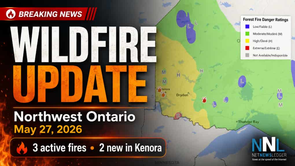
KENORA — Aviation, Forest Fire and Emergency Services is reporting three active wildland fires in Ontario’s Northwest Region as of 6 p.m. CDT on May 27, 2026, with two new fires confirmed in the Kenora area. Two fires are listed as not under control, while one is under control.
New Fires Reported Near Long Lake and Obashkaandagaang First Nation
The first new fire, Kenora 9 (KEN009), is burning north of Long Lake, about 6.8 kilometres west of Highway 596. The fire is listed at 1.5 hectares and is not under control.
The second new fire, Kenora 10 (KEN010), is located in Obashkaandagaang First Nation, also known as Rat Portage 38A, south of West End Road. That fire is listed at 0.1 hectares and is also not under control.
There are currently three active wildland fires in the Northwest Region. Of those, one is under control and two are not under control.
Why This Matters for Northwestern Ontario
For residents in Kenora, surrounding First Nations, highway corridors and nearby lake communities, even small wildland fires can become a concern quickly when dry conditions, wind and access challenges come into play.
Highway 596, local roads, seasonal properties, recreation areas and forested lands near Long Lake and Rat Portage 38A should remain on alert for changing conditions.
Smoke, aircraft activity and emergency response traffic may also be visible in affected areas.
For Thunder Bay and Northwestern Ontario, the early wildfire season is a reminder that fire conditions can shift rapidly across the region, particularly in forested areas where communities, tourism, transportation and resource-sector work are closely connected to the land.
Forest Fire Hazard Information
Ontario’s interactive fire map provides updated forest fire danger ratings across the province’s Fire Region. The ratings are calculated using data from more than 130 weather stations.
The map can change throughout the day as weather conditions shift. Blank areas on the map indicate that no data is currently available for that Ministry of Natural Resources district.
As of 5:55 p.m. CDT on May 27, the province’s fire map showed varying danger ratings across the Northwest Region.
Outdoor Fire Rules Are in Effect
Aviation, Forest Fire and Emergency Services reminds the public that Ontario’s legislated fire season runs from April 1 to Oct. 31.
Residents are encouraged to use alternatives to burning yard waste and woody debris, including composting or taking material to a local landfill.
Anyone who must burn is urged to use caution and follow Ontario’s outdoor fire rules. Fires must be started no sooner than two hours before sunset and fully extinguished no later than two hours after sunrise.
Anyone burning outdoors should have enough water and proper tools on site to contain the fire.
Residents inside municipal boundaries must also check with their local fire department for burning restrictions, fire bans or permit requirements before burning.
How to Report a Wildland Fire
To report a wildland fire north of the French and Mattawa rivers, call 310-FIRE (3473).
To report a wildland fire south of the French or Mattawa rivers, call 911.
For prevention tips and current fire information, follow Ontario’s forest fire updates on Facebook, Instagram and X at @ONforestfires and @ONfeudeforet, or visit Ontario.ca/FireUpdates.