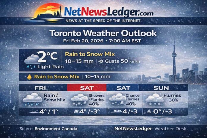
TORONTO – WEATHER – Toronto is waking up to a mild-for-February but messy start: light rain, very high humidity, and a falling barometer. Through the day, expect a rain-to-snow mix near midday, then a slushy finish as precipitation tapers and temperatures hover just above freezing.
Today’s Weather Overview
At Toronto Pearson this morning, it feels damp and raw—classic “near-freezing” weather that can turn sidewalks slick in a hurry.
-
Temperature: 1.8°C
-
Condition: Light Rain
-
Wind: East 27 km/h, gusting 45 km/h
-
Humidity: 93% (Dew point 0.8°C)
-
Pressure: 100.3 kPa, falling
-
Visibility: 10 km
Expected Conditions (Next Three Days)
Friday (Today)
-
Periods of rain changing to snow mixed with rain near noon, ending this afternoon
-
Then cloudy with a 60% chance of flurries or rain showers
-
Rainfall: 10 to 15 mm
-
Wind: East 30 km/h gusting 50, shifting to southwest 20 gusting 40 late afternoon
-
High: +4°C (UV index 1 – Low)
Tonight
-
Cloudy with a 60% chance of flurries
-
Wind: Southwest 20 gusting 40, becoming light late evening
-
Low: +1°C
Saturday (Feb 21)
-
Cloudy, 40% chance of flurries shifting to 40% chance of rain showers or flurries near noon
-
High: +4°C (UV index 1 – Low)
-
Saturday Night: Cloudy, 30% chance of flurries, low -3°C
Sunday (Feb 22)
-
Cloudy, 30% chance of flurries
-
High: 0°C
-
Sunday Night: Cloudy, 30% chance of flurries, low -3°C
Looking ahead: Monday stays cloudy (high -2°C), but the bigger change is Monday night, when temperatures dip toward -15°C, signalling a sharper push of colder air.
Wardrobe Recommendations
-
Today: Waterproof jacket with a tight hood (gusty winds make umbrellas frustrating), plus waterproof footwear for puddles and slush.
-
This afternoon: Add warm gloves—wet snow + wind can chill hands fast.
-
Weekend: Layering is key (sweater or fleece under a shell). With evening lows slipping below freezing, watch for ice patches where daytime melt refreezes.
-
Monday night cold snap: Switch to a true winter coat, insulated boots, and a face/neck layer if you’re out late.
Weather Trivia
Toronto’s winter “messy mix” days are often tied to Lake Ontario’s moderating influence. The lake can keep surface temperatures near the freezing mark, which increases the odds of rain, wet snow, or quick flip-flops between the two—especially when winds pull in different air masses over short periods.
Summary – Toronto weather forecast for Feb 20–22, 2026: light rain and gusty east winds this morning, rain mixing with snow near noon, 10–15 mm rainfall, then flurries chances through the weekend with colder air arriving Monday night.


