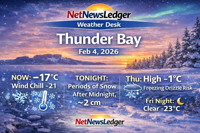
THUNDER BAY – WEATHER – Thunder Bay starts Wednesday under mostly cloudy skies and deep cold, but the bigger story is what’s ahead: snow develops after midnight, then a wintry mix risk Thursday with freezing drizzle possible late morning into early afternoon.
Today’s Weather Overview
Current Conditions (6:00 AM EST)
At the 6:00 AM observation, Thunder Bay is mostly cloudy and -17.3°C, with west winds at 5 km/h giving a wind chill of -21. Pressure is 102.9 kPa and rising, humidity 79%, and visibility is 24 km.
Today (Wednesday)
Expect partly cloudy early, becoming cloudy this morning. Winds stay light (up to 15 km/h) and the high reaches -7°C. Wind chill values run around -25 this morning, improving to near -13 this afternoon. UV index 1 (low).
Expected Conditions: Next Three Days
Tonight (Wednesday night)
Cloudy with periods of snow beginning after midnight, with about 2 cm expected. Low -12°C. Wind chill near -16 this evening.
Thursday, February 5
Snow ends in the morning, then cloudy with a 30% chance of flurries. Watch for a risk of freezing drizzle late morning and early afternoon (this can create slick sidewalks and roads fast). Additional snow amount near 2 cm. High -1°C with wind chill -12 in the morning and around -5 in the afternoon.
Friday, February 6
A mix of sun and cloud with a 30% chance of flurries. High -9°C. Friday night turns clear and much colder, low -23°C.
Extended look (weekend into Monday)
-
Saturday: Cloudy, 30% chance of snow, high -9°C; night 40% chance of snow, low -17°C.
-
Sunday: Cloudy, high -6°C; night 40% chance of snow, low -11°C.
-
Monday: 40% chance of snow, high 0°C; night 30% chance of snow, low -8°C.
Wardrobe Recommendations
-
This morning: Dress for wind chill near -21 to -25—winter coat, insulated boots, warm base layer, toque, and mitts.
-
Overnight into Thursday: With snow + freezing drizzle risk, traction matters—boots with good tread (or ice grips) and allow extra time for travel.
- Friday night’s cold dip: If you’re out late, cover exposed skin and consider a face covering—-23°C can bite quickly!
Weather Trivia
Thunder Bay’s location on Lake Superior can help “juice up” snowfall when cold air crosses open water—one reason the region can see bursts of heavier snow even when totals look modest on paper.
Summary
Thunder Bay forecast for Wed, Feb. 4, 2026: -17°C this morning under mostly cloudy skies. Snow begins after midnight (about 2 cm), then Thursday brings flurries and a risk of freezing drizzle with a high near -1°C before colder air returns Friday night.


