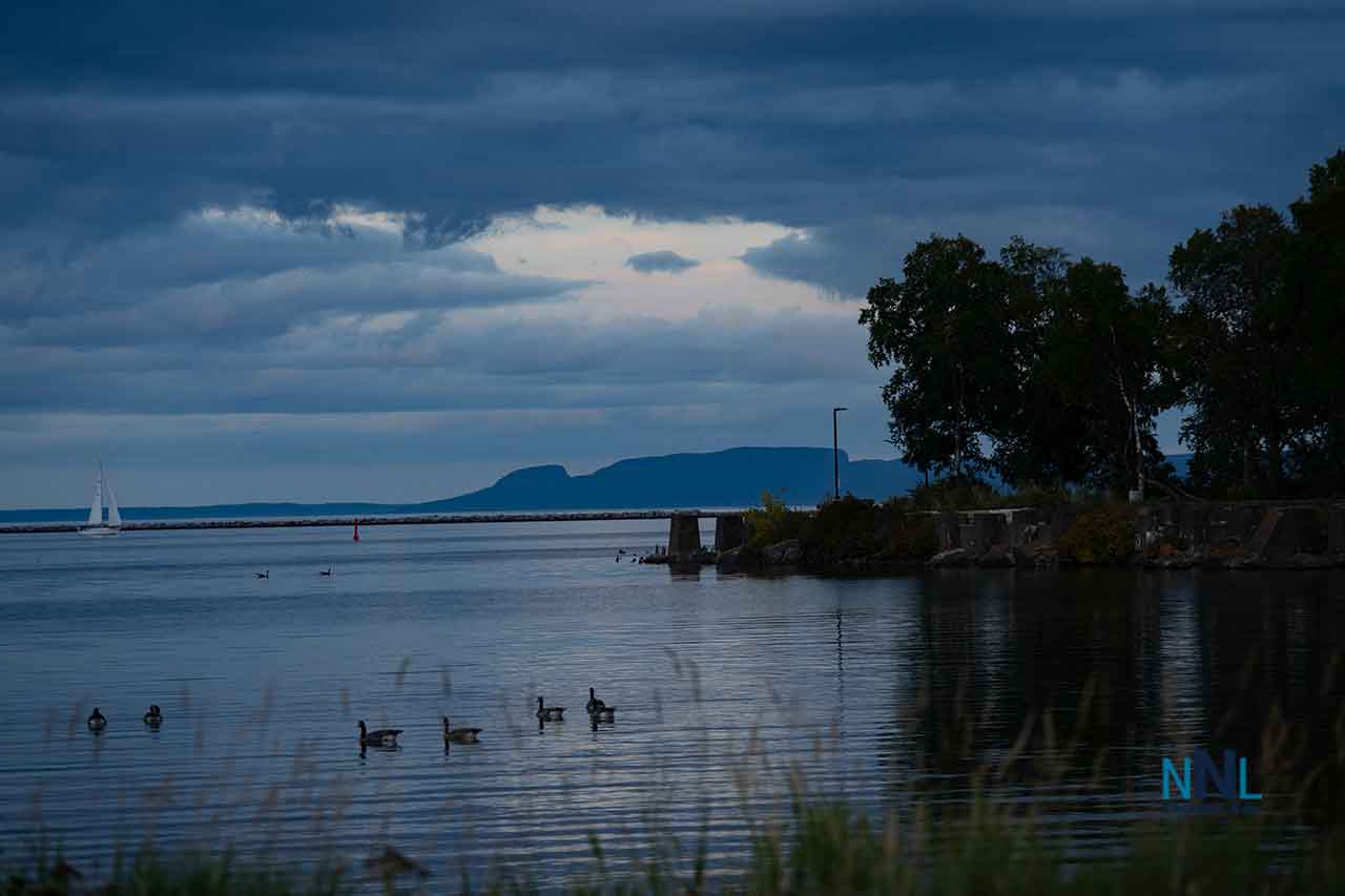
August 24, 2026: Thunder Bay Weather — Sunny 23°C Monday with Improving Lake Superior Marine Conditions
Thunder Bay – Weather Desk – Thunder Bay is starting Monday with a crisp, clear late-August morning before temperatures climb into the low 20s under sunny skies. Fog patches around the area will dissipate this morning, leaving excellent conditions for most outdoor activities.
For boaters, anglers and sailors, the Western Lake Superior marine forecast is also relatively favourable today. North winds around 15 knots will ease and turn west this afternoon, while waves of 0.5 to 1 metre gradually subside. The more unsettled marine weather arrives Tuesday as winds shift and thunderstorms become possible late in the day.
Today’s Weather Overview
Current Conditions
At 5:00 AM EDT Monday, Thunder Bay Airport was reporting clear skies and 7.5°C.
Humidity was high at 97 percent, with a dew point of 7.1°C. Barometric pressure was 101.8 kPa and rising. Winds were from the west-southwest at 9 km/h, with visibility of 24 kilometres.
It is a cool start, but temperatures will rise quickly as the morning progresses.
Monday Forecast — Sunshine and 23°C
Environment Canada’s 5:30 AM EDT forecast calls for sunny skies today, with any fog patches dissipating this morning.
The afternoon high reaches 23°C, with a humidex of 25. The UV index will climb to 6, or high, making sunscreen and sunglasses worthwhile for anyone spending an extended period outdoors.
Thunder Bay’s normal maximum for this point in August is about 22°C, so Monday will be almost exactly seasonal.
Tonight
Tonight starts clear before becoming partly cloudy near midnight.
Temperatures drop to 9°C, right around Thunder Bay’s seasonal overnight normal.
The combination of a warm afternoon and single-digit overnight temperatures makes an extra layer useful for late-evening activities.
Lake Superior Marine Weather
Western Lake Superior — Monday
Environment Canada’s marine forecast for Western Lake Superior, issued at 3:00 AM EDT Monday, calls for north winds of 15 knots this morning.
Those winds diminish and shift to west at 10 knots this afternoon. For reference, 15 knots is approximately 28 km/h, while 10 knots is about 19 km/h.
Waves
Waves will run around 0.5 to 1 metre today, then subside to 0.5 metre or less early this evening.
That makes the afternoon and early evening a comparatively favourable period on open portions of western Lake Superior as winds and waves decrease. Conditions inside Thunder Bay Harbour or other sheltered waters may be calmer than the open-lake forecast.
The Environment Canada forecast page did not list an active marine warning for Western Lake Superior with the 3:00 AM forecast. Mariners should still check for updated warnings before leaving shore because Great Lakes conditions can change rapidly.
Lake Superior — Monday Night
Winds remain relatively light tonight after becoming west at around 10 knots.
Wave heights continue to decrease to 0.5 metre or less, providing relatively quiet open-lake conditions overnight.
No precipitation is included in the Western Lake Superior marine forecast for Monday or Monday night.
Tomorrow’s Forecast
Tuesday, August 25 — Showers and Thunderstorm Risk
Thunder Bay’s weather becomes considerably more unsettled Tuesday.
Environment Canada’s latest morning forecast calls for mainly cloudy skies with a 60 percent chance of showers and a risk of a thunderstorm. The high reaches only 18°C, making Tuesday noticeably cooler than Monday.
Tuesday night remains cloudy with a 40 percent chance of showers and a milder low of 15°C.
Tuesday on Lake Superior
Marine conditions also begin changing Tuesday.
Western Lake Superior winds back to the south at 10 knots Tuesday morning, then strengthen to southeast 15 knots during the afternoon. Waves remain relatively small initially before building back to 0.5 to 1 metre Tuesday evening.
Scattered showers are forecast late Tuesday, along with a risk of thunderstorms. Anyone planning a full day on Lake Superior should keep a close watch on radar, lightning activity and updated marine forecasts during the afternoon.
Midweek Outlook
Wednesday, August 26
Wednesday remains unsettled in Thunder Bay, with a 40 percent chance of showers and a high of 21°C.
Wednesday night keeps a 40 percent shower chance with a low of 14°C.
On Western Lake Superior, winds are forecast to be southwest at 15 knots Wednesday.
Thursday, August 27
Thursday brings a mix of cloud and scattered showers, with a 30 percent chance of precipitation and a high near 21°C.
Thursday night drops sharply to 8°C, with a continued 30 percent chance of showers.
Marine winds shift to northwest at 15 knots Thursday.
Friday, August 28
Friday currently looks drier, with a mix of sun and cloud and a high near 20°C.
Western Lake Superior winds are forecast to become light Friday, potentially offering another favourable marine weather window if that forecast holds.
Boating and Outdoor Outlook
For boaters heading onto Lake Superior, Monday offers the better conditions in the immediate forecast. Winds ease from north 15 knots to west 10 knots, and waves subside below half a metre by early evening.
Tuesday requires more caution because southeast winds strengthen during the afternoon and thunderstorms become possible late in the day.
Conditions on Lake Superior can vary sharply between Thunder Bay Harbour, protected bays and exposed open water. Boaters should check the newest Environment Canada marine forecast and any warnings immediately before departure.
Wardrobe Recommendations
Monday starts cool enough for a light jacket, sweater or hoodie, but those layers will probably come off quickly once sunshine pushes temperatures toward 23°C.
For the afternoon, lighter summer clothing will be comfortable. With a high UV index of 6, add sunscreen, sunglasses and a hat if you are outside for long periods.
Anyone heading onto Lake Superior should carry a wind-resistant layer, even on an otherwise warm day. Temperatures over the lake and along exposed shorelines can feel cooler than conditions farther inland.
A sweater or light jacket will again be useful Monday evening as temperatures head toward 9°C. Rain protection becomes more important Tuesday with showers and thunderstorms in the forecast.
Weather Trivia
Thunder Bay’s normal temperature for August 24 is approximately a high of 22°C and a low of 9°C. Monday’s forecast of 23°C during the day and 9°C tonight is therefore almost perfectly seasonal.
The shortening days are becoming more noticeable as August approaches its final week. Environment Canada lists sunrise at 7:03 AM EDT and sunset at 8:55 PM EDT, providing just under 14 hours of daylight.
Lake Superior also plays an important role in Thunder Bay’s local weather. The enormous body of water heats and cools more slowly than the surrounding land, which can create noticeable temperature differences between the waterfront and inland neighbourhoods.
Sources: Environment and Climate Change Canada Thunder Bay public forecast issued 5:30 AM EDT Monday, August 24, 2026, and Western Lake Superior marine forecast issued 3:00 AM EDT Monday.
META Description
Thunder Bay weather for August 24, 2026: Sunny with a high of 23°C and a cool 9°C night. Western Lake Superior winds ease from north 15 knots to west 10 knots as waves subside, before showers and thunderstorms become possible Tuesday.