Copernicus Warns of Intensifying Wildfires From Indonesia to the Arctic
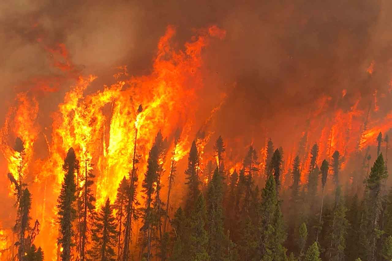
BONN, Germany — Wildfire activity is intensifying across several parts of the world, with major fires in Indonesia, northern Russia and North America sending smoke across international borders and, in some cases, deep into the Arctic.
The Copernicus Atmosphere Monitoring Service, or CAMS, says wildfire emissions across high northern latitudes are running above average, while Indonesia is experiencing an unusually intense start to its seasonal fire period during a strong El Niño year.
For Northwestern Ontario, where communities have already faced extensive wildfire activity and evacuations in 2026, the findings underline how northern fire seasons are increasingly connected through long-range smoke transport, atmospheric circulation and prolonged periods of heat and drought.
Wildfire Smoke Spreading Across Northern Hemisphere
CAMS has been monitoring significant wildfire activity across North America and northern Eurasia since the beginning of August.
Smoke from those fires has been transported across large portions of the Northern Hemisphere, including into the Arctic.
The agency says wildfire emissions at high northern latitudes and within the Arctic Circle are currently above average, placing 2026 among the more active recent years for Arctic wildfire emissions.
The monitoring is based on satellite observations processed through the Copernicus Global Fire Assimilation System, known as GFAS.
The system measures Fire Radiative Power detected by satellites and uses that information to estimate emissions from wildfires and other biomass burning.
Indonesia Fire Season Intensifies During El Niño
Indonesia is experiencing an increasingly active start to its annual wildfire season.
Seasonal vegetation fires typically develop between late July and the end of October, when dry conditions make forests and peatlands more vulnerable to burning.
CAMS says the 2026 fire season could be particularly significant because of a strong positive El Niño-Southern Oscillation, or ENSO, event in the equatorial Pacific.
El Niño conditions can contribute to hotter and drier weather across parts of Southeast Asia, increasing the potential for wildfires and persistent haze.
Initial fire activity has been concentrated on the island of Borneo, including the Indonesian provinces of West Kalimantan and Central Kalimantan.
Smoke from the fires has already contributed to air-quality problems, including school closures, while haze has affected neighbouring Singapore and Malaysia.
Peat Fires Create Difficult Suppression Conditions
Indonesia’s extensive peatlands make fire suppression particularly difficult.
Peat fires can burn beneath the surface and at relatively low temperatures, allowing fires to continue even when visible flames have been reduced.
Once peatlands dry out and ignite, fires can smoulder underground for long periods and produce large quantities of smoke.
Indonesian authorities have used cloud seeding in an effort to generate rainfall and reduce both fire activity and smoke pollution.
Cloud-seeding operations introduce particles such as salts or other materials into suitable clouds in an attempt to encourage precipitation.
CAMS says it will continue monitoring Indonesia closely as the dry season progresses.
Wildfires Continue Across Europe
Large parts of Europe have also faced elevated wildfire risk following extended heat and dry conditions.
Belgium experienced what CAMS described as the country’s largest wildfire since satellite monitoring began, with approximately 3,000 hectares burned beginning Aug. 14.
Smoke from that fire contributed to evacuation orders in the German border city of Monschau.
More favourable weather, including rainfall, later helped firefighters bring fire conditions under greater control in northwestern Europe.
However, significant wildfire activity has continued in parts of Spain, France, Greece, the Balkans and Germany.
Major fires have included incidents in the French region of Landes and the Spanish regions of Huelva and Huesca.
British Columbia, Northwest Territories Seeing Intense Fire Activity
North America remains another major centre of wildfire activity.
CAMS reports particularly intense fires in the Pacific Northwest of the United States, British Columbia and the Northwest Territories.
Some regions are experiencing wildfire emissions among the highest recorded in recent decades.
Washington and Oregon recorded their highest year-to-date wildfire emissions for July and August, according to the GFAS dataset.
Utah has recorded its highest wildfire emissions since at least 2003 following major fires during June, July and August.
For the United States overall, CAMS says 2026 wildfire emissions are running slightly above average for this point in the year.
Northern Russian Fires Producing Major Emissions
Wildfires have also been particularly active across northern areas of Russia.
CAMS identified major fire activity in Yamal-Nenets, Krasnoyarsk and portions of the Sakha Republic.
Yamal-Nenets recorded its highest daily wildfire emissions in the GFAS record during August.
Several northern Russian regions have experienced some of their highest fire-emission levels since satellite-based records began in 2003.
Despite those significant regional fires, Russia’s total wildfire emissions for the year remain below average and well below exceptionally severe seasons such as 2012 and 2021.
Arctic Fires Peaking Later Than Expected
Mark Parrington, senior scientist at the European Centre for Medium-Range Weather Forecasts working with CAMS, says some northern wildfire regions are showing unusually persistent activity.
“Based on our years of monitoring during the summer months, we expect to see continuation of wildfire emissions around the Northern Hemisphere through to the end of August,” Parrington said.
He said large and persistent fires in areas including the Siberian Arctic have produced emissions later in the season than might normally be expected.
“For Indonesia, seasonal fire emissions and regional haze are already enhanced, consistent with previous El Niño years, and we will be monitoring the situation very closely to understand how the fires and air quality impacts are changing,” Parrington added.
What This Means for Northwestern Ontario
For Northwestern Ontario residents, the international wildfire picture offers an important reminder that smoke does not respect provincial or national boundaries.
Smoke generated in western Canada, the United States, northern Russia or other regions can travel thousands of kilometres depending on atmospheric conditions.
That means local air quality can sometimes deteriorate even when the nearest major fires are hundreds or thousands of kilometres away.
Fine particulate matter, particularly PM2.5, is one of the primary health concerns associated with wildfire smoke.
People with heart or lung disease, older adults, children, pregnant people and those who work or exercise outdoors can be especially vulnerable during heavy smoke events.
However, the CAMS report does not by itself mean Thunder Bay or Northwestern Ontario is currently experiencing hazardous air quality. Residents should rely on Environment and Climate Change Canada air-quality forecasts and local alerts for current conditions.
Northwestern Ontario’s Fire Season Fits a Broader Northern Pattern
The global report comes during a significant wildfire year across Northwestern Ontario.
Communities across the Northwest have dealt with major fires, evacuation orders and large-scale suppression operations during the summer of 2026.
The broader Arctic and boreal pattern identified by CAMS is particularly relevant because Northern Ontario sits within the vast boreal forest stretching across Canada.
Longer periods of extreme heat, drought and low humidity can increase the likelihood of large fires when ignition occurs.
Wildfire behaviour still varies considerably from season to season and from region to region, making it difficult to attribute any individual fire directly to climate change.
However, climate research has consistently identified rising temperatures and changing fire-weather conditions as factors that can increase the likelihood and severity of extreme wildfire seasons in many northern regions.
Global Fire Emissions Still Relatively Low Overall
Despite intense wildfire activity in several northern regions, CAMS reports an unusual global contrast.
Year-to-date worldwide fire emissions are currently at their lowest level in the 24-year GFAS dataset.
The primary reason is lower-than-average seasonal biomass burning across tropical Africa.
Reduced burning there has outweighed sharp increases in wildfire emissions elsewhere.
The finding demonstrates why global totals can sometimes obscure severe regional events.
A year can record relatively low worldwide emissions while individual regions experience destructive and historically significant fire seasons.
Satellite Monitoring Helps Forecast Smoke Up to Five Days Ahead
CAMS uses GFAS information as part of atmospheric forecasting conducted by the European Centre for Medium-Range Weather Forecasts.
Satellite observations allow scientists to estimate wildfire and biomass-burning emissions and then model how smoke will move through the atmosphere.
CAMS can forecast smoke transport and potential air-quality impacts up to five days in advance.
The data is made publicly available to researchers, governments, emergency-management officials and the public.
For Northern communities, that forecasting can provide valuable advance information when wildfire smoke begins moving over long distances.
A Fire Season No Longer Confined to Local Boundaries
The 2026 wildfire season demonstrates how fires that begin as local emergencies can have international consequences.
Smoke from western North America can reach the Arctic. Siberian fires can affect air masses thousands of kilometres from their source. Indonesian peat fires can create haze across Southeast Asian borders.
For Thunder Bay and Northwestern Ontario, the lesson is increasingly familiar.
Wildfire preparedness is not simply about fighting flames.
It includes monitoring air quality, protecting vulnerable residents, preparing communities for evacuation, maintaining transportation routes and understanding how smoke and extreme fire weather can affect places far beyond the original fire perimeter.