July 29, 2026: Heat Warnings Cover Northwestern Ontario as Thunderstorm Risk Builds
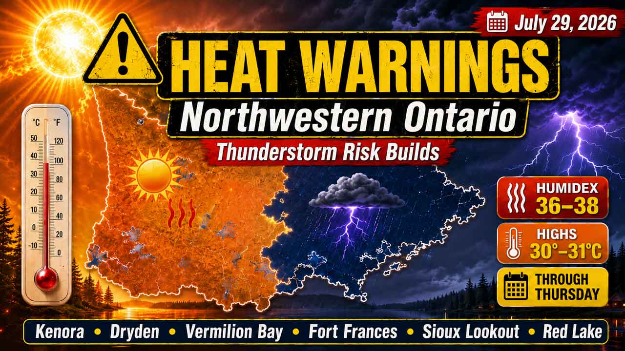
KENORA – WEATHER – Northwestern Ontario is entering another hot and humid day, with yellow heat warnings in effect for Kenora, Dryden and Vermilion Bay, Fort Frances, Sioux Lookout and Red Lake.
Temperatures will reach 30°C or 31°C in most communities today. Humidex values between 36 and 38 will make conditions feel even hotter, while scattered showers and thunderstorms may develop through tonight and Thursday.
Cooler and more stable weather is forecast to arrive Friday.
Weather Advisories and Warnings
Yellow Heat Warnings in Effect
Environment Canada has yellow heat warnings in place for all communities covered by this forecast:
- Kenora–Grassy Narrows–Whitedog
- Dryden–Vermilion Bay
- Fort Frances–Emo–Rainy River
- Sioux Lookout–Eastern Lac Seul
- Red Lake–Woodland Caribou Park
The warnings call for daytime highs of 29°C to 31°C, Humidex values between 33 and 38, and overnight lows of 16°C to 20°C. The heat event is expected to continue through Thursday evening and could extend into Friday. Hot and humid air may also cause air quality to deteriorate.
At publication time, the Environment Canada community pages displayed heat warnings but no separate severe-thunderstorm watches or warnings. Thunderstorms remain part of the forecast, however, and additional alerts could be issued if storms become severe.
Residents should check on Elders, people living alone and anyone with health conditions that may make them more vulnerable to heat. Drink water regularly, reduce strenuous afternoon activity and move to a cooler location when necessary.
Heat exhaustion symptoms can include headache, nausea, dizziness, thirst and unusual fatigue. Confusion, loss of consciousness or hot, red skin can indicate heat stroke, which is a medical emergency.
Today’s Weather Overview
Current Conditions
Kenora: At 4:00 a.m. CDT, skies were clear and the temperature was 21°C. Humidity was 92 per cent, with southwest winds at 8 km/h. Pressure was 101.3 kPa and rising.
Dryden and Vermilion Bay: Dryden Airport reported mainly clear skies and 19.6°C at 4:00 a.m. CDT. The south wind was 11 km/h, humidity was 86 per cent and pressure was 101.3 kPa. The Dryden forecast also serves the Vermilion Bay area.
Fort Frances: The temperature was 14.6°C at 5:00 a.m. CDT, with calm winds and humidity of 99 per cent. Pressure was 101.3 kPa and rising. A sky condition was not reported by the station.
Sioux Lookout: Mostly cloudy skies and 16.1°C were reported at 5:00 a.m. CDT. Winds were calm, humidity was 100 per cent and pressure was 101.3 kPa and rising.
Red Lake: Skies were clear with a temperature of 14.2°C at 5:00 a.m. CDT. The east wind was 3 km/h, humidity was 96 per cent and pressure was 101.2 kPa and falling.
Three-Day Northwestern Ontario Forecast
Kenora
Wednesday, July 29
A mix of sun and cloud is expected, with a 30 per cent chance of showers and a risk of a thunderstorm. The high will reach 31°C, with a Humidex of 38 and a very high UV index of 8.
Skies will initially be clear tonight before cloud increases around midnight. There will be a 40 per cent chance of overnight showers and a thunderstorm risk. The low will be 20°C.
Thursday, July 30
Thursday will be mainly cloudy with a 40 per cent chance of showers and a risk of a thunderstorm. The high will be 28°C, feeling closer to 35.
Thursday night will remain cloudy with a 30 per cent chance of showers and a low of 18°C.
Friday, July 31
Sunshine returns Friday with a high of 26°C. Friday night will be clear with a low of 17°C.
Dryden and Vermilion Bay
Wednesday, July 29
A mix of sun and cloud will bring a 30 per cent chance of showers during the late morning and afternoon. There is a risk of a thunderstorm.
The high will reach 30°C, with a Humidex of 37 and a very high UV index of 8.
Tonight will be partly cloudy. The chance of showers will be 30 per cent early in the evening and 40 per cent before morning, with a continued thunderstorm risk. The low will be 19°C.
Thursday, July 30
A mix of sun and cloud is expected with a 40 per cent chance of showers and a high of 28°C.
Thursday night will be cloudy with a 30 per cent chance of showers and a low of 17°C.
Friday, July 31
Friday will be sunny with a high of 26°C. Clear skies are expected Friday night, with a low of 16°C.
Fort Frances
Wednesday, July 29
Fort Frances will be sunny early before a mix of sun and cloud develops. There is a 30 per cent chance of showers late this morning and this afternoon, along with a risk of a thunderstorm.
Morning fog patches will dissipate. The high will reach 31°C, with a Humidex of 38 and a very high UV index of 8.
Tonight will be partly cloudy. Shower chances will increase from 30 per cent early in the evening to 40 per cent before morning, with another thunderstorm risk. The low will be 19°C.
Thursday, July 30
Thursday will be mainly cloudy with a 40 per cent chance of showers and a risk of a thunderstorm.
The high will be 29°C, but humidity will make it feel closer to 37. Thursday night will be cloudy with a 30 per cent chance of showers and a low of 19°C.
Friday, July 31
Friday will be sunny and less humid, with a high of 26°C. Clear skies are expected Friday night, with a low of 18°C.
Sioux Lookout
Wednesday, July 29
A mix of sun and cloud will bring a 30 per cent chance of showers during the late morning and afternoon. There is a risk of a thunderstorm.
The high will reach 30°C, with a Humidex of 36 and a high UV index of 7.
Tonight will be partly cloudy. There will be a 30 per cent chance of early-evening showers, increasing to 40 per cent before morning, with a continued thunderstorm risk. The low will be 19°C.
Thursday, July 30
Thursday will be mainly cloudy with a 40 per cent chance of showers and a risk of a thunderstorm.
The high will reach 29°C, with a Humidex of 35 and a high UV index of 7. Thursday night will be cloudy with a low of 17°C.
Friday, July 31
Friday will be sunny with a high of 27°C. Skies will remain clear Friday night as temperatures fall to 15°C.
Red Lake
Wednesday, July 29
Red Lake will become a mix of sun and cloud this morning. There is a 30 per cent chance of showers and a risk of a thunderstorm.
The high will reach 30°C, with a Humidex of 36 and a high UV index of 7.
Cloud will increase tonight, bringing a 40 per cent chance of overnight showers and another thunderstorm risk. The low will be 19°C.
Thursday, July 30
Thursday will be cloudy with a 40 per cent chance of showers and a risk of a thunderstorm.
The high will be 29°C, with a Humidex of 34. Cloudy periods are expected Thursday night, with a low of 16°C.
Friday, July 31
Friday will be sunny with a high of 27°C. Friday night will be clear with a low of 15°C.
Wardrobe and Safety Recommendations
Wear lightweight, loose-fitting and light-coloured clothing during the heat warning. A wide-brimmed hat, sunglasses and sunscreen will be important, especially where the UV index reaches 7 or 8.
Keep a light rain jacket nearby, but do not rely on it for protection during thunderstorms. When thunder is heard, move indoors or into a fully enclosed vehicle and remain there until the storm has passed.
Outdoor work, travel and recreation should be scheduled for the cooler morning or evening hours. Carry more drinking water than usual and take frequent breaks in shaded or cooled areas.
Never leave children, adults or pets inside a parked vehicle.
Weather Trivia
Normal late-July daytime highs across much of Northwestern Ontario are around 24°C to 25°C. Forecast highs of 30°C to 31°C today are therefore approximately five to seven degrees above normal in several communities.
Summary: Yellow heat warnings cover Kenora, Dryden, Vermilion Bay, Fort Frances, Sioux Lookout and Red Lake, with Humidex values near 38 and thunderstorms possible through Thursday.