
NORTHWEST REGION – The Aviation, Forest Fire and Emergency Services (AFFES) reports that two new wildfires were confirmed in the Northwest Region by late afternoon on May 11, 2025, bringing the current total to six active fires.
Of these, two are under control, while four remain not under control, as crews work aggressively across the region amid high to extreme fire hazard conditions, especially along the Minnesota border from Rainy River to Quetico Park.
New Fires Reported on May 11
-
Kenora 16 (KEN016): Burning on a peninsula along Maynard Lake, this 3-hectare fire is currently not under control.
-
Fort Frances 3 (FOR003): Located next to Highway 611, about 8 km northwest of Fort Frances, this 0.1-hectare fire is not under control.
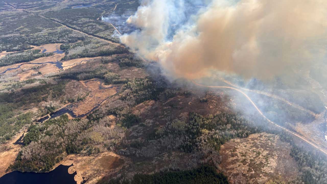
Kenora 14 Fire Holds Steady as Crews Make Progress
Kenora 14 (KEN 014) remains the fire of most concern. On May 10, favourable conditions saw minimal growth, with the fire still measuring 1,027 hectares.
Southerly winds continued Sunday, helping keep smoke and fire activity away from Wabaseemoong Independent Nation, while giving FireRanger crews the opportunity to advance hoselines on the southern and western edges near vulnerable structures.
Current resources assigned to Kenora 14:
-
11 FireRanger crews (plus 3 more en route)
-
4 helicopters, with 3 more aircraft, including two heavy helicopters, arriving to support suppression efforts.
Travel Restrictions Remain in Place – Kenora 14 Emergency Area Order
Emergency Area Order (EAO 2025-01) remains in effect to ensure public safety and allow effective firefighting operations:
-
All travel and use of roads, including Highway 525 beyond Wabaseemoong First Nation, is prohibited without a travel permit.
-
Use of lakes and waterways in the English River system and surrounding areas is restricted.
-
Crown land use within the defined order area is also prohibited.
Permits can be requested by contacting Annie Langford at the Kenora District Office:
📞 (807) 456-2370 | 📧 Annie.Langford@ontario.ca
View Implementation Order Map
Dryden 5 Fire Remapped at 62.9 Hectares
Dryden 5 (DRY005) near Peterson Cove on Sturgeon Lake has been remapped at 62.9 hectares and remains not under control.
The fire has responded well to waterbombing operations, which have helped minimize aggressive fire behaviour.
Extreme Fire Hazard in Parts of Northwest Region
The wildland fire hazard remains high across most of the Northwest Region, with extreme conditions along the Minnesota border.
Areas around Thunder Bay and Greenstone are seeing low to moderate hazard levels.
Residents are strongly urged to exercise extreme caution with outdoor burning. For up-to-date hazard conditions, visit Ontario’s Interactive Fire Map.
Public Safety Reminder: No Drone Zone Near Wildfires
Flying drones near wildfires is illegal and dangerous, putting both fire crews and aircraft at risk.
Stay safe. Stay clear of wildfires. Leave the skies to the professionals.
How to Report a Wildland Fire
-
North of the French and Mattawa Rivers: Call 310-FIRE (3473)
-
South of those rivers: Call 9-1-1


