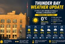
A Chilly Start Warms into a Mild Afternoon—With Some Cloudy Curveballs
Morning Freeze and Sunshine Tease
It’s a frosty spring morning in Thunder Bay where, as of 6:00 AM EDT, temperatures are clinging to -3.8°C. Observed at the Thunder Bay Airport, the air is perfectly saturated at 100% humidity—your breath is fogging up, your windshield definitely needs scraping, and you may be rethinking that lighter jacket. A gentle westerly breeze at 7 km/h makes it feel closer to -7°C, so the wind chill has a bit of bite. The pressure stands at 101.7 kPa and is on the rise—Mother Nature’s way of suggesting that today starts strong… but hold onto your hat.
The skies are partly cloudy now but expect sunshine through the morning before clouds start thickening early this afternoon. Winds will remain light, up to 15 km/h, making today feel fairly calm, all things considered. The temperature will rise to a high of 8°C, so by lunchtime, the spring jacket can come out of hiding. The UV index reaches 5 today—moderate enough to warrant a dab of sunscreen if you’ll be outdoors.
Tonight: Spring Mix on the Menu
As the day winds down, the clouds roll in with a 40 percent chance of rain showers that may turn into flurries near midnight. That’s right—don’t write off snowflakes just yet. Temperatures will drop to a low of 0°C overnight, so things will stay on the chilly side even as April inches toward May.
Midweek Mix: Flurries, Rain, and Rising Temps
Wednesday continues the cloud coverage with a 60 percent chance of flurries or rain showers in the morning, which will gradually shift to just rain showers. The temperature will climb to a more comfortable high of 12°C, and the UV index remains moderate at 4. Winds will stay light, which is a blessing if you’re tired of your hair taking flight.
Wednesday night keeps things unsettled with cloudy skies and a 40 percent chance of more rain showers or flurries. The low hovers just above freezing at +1°C.
Thursday is mostly cloudy again, with a 30 percent chance of showers and a high of 13°C. That’s progress! But by Friday, clouds return with a 40 percent chance of rain and a slightly cooler high of 8°C. Friday night cools further with cloudy periods, a 30 percent chance of showers, and a low of -1°C—one last gasp from winter, perhaps?
What to Wear: It’s All About Layers
This is one of those mornings where your parka is still justified, especially with that -7°C wind chill. Layers are your best friend today—opt for a cozy hoodie or fleece under a light shell for the afternoon. Gloves might still be needed early on, and an umbrella could come in handy tonight. Welcome to Thunder Bay, where every season shows up in a 24-hour window.
Weather Trivia: Thunder Bay’s April Extremes
April 22 has seen both sunny highs and snowy lows in Thunder Bay’s history. The record high for this date is a springlike 23.3°C, set in 1987. On the flip side, the record low was a bone-rattling -13.3°C in 1985. So, as far as April 22nds go, this one’s pretty tame!


