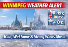
Spring Snow Surprise Followed by a Toasty Turnaround
WINNIPEG, MB – WEATHER REPORT – April 17, 2025 – It’s a classic Prairie rollercoaster this Easter weekend in Winnipeg. We’re starting off mild enough, but just when you thought it was safe to put away the snow brush—flurries make a surprise reappearance. Don’t worry, though: by Sunday and Monday, spring returns with sunshine and warmth that may just have you reaching for short sleeves.
Current Conditions: Mild and Moist
As of 5:00 AM CDT at Winnipeg Richardson International Airport, it’s mostly cloudy with a temperature of 5.5°C. The dew point is close behind at 4.5°C, resulting in a very humid morning at 93%. Winds are light from the west-northwest at 7 km/h, and visibility is excellent at 24 km. Barometric pressure sits at 100.6 kPa but is on the decline—always a good hint that change is in the air (literally).
Thursday: Mild Morning, Cooler Finish
A few showers will wrap up early this morning, giving way to mostly cloudy skies for the rest of the day. Temperatures will rise to a high of 13°C, which sounds like the perfect mid-April day—until the wind shifts. Expect winds to turn north and ramp up to 20 km/h by late afternoon, nudging in cooler air. The UV index will reach a moderate 3—sunscreen optional, but those with sensitive skin might still consider a dab.
Tonight: Rain, Then Flurries—Yes, Really
Tonight starts off partly cloudy but transitions quickly after midnight. There’s a 60% chance of rain showers, which could change to flurries before morning as temperatures fall to -1°C. Winds will increase from the northwest, hitting 30 km/h, and bringing in that brisk Prairie chill. Better keep the windshield scraper on standby… just in case.
Friday: Say Hello to Second Winter
Friday morning will feel like a full step back into winter. Expect flurries throughout the day and strong northerly winds at 30 km/h, gusting up to 50. The high will barely touch 0°C, and with the wind chill, it’ll feel more like -8°C in the morning. The UV index drops to a low 2, but the real concern is staying warm and dry.
Friday night continues the snowy theme, with accumulating snow possible and a low of -6°C. Classic Winnipeg move.
Saturday to Monday: Spring Strikes Back
Just as fast as it left, spring comes roaring back:
-
Saturday will be sunny and much warmer, with a high of 9°C and clear skies at night, dipping only to +2°C.
-
Easter Sunday is shaping up to be downright delightful: sunny with a high of 16°C and a mild night low of +4°C.
-
Monday keeps the vibe going with a mix of sun and cloud, highs soaring to 18°C, and a nighttime low right around the freezing mark.
Break out the patio furniture (but maybe keep a blanket handy).
What to Wear
Start your weekend bundled up—especially on Friday when the snow and wind return. But by Sunday and Monday, it’s safe to bring out your lighter springwear. Layers are your best friend in the meantime!
Did You Know?
Winnipeg is famous for its fast-changing weather. In fact, the city once saw a 27°C swing in a single day—from -2°C in the morning to 25°C by late afternoon. So, a little snow before Easter? Par for the course.


