
Snow for South and Extreme Cold for Far North
THUNDER BAY – WEATHER – More snow in the forecast for Thunder Bay. Road conditions on area highways and secondary roads are snow covered or slippery.
The OPP advise at 19:00 EST on Saturday evening, there is a collision 40 kilometres east of Ignace. Highway 17 is currently closed between Upsala and Highway 599 while crew clear the accident.
For the City of Thunder Bay, snow clearing routes are ranked on priority.
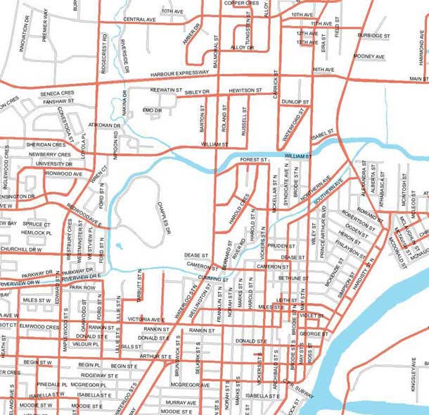
Arterial and waste collection routes (in red) are priorities, and will be cleared when five cm of snow has accumulated. All other roadways will be cleared after 10 cm of snow has accumulated.
For more information about Thunder Bay’s Winter Operations standards, and to view a full map of priority routes, visit www.thunderbay.ca/snow
Special weather statement in effect for:
- City of Thunder Bay
- Atikokan – Upsala – Raith
- Ignace
- Dryden
- Sioux Lookout
- Nipigon – Marathon – Superior North
Significant snowfall amounts expected tonight.
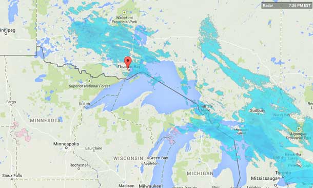
Snow associated with an Alberta clipper continues over parts of Northern Ontario. Most regions will receive snowfall amounts in the 10 to 15 cm range by Sunday morning. This is below the warning threshold of 15 cm per 12 hours.
Poor winter driving conditions are expected due to low visibility in snow and occasional blowing snow. Untreated roads will become snow covered and may become slippery. Motorists should allow extra time to reach their destination.
For the Far North Extreme Cold Warnings are in Effect
Extreme Cold Warning in effect for:
- Attawapiskat
- Washaho Cree Nation / Fort Severn
- Big Trout Lake – Kasabonika
- Sachigo Lake – Bearskin Lake
- Kashechewan
- Webiquie – Fort Hope
A prolonged period of very cold wind chills is expected.
A frigid arctic airmass with light to moderate winds will result in wind chill values near minus 45 tonight and Sunday morning.
While anyone who isn’t dressed warmly is at risk in cold weather conditions, some are at greater risk than others for frost bite and hypothermia:
– homeless people
– outdoor workers
– people living in homes that are poorly insulated (with no heat or no power)
– people with certain medical conditions such as diabetes, peripheral neuropathy and diseases affecting the blood vessels, people taking certain medications including beta-blockers
– winter sport enthusiasts
– people who consume excess alcohol
– infants and
– seniors.
Protect yourself.
– On sunny days wear sun glasses, lip balm and sunscreen to protect your skin from UV and keep it moisturized to help prevent windburn.
– Wear a face mask and goggles if you are participating in winter activities such as skiing, snowmobiling and skating to protect your face from frostbite and windburn.
– Keep moving (especially your hands and feet) to keep your blood flowing and maintain your body heat.
– Drink enough fluids, but avoid very cold drinks and consume warm meals regularly.


