
Forecasters Starting to Put Weather Outlook Together
THUNDER BAY – Weather – The “Santabomb” storm that has been building across North American is continuing to build according to the latest data. It is starting to look like the storm may end up moving the brunt of the forecasted Christmas Day snowfall east of Thunder Bay.
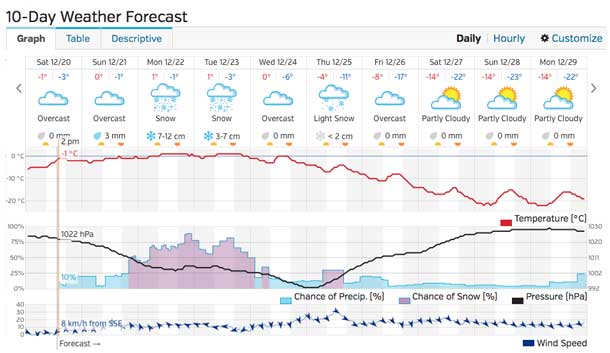
The snowfall amounts for Thunder Bay in the latest forecast have dropped and moved to earlier in the week from previous reports.
The region is still likely to get enough snow to ensure the need for smart winter driving, and for ensuring you keep a good eye on the road conditions before heading out.
Here are the latest figures for the snowfall amounts.


