
THUNDER BAY – Strong winds seem to be the weather story today. NASA’s newest Earth observing mission, the International Space Station-Rapid Scatterometer, or ISS-RapidScat provided a look at the winds within post-tropical cyclone Nuri on Nov. 5 and 6 as it moved parallel to Japan. Nuri has moved across the Pacific and is expected to bring hurricane-force wind gusts to Alaska’s Aleutian Islands today, Nov. 7.
“RapidScat passed over Nuri, near Japan, three times within a 24 hour period,” said Doug Tyler of NASA’s Jet Propulsion Laboratory, Pasadena, California. “The progression [in three images] showed Nuri’s path.”
The International Space Station-Rapid Scatterometer, or ISS-RapidScat was launched Sept. 21, 2014 to the International Space Station. From the unique vantage point of the space station, this space-based scatterometer instrument will use radar pulses reflected from the ocean’s surface from different angles to calculate ocean surface wind speeds and directions.
On Friday, Nov. 7, NOAA’s National Weather Service (NWS) Office in Anchorage, Alaska issued a High Wind Warning for the Western Aleutian Islands including the cities of Shemya and Amchitka. The warning was posted at 4:23 a.m. AKST on Nov 7 and remains in effect through 9 a.m. AKST on Saturday, Nov. 8.
The warning states that southwest winds 20 to 35 mph (32.1 to 56.3 kph) early on Nov. 7 will rapidly increase to south 60 to 75 mph (96.5 to 120.7 kph) with gusts of 80 to 90 mph (128.7 to 144.8 kph) by late morning. During the afternoon and evening winds will shift to the southwest and continue through Saturday morning before slowly diminishing. Any travel may be difficult. Loose debris can be moved and damage property.
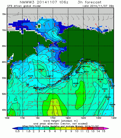
Marine interests have a hurricane force wind warning through tonight, Nov. 7, as during the day, sustained winds will increase from 30 knots (34.5 mph/55.5 kph) to 70 knots (80.5 mph/129.6 kph). On the Bering side seas will be as high as 20 feet building to 28 feet in the afternoon. On the Pacific side of the islands, seas will be 24 feet (7.3 meters) building to 35 feet (10.6 meters) in the afternoon with rain. At night on Nov. 7, southwesterly winds will increase to 70 knots (80.5 mph/129.6 kph) and seas are expected to reach 45 feet (13.7 meters) in rain showers. By Saturday, Nov. 8, sustained southwesterly winds are forecast near 55 knots (63.9 mph/101.9 kph) with 39-foot (11.8 meter)-high seas on the Bering Sea side and 41-foot (12.5 meter) high seas on the Pacific side.


