Thunder Storm and Rainfall Weather Alerts Issued
THUNDER BAY – Weather – Environment Canada has rainfall warnings and thunderstorm watches in effect across parts of Northern Ontario.
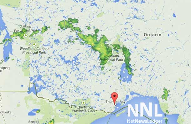
Severe thunderstorm watch in effect for:
- Dryden – Vermilion Bay
- Ignace – English River
- Kenora – Grassy Narrows – Whitedog
- Sioux Narrows – Nestor Falls – Morson
- Atikokan – Shebandowan – Quetico Park
Conditions are favourable for the development of severe thunderstorms that may be capable of producing strong wind gusts, large hail and heavy rain.
A few showers and the odd thunderstorm are occurring across much of Northwestern Ontario ahead of a low pressure centre moving into Southern Manitoba. As the disturbance continues to progress eastwards this evening, conditions will become increasingly favourable for a few strong to locally severe thunderstorms to form late this afternoon or early this evening. Although large hail and strong wind gusts are the primary threats, an isolated tornado cannot be ruled out as well.
Large hail can damage property and cause injury. Strong wind gusts can toss loose objects, damage weak buildings, break branches off trees and overturn large vehicles. Remember, severe thunderstorms can produce tornadoes. Be prepared for severe weather. Take cover immediately, if threatening weather approaches. Stay indoors when a thunderstorm strikes. There isn’t a place outside that is safe during a thunderstorm.
Rainfall warning in effect for:
- Pikangikum – Poplar Hill – MacDowell
- Sandy Lake – Weagamow Lake – Deer Lake
- Big Trout Lake – Kasabonika
- Sachigo Lake – Bearskin Lake
- Summer Beaver – Wunnummin Lake – Kingfisher Lake
Rain, at times heavy, is expected.
Rain is expected to continue until Monday morning and may be heavy at times. General rainfall amounts of up to 60 millimetres are forecast with the highest amounts occurring in thunderstorms.
Heavy downpours can cause flash floods and water pooling on roads. Localized flooding in low-lying areas is possible.