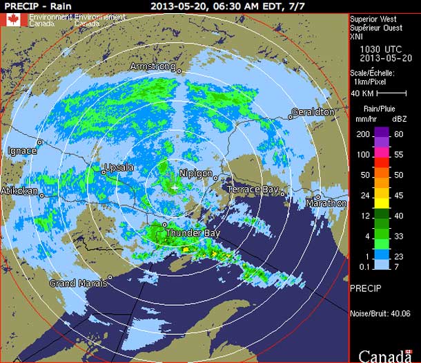
THUNDER BAY – Rainfall Warning continues for Thunder Bay. For the next several hours, Thunder Bay will be under the greatest amount of the forecasted rain. The radar image shows how the green, an area of greater precipitation is just to the south of the city.
Rainfall Continues for Thunder Bay
While a flood warning remains in effect for the City of Thunder Bay and region, declared by the Lakehead Regional Conservation Authority, it must be noted that in 2012, the massive flooding followed 200mm of rain after several days of rain. That rain left the ground saturated, and the massive rainfall overwhelmed the Atlantic Ave sewage treatment facility.
Sourced tell NetNewsLedger, that the City of Thunder Bay is far more prepared for potential flooding this spring. Over the weekend, city officials are on duty.
Environment Canada reports, “A slow moving warm front over Northern Minnesota will continue to bring a band of rain to parts of Northwestern Ontario along the Minnesota border. As of 2 AM 55 mm of rain have been reported at Atikokan. While there may be some breaks, the rain is expected to be fairly persistent today, tonight and into the overnight period. Thunderstorms embedded in this rain band will contribute to higher rainfall amounts”.
Another 30 to 50 mm of rain is expected by Tuesday morning, with storm totals of 50 to 70 mm possible, especially near the Minnesota border.


